forest of northern Thailand. Ecology and Society 9(3): 5. [online] URL: http://www.ecologyandsociety.org/vol9/iss3/art5
Synthesis
Spatial Organization of Environmental Knowledge:
Conservation Conflicts in the Inhabited Forest of Northern
Thailand
Robin Roth
ABSTRACT. Managing forests for their satisfactory provision of multiple goods and services to both the global and local commons requires effective cross-scale cooperation between local management institutions and state management institutions. Integrating the distinct sets of knowledge produced and used at the two scales of management has proven very challenging. This paper shows how a better understanding of the spatial expression of knowledge operating at distinct scales can help lead to a more fruitful integration of local knowledge and practice with state knowledge and practice. Using a case study from northern Thailand, this paper examines the links between the production of knowledge and the production of space within resource management institutions. It then identifies moments of convergence, compatibility, and conflict between local and state management institutions to inform more effective cross-scale linkages in environmental management.
INTRODUCTION
The management of tropical forests to meet the needs of both local communities and the global commons requires cooperation across scale between national forestry departments and local communities. To be effective, this type of institutional cooperation must include a greater integration of stakeholder interests, knowledge, and management institutions (FAO 2003). Unfortunately, there are few instances of cooperation and integration across scale, and tropical forests are experiencing increasing conflict and tension among multiple stakeholders. Conflict is particularly prevalent in areas in which the long-term residents are resisting state conservation activities such as the establishment of national parks. Meanwhile, the efforts at cooperation that do exist in tropical inhabited forests are being criticized by both community advocates and conservationists. The former claim that co-management arrangements have adopted simplistic definitions of community and have not adequately addressed unequal power relationships (Agarwal and Gibson 1999, Brown 2002, Wilshusen et al. 2002), whereas the latter claim that co-management projects pay too much attention to social needs and have thus failed to meet conservation goals (Oates 1999,
Terborgh et al. 2002). Evidently there is still progress to be made in the task of creating new institutions and adapting old ones to better manage the multiple goods and services provided by inhabited forests. Developing the means to integrate local and state management and knowledge is an increasingly important step in meeting this ambitious goal.
the meaning of boundaries, is beneficial for the understanding of TEK, SEK, and their associated management systems. This paper argues that documenting the spatial organization of environmental practices and management institutions will contribute to our understanding not only of traditional and scientific management institutions but also of the challenges to and possibilities for their integration.
The paper proceeds as follows. The first section introduces Berkes' (1999) knowledge-practice-belief complex as a means of understanding both TEK and SEK. Knowledge is produced through the social relations, experience, and practices in which it is embedded. The paper then argues that space is an integral dimension of state and community knowledge-practice-belief complexes. The understanding of these complexes is crucial to the task of integrating SEK and TEK into a more robust and effective conservation practice that can address both the needs of local populations and the demands of the global commons. The second section illustrates this approach by investigating the centralized conservation management prevalent in Thailand as an example of conventional SEK and Karen resource management institutions as an example of TEK. The case study identifies instances of convergence, compatibility, and conflict between the spatial organizations associated with TEK and SEK. The concluding section reviews current literature on collaborative management institutions to recommend a path toward greater cooperation and integration of knowledge in this conflict-ridden region.
KNOWLEDGE, MANAGEMENT
INSTITUTIONS, AND SPACE
For the purposes of this paper, it is understood that knowledge is not only used by resource management institutions but also produced, maintained, and adapted through the practices of such institutions and thus embedded in their social, cultural, economic, and political contexts. Knowledge is consequently inseparable from the institutions and practices that create it. This approach to environmental knowledge draws on two dominant approaches in traditional environmental knowledge (TEK) studies. The first emphasizes the characteristics of traditional knowledge and asserts its legitimacy for environmental management in the face of the dominant scientific paradigm adopted by state governments. Much of this literature documents the
differences between traditional knowledge and scientific knowledge used by the state, describing TEK as detailed, holistic, and adapted to context and SEK as general, segmented, and universally relevant (Chambers et al. 1989, Thompson and Scoones 1994, Berkes 1999). The unique characteristics of TEK are thought to stem largely from the fact that it has been embedded for a long time in a particular cultural and environmental context. The second approach emphasizes the process of knowledge production over the characteristics of the knowledge produced, and argues that there is tremendous heterogeneity within state/scientific environmental knowledge (SEK) and TEK and too many similarities, especially of method, to suggest a strict difference between the two knowledge sets (Thompson and Scoones 1994, Robbins and Maddock 2000, Agarwal 2002). Such an approach treats TEK as an applied science. It documents innovations in TEK that are the result of careful experimentation through experience and systematic observation (e.g., Richards 1985, Rocheleau 1994).
Berkes' (1999) knowledge-practice-belief complex emphasizes the embeddedness of environmental knowledge in the management institutions, practices, and world view of a particular knowledge community. He recognizes four realms of ecological knowledge that I argue are relevant to both TEK and SEK: environmental institutions, environmental practices, social institutions, and the world view (see Appendix 1 for details). These four realms are not in any way separate from each other; they are instead always interacting and influencing each other and are best thought of as an integrative package. Viewing both SEK and TEK as knowledge-practice-belief complexes produced through practice and embedded in culture makes it possible to evaluate their differences, similarities, and complementarities in all realms of environmental knowledge.
The documentation of detailed traditional environmental knowledge (Realm 1) and its incorporation into the environmental practices and social institutions (Realms 2 and 3) of scientific management remains the most accepted means of integrating TEK and SEK. Detailed ethnobotanical information as well as knowledge regarding the population and foraging characteristics of important species is considered proof that local communities have knowledge useful to the conservation agenda. Critics, however, claim that abstracting TEK from its context and placing it into a scientific frameworks makes it less relevant to the process of formulating resource management plans (Baviskar 2000:114) and is likely to lead to significant errors in interpretation, assimilation, and application (Thompson and Scoones 1994). By incorporating local ecological knowledge into current scientific management frameworks, we risk shedding TEK of its context and reducing it to “ ... bite-sized chunks of information that can be slotted into western paradigms, fragmented, [and] decontextualized ... “ (Ellen et al. 2000:15).
Acknowledging the embeddedness of both SEK and TEK makes us recognize that neither knowledge-practice-belief complex has interchangeable parts. A meaningful integration of TEK and SEK will need to look at all realms of knowledge for elements of compatibility and convergence. We must pay attention to the knowledge expressed in the environmental practices and social institutions (Realms 2 and 3) of both traditional and scientific resource management with the goal of finding the means to fit the knowledge-practice-belief complexes together in a
way that uses their recognized strengths.
This paper analyzes the spatial organization of environmental practices and social institutions as an important yet underexplored aspect of environmental knowledge with the aim of facilitating the goal of integrating SEK and TEK in conservation management. Space and knowledge are both produced in interaction with immediate social and environmental processes and are thus intimately connected through their mutual dependence upon, and enabling of, particular management institutions. Management institutions, their associated environmental knowledge, and their spatial expression are homologous: they are all produced through their embeddedness in the world. Thus, when thinking about how TEK and SEK can be integrated, we must also examine the spatial expression of such knowledge. More precisely, we must examine the spatial organization of environmental practices and social institutions across scale. Environmental practices (Realm 2), such as the tools and techniques used to harvest nontimber forest products, graze cattle, encourage plant growth, or protect the forest, are expressed spatially as patterns of use and management. Social institutions (Realm 3) such as rules of access, enforcement, and tenure arrangements are expressed spatially as zones and property boundaries along with the meanings attached to them.
need to address the contrasting spatial organizations of existing institutions and imagine what type of spatial organization might be suitable for new institutions.
I will now turn to a case study in northern Thailand to show how space, knowledge, and management institutions across scale interact in a landscape whose primary management authority is in transition from the local to the state level.
Study area: Northern Thailand
The Thai government has been encouraging the rapid expansion of protected areas over the past decade. Currently, 18% of Thai territory is contained within protected areas, and the Royal Forestry Department (RFD), whose functions have recently been relocated to the new Ministry of Natural Resources and the Environment, has an official target of 25% (Poffenberger 1999, Nootong 2000). The expansion is concentrated in the north, where more than 50% of the remaining forest cover in Thailand is located and where a number of ethnic minority groups inhabit the mountain forests (C. Wittayapak, unpublished manuscript). Although there has long been tension between the state and highland ethnic minorities (see Vandergeest 1996, Lohman 1999, Roth 2004b), conflicts between highland and lowland farmers over the issue of watershed protection and between highland farmers and the RFD have been increasing in number and severity. For instance, in August 2000, lowland farmers from Nan province protested water shortages by attacking and burning lychee plantations upstream from their farms (Vandergeest 2003). In February 2002, thousands of highland farmers gathered for one month at the provincial headquarters to bring attention to, among other things, the difficulties faced by highland villages enclosed within protected areas. The RFD is coming under increasing pressure to recognize the role local people can have in forest management. The 1997 constitution contains a clause that states that “... the right of a person to participate with the State and with communities in the preservation and exploitation of natural resources and biological diversity ... is protected, as provided by law ...” (Government of Thailand 1997:14). In addition, a community forest law has been in negotiation for more than a decade. Thus far, the senate has passed a version of the law that allows community forests to be established in forest reserve land but not in national parks (Samabuddhi 2002). With an increasingly active civil society, a new constitution, a strong conservation
agenda, and a community forestry law in development, greater participation by local communities in managing forests for a balance of local and global needs is on the horizon.
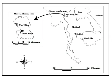
Mae Tho National Park
In an effort to understand the conflict between conventional conservation and highland livelihoods, I conducted research in the proposed Mae Tho National Park located in northern Thailand (see Fig. 1). The field site, destined to become a national park, is in transition from local to state management institutions, knowledge, and spatial organization. This transition and the conflicts that arise from it currently set the tone for any possibility of future cooperation and integration. The main conservation concern linked to Mae Tho National Park is that of watershed conservation; the district in which it is located provides 40% of the water to the Ping River, a main tributary of the Chao Phraya River (ICRAF 2001). According to the park superintendent, the conservation goal for the park is to maintain and eventually increase forest cover. Other Thai conservation concerns, such as the protection of rare fauna, are not the driving force behind this particular park because there are currently no documented incidences of endangered species within the proposed boundaries. There is a hope that, with increased forest cover, the area will witness an increased presence of deer and other large mammals. For now, however, the focus is on watershed protection. The 990 km2
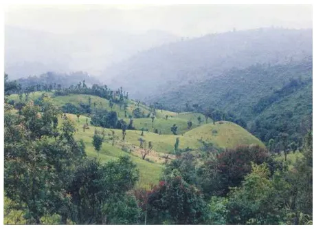
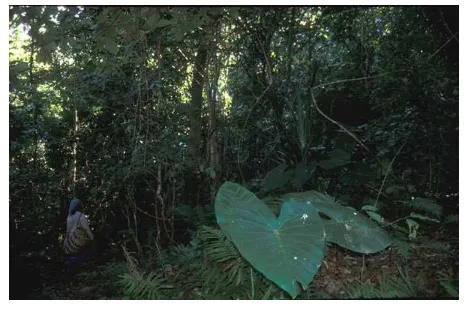
area is extremely mountainous, with an elevation ranging from 340 to 1720 m. It contains a mixture of primary and secondary hill evergreen forest, secondary dry dipterocarp forest, and mixed deciduous forest. The area is home to approximately 60 villages, most of which are of the Karen, Lua, and Hmong ethnic minority groups who practice some form of shifting cultivation on the steep slopes (see Fig. 2).
with the negotiation of boundaries, they have encouraged a model of “sustainable land use.” The model has four key components: classifying land into land-use categories, reducing shifting cultivation, encouraging permanent cash-crop agriculture, and encouraging private property. The model's goal is to intensify local livelihood activities in a smaller space while conserving newly freed forest land inside a national park. There is a clear spatial component to this model: the imposition of static boundaries
separating people from forests and individual household land holdings from each other and establishing separate spaces for separate uses. This is in contrast to traditional land-use patterns in the region, which largely reflect communal management of a forest-farm mosaic with overlapping and nested tenure rights and no strict division between village land and forest land. The park landscape is in transition from local to state management and spatial organization.
Fig. 1. Map of study sites.
I conducted research in two villages at different stages of this spatial transition. The inhabitants of both villages are of the Karen ethnic minority, practice shifting cultivation for primarily subsistence purposes, and have occupied their current locations for more than a century. The village I refer to as Insom Village has cooperated with the the RFD (see Fig. 1) by reclassifying land, decreasing the amount of shifting cultivation, formalizing rules of forest access, and moving toward the ownership of private property. The
Fig. 2. The shifting cultivation landscape common to Mae Tho National Park.
RESEARCH METHODS
I resided in Thailand from February 2001 to July 2002. The purpose of the study was to examine the spatial dimension of the livelihood and landscape transformations associated with the establishment of Mae Tho National Park and to help identify the similarities and differences between local and state management institutions.
The community data used for this article were primarily collected through focus groups and interviews with key informants who were either spiritual leaders, elected or appointed officials chosen for their status in the village, or respected elders recommended to me by other community members. At the end of each key informant interview, I conducted a wealth-ranking exercise (Thomas-Slayter et al. 1995) to identify the social groups within the village. This exercise yielded a series of livelihood criteria for
was incorporated into community management and practice. The 100% household survey (N = 91), which asked questions specific to the findings of the focus groups, further tested the degree to which a knowledge claim had become part of community knowledge.
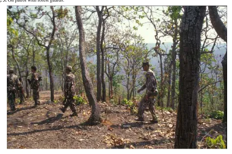
I also conducted multiple interviews with every management-level employee of the park (N = 6) and with every patrol guard (N = 16). Park operations are
very centralized, and I relied heavily on interviews with the superintendent and deputy superintendent for my general understanding of management institutions, whereas I used interviews with lower-level management and forest patrols to determine how the directives were being interpreted in the field (see Fig. 3). I also rode along on forest patrols and studied government documents.
Fig. 3. On patrol with forest guards.
RESULTS AND ANALYSIS
My analysis will first focus on three key aspects of traditional and scientific management in which space, management institutions, and knowledge intersect. They are (1) the scale of management, (2) the degree of social-ecological integration, and (3) the speed of adaptation to changing circumstances. The analysis then examines how understanding the spatial organization of these aspects is important to the integration of traditional environmental knowledge (TEK) and state/scientific environmental knowledge (SEK) within the context of environmental conservation in inhabited forest landscapes.
Intersections of space, management
institutions, and knowledge
Management scale
spread throughout the forest] and move them all close to the village. That way the rest of the forest can be cared for by the forest department.” He went on to ask, “How can they care for all that forest by themselves anyhow? It is too large.” This quotation demonstrates the desire to separate forests from people and shows a lack of awareness of local management institutions. I will return to these points later in this paper. Notably, the plan was for a village that the RFD official had not visited. He was using the map to reorganize a landscape about which he had no firsthand knowledge. This type of management activity results in part from managing a large area without the benefit of detailed knowledge about the landscape in question and using information acquired in one place to prescribe a policy in a different locale. Management scale is a key aspect of state-led conservation and represents the first of three important differences between the state and local knowledge-practice-belief complexes discussed in this section.
State management requires that the management of the park, and the knowledge associated with it, be comprehensible by and transferable to a manager with no firsthand experience in the park territory. Scott (1998) refers to this process as state “legibility.” It is Thai government policy that the superintendent of the park, along with his/her management staff, change positions every five years. The new superintendent of the Mae Tho National Park had been there 10 months when I first met him. He claimed at the time that the villagers in the area cut down primary forests for shifting cultivation, although it was impossible for him to have any firsthand knowledge of this because he had not lived in the area during cutting season. This was, in fact, “textbook” knowledge he had learned in school and from experience elsewhere in northern Thailand, and his contentions were hotly contested by villagers in the Mae Tho region, who claimed that they had not cut primary forest for decades.
Having a park manager whose knowledge and experience originated in a landscape other than the one he is now managing is a constant source of discontent for resident villagers. One key informant explained that “ ... the leader of the park changes all the time. The last one was OK, he began to understand the lives of people in the mountains, but then he had to leave, and now we have a new one. Now we have to teach him. As soon as he begins to understand, he will leave too.”
The theme of RFD officials not understanding the livelihoods of villagers was prevalent in discussions. The villagers asked how officials who do not have an intimate knowledge of the landscape could create policy and make decisions about it. Many farmers recounted stories of foresters who could not identify many of the common trees in the forest, whereas my research with villagers yielded names and uses for more than 200; other foresters claimed that the villagers were burning down the forest when they burnt their fallow agricultural fields. These stories were recounted to me to show how little the foresters knew about the forest and about the livelihoods of the villagers. They also point to a relationship between scale and knowledge used in conflicting management institutions: foresters produce general information about a large area, whereas villagers produce detailed information about a particular area. These knowledge characteristics emerge from the scale at which the resource manager operates and the consequent position of the manager vis-à-vis the production of knowledge about the landscape being managed.
acquainted with the geography in question (Rundstrom 1995). However, this does not preclude the use of GIS in a collaborative management effort, a point I will return to in the last section of this paper.
Integrated and segmented spaces
The goal of separating people spatially from forests is also indicative of the nonintegrated management practices common in state management, which stem from a disregard for the role of human agency in shaping the forested landscape. Scientific resource management and conservation practices are roundly criticized for their adherence to a reductionist and mechanistic scientific framework that compartmentalizes human from nonhuman and enforces this dualism through policy and practice. Spatially, this is reflected in strict boundaries where human habitation is permitted on one side of the divide and “nature” is encouraged on the other, such as the plan for Mae Tho National Park. Reflecting the foresters' knowledge base in the (nonhuman) ecology of forested landscapes, land classifications such as the watershed classification and eco-zones are based solely on ecological principles yet carry social consequences. This segmented state of knowledge and management can also be witnessed in the structure of park management and park goals.
The primary goal of the park is to manage and protect the forest as it exists separately from the villages located in it. Thus, when social concerns are brought to the park staff, they do not consider them part of their mandate. When questioned about how the villagers are supposed to support themselves on their reduced land base, park officials frequently responded that this was a task for agricultural extension, not the forestry department. This lack of integration was seen as a problem by at least one, particularly progressive, RFD official, who said, “This area doesn't need to be a park. The RFD shouldn't be the only one managing it. State employees should manage it, but maybe not the RFD. We need an organization equipped to deal with all aspects of land, not just the forest.”
The lack of coordination and integration among other parts of the government that manage land is also a hindrance to fulfilling the park mandate. This is illustrated by an instance in which the Nay Amphoe, an appointed district official in the Ministry of Interior, approved the building of a new village and thus the clearing of forest for agriculture in an area slated for
inclusion in the national park without first consulting the park officials. RFD staff then recognized the limitations of a segmented approach for a variety of reasons and expressed a desire to cooperate more with NGOs, researchers, and other government departments so that different branches of scientific expertise could be combined in management. They have yet to contemplate, however, what an integrated social-ecological approach might mean spatially.
TEK has the potential to offer some guidance. Because it is produced in service of a livelihood very much intertwined with the forest and land, TEK regularly does not compartmentalize its subject but instead stresses the relationships between nature and culture. For this reason, TEK is interesting to scholars and practitioners searching for resource management models that can serve as holistic alternatives to the dominant models based on mechanistic, linear Newtonian science. The similarity of TEK to innovative state practices such as adaptive management has been noted (Berkes et al. 2000). Spatially, this holism is expressed by the integration of social and environmental criteria in forest classification. For example, Insom Village adopted the division between shifting cultivation land and community forest land, but many still found it confusing. They explained that they prefer to “ ... take care of our forest as well as use it for agriculture.” Before the separate categories of community forest and agriculture land, they had one unitary category of land in which forest land was potential agricultural land and vise versa. This is not to say that all forest could become agriculture; belief in forest and ancestral spirits enables some territorial conservation. The burial forest is an obvious example of a traditional conservation area that is rarely entered and is not used for gathering products. The villages I worked in also preserved forest near rivers and on mountaintops to facilitate the movement of forest, water, and wind spirits. These designations are consistent with descriptions of traditional Karen land use in the ethnographic literature (McCaskill and Kampe 1997, Trakarnsuphakorn 1997, Luangaramsri 2001).
patterns, then, do not adhere to the two-dimensional zones set out by an eight-category land-use classification scheme.
Flexible and static spaces
The final key characteristic of state and local knowledge-practice-belief complexes, which demonstrate a relationship between management institutions, space, and knowledge, is (in)flexibility. In local management, the inseparability of the manager from the producer of environmental knowledge ensures a detailed knowledge that is flexible and able to adapt to changing conditions (Conklin 1954, Kunstadter 1978, Berkes et al. 2000). Environmental practices and social institutions are similarly flexible and adaptive; in particular, they are capable of changing seasonally or with different market conditions. Tenure systems are often spatially complex, making distinctions between land and products of the land (Vandergeest 1996, Rocheleau and Edmonds 1997). For example, in both case study villages, if a household plants bamboo within communally held land, the household retains rights to the bamboo; the crop does not become the property of the entire village. Scientific management, however, with its external managers prefers strict territorial arrangements in which boundaries are static and zones of use and management are distinct and homogenous. Scientific management institutions are often criticized for their attempt to control the environments they manage to render them predictable and easier to manage (e.g., Holling and Gunderson 2002). Local management can offer nuance and flexibility to complement the centralized control of scientific management.
The single largest problem from the villagers' perspective is the lack of flexibility in national park design, management, and law. As one farmer volunteered, “ ... the park is just like a big stone. You can't take anything out, you can't move it, you can't change it. It can't be here with the village.” The perceived inflexibility of park management manifests itself in a number of ways. First is the enforcement of park rules. Although the forest guards I interviewed claimed to be very flexible in how they enforced laws, and many said that they would not arrest villagers caught cutting trees, the villagers claimed that a park meant that they could not remove a single thing. The story of four villagers from another village who were caught with a deer, were sent to the police, and had to
each pay a fine of 200,000 baht (U.S.$4000) was recounted on a number of occasions to illustrate their point. “The park uses their power. They could have dealt with it in a village setting. There was no need to send the hunters to the police.” The villagers see this as an example of the inflexibility of the park rules and a unilateral enforcement of what are state-delineated boundaries. The story further demonstrates a challenge by villagers to the authority of park staff and police in matters of resource management. In this case, the villagers thought that the hunters could be effectively reprimanded within the village. When asked why there could not be more flexibility in park rules, an important park official answered that “ ... rules are rules. If you let them get away with it once, they will do it again.” The deer, he explained, is a protected species in Thailand, and no one is allowed to hunt it. Park management also reminded me that villagers are residing in Watershed Classification 1A and are thus technically illegal. Law, rules, and management institutions are effectively the same for all national parks in Thailand; the institution rarely adapts to changing local realities.
Local management, however, has demonstrated an ability to adapt rapidly to changing political and ecological conditions. In 1990, Nira Village decided to stop cultivating an upland area because it and neighboring villages had experienced a decrease in water flow. At the same time, the villagers collectively decided to ban hunting and cutting in the evergreen forest on the hill above their village. This was in reaction to a decrease in the number of mammals and concern over the recent extraction of timber for building the school in a neighboring village. Likewise, while I was in the village, the villagers took a collective decision to begin forest patrols. This was to demonstrate to the RFD that they were capable and willing to take care of the forest on their own. Less dramatic decisions are taken more frequently when the seasonal rainfall, the presence of indicator species, temperature, and market conditions help inform villagers what and where to plant, where to go to look for a particular herb, or when to prepare the fields for burning. The flexibility of local management is in distinct contrast to the inflexibility of state-led management.
each of six large agriculture plots, every family has a small plot that it plants and for which it is responsible. Each family's field is demarcated, often by planted trees or bamboo poles along the ground. However, these boundaries are very porous; labor sharing is common, especially during weeding and harvesting seasons, and villagers gather vegetables from each other's fields without the need to seek permission first. The boundaries are the most permeable for members of the immediate family. This privilege does not extend to rice, however, or to cash crops. Tenure is not static in that, if one household does not have enough land, it will “borrow” land from another household. The “borrowing” extends to families in neighboring villages as well. Intervillage relations further demonstrate this flexibility. Although only the inhabitants of Nira Village may cultivate crops or cut trees within its boundaries, villagers from outside may come in and collect forest products. Likewise, villagers from Nira Village may collect forest products and graze cattle outside village boundaries. The boundary, then, is commonly understood to be a boundary of responsibility and control, not use. This flexible management arrangement is expressed spatially by multiple fuzzy and simultaneously overlapping boundaries and territories that are contingent upon changing circumstances.
Residents of Insom Village are in transition from this flexible, communally managed shifting-cultivation landscape to a more static, privately managed agricultural landscape, and there are clear consequences. The RFD and NGO promotion of permanent cultivation and clearly demarcated boundaries results in ambiguity and reduced flexibility for the sake of legibility. For instance, an NGO created a land use map for the village on which each current field and most recently used fallow was allocated to a household. The rational was to make ownership explicit and to thus increase the security of villagers in the face of a national park. However, this static spatial demarcation has unintentionally led to the erosion of flexible land-allocation institutions (Roth 2004a :83-119). In fact, many arguments ensued in the village as to whose land was whose, whether it had been borrowed or stolen and so on, so that the “right” number could be put on the map. The strict demarcation of village boundaries has also changed land use patterns, with villagers not entering neighboring territories to collect nontimber forest products or firewood. As one key informant explained, “ ... we don't go to [Noi Village], the community forest there belongs to them. They have wild pig now, but we
don't go hunt them, but if one comes into our village, we can shoot it.” This is in stark contrast to the explanation of boundaries given to me in Nira Village. “We collect firewood or vegetables near another village. We don't go to the village, only in a little in the area. We don't ask permission, because it is not only theirs but it belongs to us too. It is nature.”
Residents of Insom Village continually expressed a real fear of the RFD. They are scared to plant in traditional spaces, spaces now allocated to forest, not people. Some villagers mourn this loss of flexibility. “Before the park, we could do anything. We didn't need to ask.” As a man from Nira Village explained, “ ... if I want something, I will have to ask the RFD first [once the park comes], and if I don't ask first, they will arrest me. I don't want money or anything. I just want to be able to cut what I need without asking.” This quotation shows resentment toward the RFD for imposing its authority at the local level. This man, when questioned further, admitted that he asks the village committee before cutting, but he did not consider that the same thing as asking the RFD.
Transition from local to state management
understood that whatever land was allocated to forest rather than agriculture in the park's current static mapping system would be forever lost to them.
The transition from local to state management, then, constitutes a transition from a flexible, complex spatial organization compatible with the integrated, connected, and adaptive characteristics of TEK to the static, bounded spatial organization compatible with the segmented, displaced, and universal characteristics of SEK. Conducting a transition from local to state management that is blind to the spatial and knowledge dimensions can result, as it has thus far in Mae Tho National Park, in dissatisfaction, fear, and a consequent resistance to state conservation plans. The reification of once flexible management systems has lessened community cooperation and choice in farming activities, increased
intercommunity conflict, and eroded community institutions for land allocation. Consequently, villagers wish to reestablish old territories, thwarting government efforts to establish a national park.
With the expansion of state-led conservation initiatives in inhabited forests, it is critical that we take into account the differences discussed above and presented in a simplified fashion in Table 1, and shift our focus toward integrating SEK and TEK in conservation management. The next section identifies possible strategies for integration by examining some instances of similarity and complementarity between village-level knowledge and state knowledge in Mae Tho National Park. It then suggests some ways forward in the task of building integrated institutions of management.
Table 1. Summary of the spatial organization of traditional environmental knowledge (TEK) and state/scientific environmental knowledge (SEK).
Type of
knowledge Characteristics
Associated management practices and institutions
Associated spatial organization
TEK
Detailed
Adaptive to context Holistic
Producer = user of knowledge Flexible depending on context Integrated management practices
Dynamic Overlapping
SEK
General
Universally relevant Segmented
Producer dislocated from user of knowledge
Homogeneously applied; slow to change
Social and environmental management separate
Fixed Bounded
INTEGRATION OF KNOWLEDGE:
SIMILARITY AND COMPLEMENTARITY
The conflict in northern Thailand is pronounced, and there is a long history of strong centralized resource management and an ingrained distrust between local people and the forestry department. On the surface, there appears to be little hope of building cooperative relationships across scale. In Mae Tho National Park, the park administration was growing increasingly frustrated with its inability to establish the park, and community members were increasingly frustrated with the continual conflict the park had brought to the region. Tension between park staff and local communities increased and
Tho National Park is facing an opportunity for reorganization, and, given the right personalities, it is possible that institutional change could occur and cooperative management could emerge, especially because the federal government now recognizes that there must be more input from local communities with regard to natural resource management. In view of the fact that conditions are now more amenable to collaborative management of the Mae Tho region than ever before, the task is to begin identifying the areas in which collaboration can begin and the barriers that might prevent it from being effective.
The most recent studies of successful collaborative management have all to greater or lesser degrees emphasized the importance of having common ground and trust among stakeholders (Wondolleck and Yaffe 2000, Buck et al. 2001, Berkes et al. 2003). Despite the differences between state and local knowledge embedded in environmental practices and social institutions, there are some similarities whose identification shows promise for integrating TEK and SEK in more cooperative management institutions. Even in regions such as northern Thailand, where the conflict is acute and the level of cooperation is currently almost nil, there are places to start a process of more collaborative management. If such collaborative management is set up to encourage learning and adaptation, then greater trust can emerge (Fisher 2001). This section first identifies
two concrete instances of similarity between TEK and SEK in which collaboration might begin and then recommends a way forward by building on similarity and complementarity to develop management institutions that will build trust and engage both TEK and SEK.
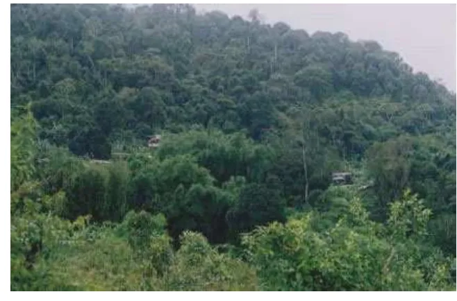
One important similarity is that both state foresters and community residents in Ban Nira identified the same area of forest, located on top of the hill behind the houses, as an example of a healthy forest (see Figs. 4 and 5). The village had already adopted hunting and logging bans in the late 1980s for this forest, and the villagers justified it as an example of a healthy forest because it gave shade, it was cool in the summer, the trees were big, and it gave lots of vegetables. Foresters have different criteria but the same message. They designate the forest as healthy because it is hill evergreen forest, an increasingly rare forest type in this region. In addition, the trees are large and have not been cut in living memory. Regardless of differences in criteria, this points to the possibility that agreement can be reached on the kind of forest both foresters and villagers wish to preserve. With an appropriate management institution and further negotiation, a set of functional criteria could likely be agreed upon, such as the maintenance of certain species, cutting and hunting bans, and so on. The hill evergreen forest located on the top of the hill above the village is a good place to start a joint decision-making process.
Fig. 5. Gathering nontimber forest products under the canopy of the hill evergreen forest.
Although there are differences in the spatial form that TEK and SEK take, there are also similarities. Despite their different rationales, both TEK and SEK contain forms of territorial management. Conventional conservation makes extensive use of the territorial form of management by promoting firmly bounded, homogeneously managed spaces such as national parks or “conservation forests.” In Insom Village, many villagers understood the idea of a conservation forest as “the home for animals.” This is a concept that is readily understood by the Karen because the forest is their home. “The forest is the life of the village,” explained one woman. In addition, traditional territorial conservation is common in Karen culture and often for the purposes of giving a home to ancestral spirits or the spirits of land, water, and forest. Traditional conservation territories of the Karen range from small spiritual sites with a single tree to burial forests and hill and riverine forests. These special places all have different sets of rules; some are rarely visited, others are places to collect nontimber forest products or firewood, but none of them permit the
cutting of trees. Such areas are also sites of possible cooperation, where the forestry department could contribute its knowledge to that of the local community to bolster community conservation efforts.
interactions across space can promote the exchange of knowledge and techniques and provide support for joint decision making (Gadgil et al. 2003).
As discussed in the first section, one of the differences between TEK and SEK is the scale of management. The state management institutions operate at a broader scale, whereas community management institutions operate at a more local scale. This difference can also be complementary and needs to be taken into account in building vertical interactions into institutions for cooperative management. Park management exhibited general knowledge about the whole area of the park, but, when questioned about specific sites, managers knew few details. Villagers exhibited detailed information about the landscapes they use on a daily basis but had little detailed knowledge about other areas within the park or about how their local landscapes might relate to the greater context of climate, hydrology, or biodiversity preservation.
These kinds of scale-based complementarities have been noted in many studies of common-property institutions and have led to the support of nested institutional arrangements in which national, regional, local, and community institutions each have clear-cut responsibilities that include helping “lower-level” institutions to fulfill their own roles and responsibilities. As Ostrom et al. (1999) state, “ ... higher levels of government can facilitate the assembly of users of a CPR [common property resource] in organizational meetings, provide information that helps identify the problem and possible solutions, and legitimize and help enforce agreements reached by local users.” Pretty and Ward (2001) also examine the growing importance of social capital in environmental management and argue that government development policy needs to better support established and newly formed management groups. Problems arise when “higher-level” institutions overstep their scale of operation and attempt to micro-manage local resource use, decreasing the legitimacy of local institutions. This can be seen in Mae Tho, where the forestry department is attempting to demarcate village-level zones with only minimal local input. Likewise, problems also arise when local-level institutions do not appreciate the greater context that higher levels of governance can bring and refuse “outside” help in managing of their resources. Many residents of the Mae Tho region believe that they can continue managing their resources without outside aid. Alhough they are suspicious of advice from foresters, these
communities have worked with NGOs and, in my case, outside researchers to help in resource management.
One of the greatest challenges to overcome in building vertical linkages for co-management is the lack of mutual respect and trust. Doing so would require both time and an institutional structure that enables vertical interaction between state and local managers. At the moment, interaction is ad hoc, but even this has yielded positive results. Most park officials do not believe that the villagers can take care of the forest and have little knowledge of the specific management institutions already in place at the village level. This lack of knowledge about local management changed dramatically with the amount of time any given RFD staff member spent in the communities. This was most evident with the senior RFD official who spent the most time with villagers demarcating boundaries. The villagers believed that he and he alone understood their livelihood strategies, and there was growing trust, which, if it were more widespread, could be the beginning of a working partnership. Likewise, community leaders who had had opportunities to speak with RFD officials and travel to provincial meetings had a greater understanding of the concerns of the forest department and the regional significance of their territory. These two community leaders had a greater willingness to negotiate with park officials than did many of their fellow community members. They thus had to tread carefully so that other members of their communities did not become suspiscious of their motives. For instance, at one point in my research, a rumor spread throughout the district that one community leader was getting paid by the forestry department to stop resisting the park.
relationship of mutual understanding must be given time to develop, and the policy of regularly replacing senior park management must stop.
Horizontal linkages are equally important for both for state agencies and communities. The lack of integration at the state level among forest, agricultural, and development agencies posed many problems for both the community members, who generally believed that the park officials did not care about the problems of the villagers, and the RFD, which came into increasing conflict with other agencies as it tried to implement its conservation plans. Better horizontal linkages among state institutions, especially agricultural extension agencies, would be beneficial for all parties. Likewise, communities could gain from more formalized interaction with other communities in the region. Networks of communities can not only support each other by sharing information and techniques but they can also coordinate resource management efforts over a larger area to help meet regional social and environmental goals (Pretty and Ward 2001, Folke et al. 2003). Although Care Thailand and the Northern Farmers Network could theoretically facilitate this type of interaction, these organizations unfortunately have a long history of antagonism to each other and, in some instances, to the RFD and individual villages. In this case, it might be best to encourage Tambon organizations, which are the lowest level of elected government and which are gaining increasing power under the new constitution, to facilitate the strengthening of horizontal linkages (see Ribot 2002).
Moves toward collaborative management that can integrate TEK and SEK in the Mae Tho region must start slowly and in places where there is already common ground, then build and strengthen the vertical and horizontal linkages outlined above. Any collaborative institutional arrangement of this type must take seriously the spatial organization of TEK and SEK. This paper, consistent with the literature on collaborative management, has argued that the strength of SEK is in its ability to serve broadscale conservation goals, whereas the strength of TEK is in its ability to serve local livelihood goals. There are times and places in which these goals are compatible, which is where collaboration should begin, but, for the most part, landscape form and associated activities will need to be negotiated through a multiparty, multiscale management institution.
Building on these complementary scales of operation, as a first step in cooperation communities and the RFD
could negotiate a conservation framework with specific performance criteria that allow local management the flexibility to meet goals in whatever way they wish. The importance of having reasonable, clear, and precise goals for the delivery of environmental and social services and defining appropriate performance criteria and reward systems cannot be understated (Sayer 2001). For example, instead of fixing the swidden plots in space, it might be possible for the village to negotiate with the RFD on the percentage of land that is to be maintained as forest cover, i.e., on the amount rather than the location. Currently, the village maintains 49% of its territory under permanent forest cover. This arrangement would allow the villagers, who value their forest-farm matrix for both its farm products and its forest products, to decide for themselves, based on prevailing conditions, where to plant. This would also make it possible to continue the flexible land-allocation strategy that acts as a social safety net for those in need and a redistribution mechanism for those with more than they need. Such an institutional arrangement would allow the larger-scale vision of the RFD, with its focus on providing for the regional and global commons, to effectively interface with the local-scale vision of livelihood security. Even more important, by allowing local resource management institutions to adapt to negotiated management goals, local processes of knowledge production are maintained, and, with the RFD enlisting its knowledge to help local communities to meet the performance criteria, new forms of knowledge would emerge. An arrangement such as this, however, would require forestry management to abandon the delineationof sharp boundaries between households and between villages and, more importantly, would require a real transfer of authority to the local level.
CONCLUSION
Moving toward the integration of SEK and TEK into viable conservation arrangements capable of managing for the needs of both local communities and the global commons is no easy task. However, such a task cannot be accomplished with only community-based knowledge and management, nor can it be achieved with only state-based scientific management and knowledge. Moreover, as this paper has shown, space is an important dimension of local and state knowledge and management institutions. In attempting to scale up, we need to respect the spatial complexity of local use and management and make an attempt to incorporate this through true partnerships. There are times when, regardless of the scale at which we operate, we need to deal with complexity and uncertainty, and local mechanisms have demonstrated the ability to do so (see Berkes and Folke 1998, Berkes et al. 2003). It is not merely a question of inserting ethnobotanical information into a scientific framework; global science must acknowledge its own status as complementary to local knowledge-practice-belief complexes and not as a replacement for them. Instead, what lies ahead is a long process of building joint institutions and knowledge sets that mobilize a wider range of practices, tools, and knowledge than are currently used in conventional conservation. Ideally, such institutions would provide a platform for greater vertical and horizontal interaction, thus enabling the continued production of TEK and SEK while also supporting the production of a new type of hybrid knowledge suited to the new institutional and political environment.
The investigation into Mae Tho National Park demonstrates that a thorough investigation of spatial organization and its links to social institutions is necessary to understand resource management strategies. Moreover, it has shown that state policies reorganize local resource management institutions,
knowledge, and spatial structure, often with detrimental results. In this case, the blind reorganization under way has endangered local livelihoods and efforts to establish a protected area. With an investigation of the differences and similarities between TEK and SEK along with their spatial expression, there is the potential to create a more efficient organization within which environmental goods and services for both the global commons and the local population can be provided. To do this, we must abandon the simplistic solution of spatially separating people from forests and instead build partnerships of co-management in which conservation and livelihood objectives are sought in the same space. The latter will require a complex spatial organization with flexible categories of use and management that are negotiated across scale and that reflect the dynamic environmental and social context within which they are embedded.
Responses to this article can be read online at: http://www. ecologyandsociety.org/vol9/iss3/art5/responses/index.html
Acknowledgments:
I thank the community members of Insom and Nira Villages and Mae Tho National Park staff for sharing their knowledge and experience with me. The project was funded by Fulbright IIE and the Social Sciences and Humanities Research Council of Canada (SSHRC). This article was improved by comments on earlier drafts by Dianne Rocheleau, B.L. Turner, and Alice Hovorka as well as by conversations with Fikret Berkes. I would also like to thank two anonymous reviewers for stimulating and helpful comments and Carl Folke for his clear editorial guidance. Any oversights or flaws remain my own. The cost of publishing this article was paid for by the Resilience Alliance.
APPENDIX 1. FOUR REALMS OF THE
KNOWLEDGE-PRACTICE-BELIEF COMPLEX
Adapted from Berkes (1999).
Realm 1: Environmental information
as the system used to classify such knowledge, e.g., medicinal plants, taxonomies, and ecosystem functioning.
Realm 2: Environmental practices
These include practices, tools, and techniques required to use and manage resources and the ecological knowledge needed to develop them, e.g., ecosystem functioning, silviculture, harvest and planting techniques.
Realm 3: Social institutions
These are the rules of access, tenure, and social relationships that govern the use and management of resources, e.g., tenure arrangements and kinship systems.
Realm 4: World view
This is the conceptual understanding of the world, including belief systems, e.g., religion, perception, politics.
LITERATURE CITED
Agarwal, A. 2002. Indigenous knowledge and the politics of classification. International Journal of Social Science 54(173):287-297.
Agarwal, A., and C. C. Gibson. 1999. Enchantment and disenchantment: the role of community in natural resource conservation. World Development27(4):629-649.
Baviskar, A. 2000. Claims to knowledge, claims to control: environmental conflict in the Great Himalayan National Park, India. Pages 101-119 in R. Ellen, P. Parkes, and A. Bicker, editors. Indigenous environmental knowledge and its transformations: critical anthropological rerspectives. Harewood Academic, Amsterdam, The Netherlands.
Becker, D., and K. Ghimire. 2003. Synergy between traditional ecological knowledge and conservation science supports forest preservation in Ecuador. Conservation
Ecology 8(1):1 [online] URL:
http://www.consecol.org/vol8/iss1/art1.
Berkes, F. 1999. Sacred ecology: traditional ecological knowledge and resource management. Taylor and Francis, Philadelphia, Pennsylvania, USA.
Berkes, F., J. Colding, and C. Folke. 2000. Rediscovery of traditional ecological knowledge as adaptive management. Ecological Applications10(5):1251-1262.
Berkes, F., J. Colding, and C. Folke, editors. 2003. Navigating social-ecological systems: building resilience
for complexity and change. Cambridge University Press, Cambridge, UK.
Berkes, F., and C. Folke, editors. 1998. Linking social and ecological systems: management practices and social mechanisms for building resilience. Cambridge University Press, Cambridge, UK.
Brown, K. 2002. Innovation for conservation and development. Geographic Journal168(1):6-17.
Buck, L., C. Geisler, J. Schelhas, and E. Wollenberg, editors. 2001. Biological diversity balancing interests through adaptive collaborative management. CRC Press, London, UK.
Chambers, R., A. Pacey, and L.-A. Thrupp. 1989. Farmers first: farmer innovation and agricultural research. Intermediate Technology Publications, London, UK.
Conklin, H. 1954. An ethnographic approach to shifting agriculture. Transactions of the New York Academy of Sciences17:133-142.
Davis, A., and J. Wagner. 2003. Who knows? On the importance of identifying “experts” when researching local ecological knowledge. Human Ecology31(3):463-489.
FAO. 2003. State of the world's forests. FAO, Rome, Italy.
Fisher, R. J. 2001. Experiences, challenges, and prospects for collaborative management of protected areas: an international perspective. Pages 81-96 in L. Buck, C. Geisler, J. Schelhas, and E. Wollenberg, editors. Biological diversity balancing interests through adaptive collaborative management. CRC Press, London, UK.
Folke, C., S. Carpenter, T. Elmqvist, L. Gunderson, C. S. Holling, and B. Walker. 2002. Resilience and sustainable development: building adaptive capacity in a world of transformations. Ambio31(5):437-440.
Folke, C., J. Colding, and F. Berkes. 2003. Synthesis: building resilience and adaptive capacity in social-ecological systems. Pages 352-387 in F. Berkes, J. Colding, and C. Folke, editors. Navigating social-ecological systems building resilience for complexity and change. Cambridge University Press, Cambridge, UK.
Gadgil, M., P. Olsson, F. Berkes, and C. Folke. 2003. Exploring the role of local ecological knowledge in ecosystem management: three case studies. Pages 189-209 in F. Berkes, J. Colding, and C. Folke, editors. Navigating social-ecological systems: building resilience for complexity and change. Cambridge University Press, Cambridge, UK.
Government of Thailand. 1997. Constitution of the Kingdom of Thailand. Translation by the Office of the Council of State, Bangkok, Thailand.
Gunderson, L., and C. S. Holling. 2002. Panarchy. Island Press, Washington, D.C., USA.
Holling, C. S. 2001. Understanding the complexity of economic, ecological, and social systems. Ecosystems 4:390-405.
Holling, C. S., and L. Gunderson. 2002. Resilience and adaptive cycles. Pages 25-62 in L. Gunderson and C. S. Holling, editors. Panarchy. Island Press, Washington, D.C., USA.
International Center for Research in Agroforestry (ICRAF). 2001. Landscape agroforestry in northern Thailand: impacts of changing land use in an upper tributary watershed of Montane mainland Southeast Asia. ICRAF, Chiang Mai, Thailand.
Kunstadter, P. 1978. Ecological modification and
adaptation: an ethnobotanical view of Lua swiddeners in northwestern Thailand. Pages 168-200 in R. I. Ford, editor. The nature and status of ethnobotany. Anthropological Papers Number 67. Museum of Anthropology, University of Michigan, Ann Arbor, Michigan, USA.
Li, T. M. 2000. Locating indigendous environmental knowledge in Indonesia. Pages 121-150 in R. Ellen, P. Parkes, and A. Bicker, editors. Critical anthropological perspectives. Harwood Academic, Amsterdam, The Netherlands.
Lohman, L. 1999. Forest cleansing: racial oppression in scientific nature conservation. CornerHouse Briefing Number 13. The Corner House, Sturminster Newton, UK.
Luangaramsri, P. 2001. Redefining nature: Karen ecological knowledge and the challenge to the modern conservation paradigm. Earthworm Books, Chiang Mai, Thailand.
McCaskill, D., and K. Kampe, editors. 1997.
Development or domestication? Indigenous peoples of South East Asia. Silkworm Books, Chiang Mai, Thailand.
McKinnon, J. 2001. Mobile interactive GIS: bringing indigenous knowledge and scientific information together. A narrative account. Available online at:
http://64.233.161.104/search?q=cache:4A7T0TM78X4J:ww w.iapad.org/publications/ppgis/mobile_interactive_gis.pdf+
Mobile+interactive+GIS&hl=en.
Nootong. 2000. Thailand country report. Pages 84-88 in A. Galt, T. Sigaly, and M. Vinton, editors. Proceedings: papers presented at the World Commission on Protected Areas Second Southeast Asia Regional Forum, (Pakse, Lao PDR, 1999). IUCN, Vientiane, Lao PDR.
Oates, J. 1999. Myth and reality in the rain forest: how conservation strategies are failing in West Africa. University of California Press, Berkely, California, USA.
Ostrom, E., J. Burger, C. Field, R. Norgaard, and D. Policansky. 1999. Revisiting the commons: local lessons, global challenges. Science284(5412):278-279.
Poffenberger, M., editor. 1999. Communities and forest management in Southeast Asia. International Union for the Conservation of Nature, Gland, Switzerland.
environment. World Development29(2):209-227.
Ribot, J. 2002. Research report: democratic
decentralization of natural resources: institutionalizing popular participation. World Resources Institute, Washington, D.C., USA.
Richards, P. 1985. Indigenous agricultural revolution: ecology and food production in West Africa. Hutchinson, London, UK.
Robbins, P., and T. Maddock. 2000. Interrogating land cover categories: metaphor and method in remote sensing. Cartography and Geographic Information Science 27(4): 295-309.
Rocheleau, D. 1994. Participatory research and the race to save the planet: questions, critique, and lessons from the field. Agriculture and Human Values11(2/3):4-25.
Rocheleau, D., and D. Edmonds. 1997. “Women, men and trees: gender, power and property in forest and agrarian landscapes. World Development25(8):1351-1371.
Roth, R. 2004a. “Fixing” the forest: the spatial reorganization of inhabited landscapes in Mae Tho National Park, Thailand. Dissertation. Clark University, Worcester, Massachusetts, USA.
Roth, R. 2004b. On the colonial margins and in the global hotspot: forest conflict in highland Thailand. Asia Pacific Viewpoint45(1):13-32.
Rundstrom, R. A. 1995. GIS, indigneous peoples, and epistemological diversity. Cartography and Geographic Information Systems22(1):45-57.
Samabuddhi, K. 2002. Academic slams senators over ban: middle class bias a problem. Bangkok Post (16 March), Main Section:4.
Sayer, J. 2001. Learning and adaptation for forest conservation. Pages 69-80 in L. Buck, C. Geisler, J. Schelhas, and E. Wollenberg, editors. Biological diversity balancing interests through adaptive collaborative management. CRC Press, London, UK.
Scott, J. C. 1998. Seeing like a state: how certain schemes to improve the human condition have failed. Yale University Press, New Haven, Connecticut, USA.
Terborgh, J., C. van Schaik, L. Davenport, and M. Rao, editors. 2002. Making parks work: strategies for preserving tropical nature. Island Press, Washington, D.C., USA.
Thomas-Slayter, B., R. Polestico, A. Esser, O. Taylor, and E. Mutua. 1995. A manual for socio-economic and gender analysis. Ecology, Community Organization (ECOGEN), Worcester, Massachusetts, USA.
Thompson, J., and I. Scoones. 1994. Challenging the populist perspective: rural people's knowledge, agricultural research, and extension practice. Agriculture and Human Values11(2/3):58-76.
Trakarnsuphakorn, P. 1997. The wisdom of the Karen in natural resource conservation. Pages 205-218 in D. McCaskill and K. Kampe, editors. Development or domestication? Indigenous peoples of South East Asia. Silkworm Books, Chiang Mai, Thailand.
Vandergeest, P. 1996. Mapping nature: territorialization of forest rights in Thailand. Society and Natural Resources 9:159-175.
Vandergeest, P. 2003. Racialization and citizenship in Thai forest politics. Society and Natural Resources16:19-37.
Wilshusen, P., S. Brechin, C. Fortwangler, and P. West.
2002. Reinventing a square wheel: critique of a resurgent “protection paradigm” in international biodiversity conservation. Society and Natural Resources15(40):17-40.