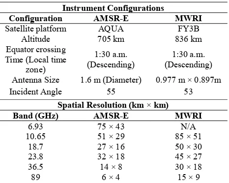
isprs archives XLI B8 513 2016
Teks penuh
Gambar
Garis besar
Dokumen terkait
The program requires two input files: metadata file of the OLI surface reflectance product and a table of land cover The International Archives of
The present study which is motivated by the above statement aims to employ multi-temporal satellite images of Landsat 7 ETM+ to investigate the inter-seasonal
From the environmental characterization, it is possible to understand the spatial and temporal dynamic of the area’s coffee lands, establish the relation between
The lower part of Table 1 lists the CVs for the spheres derived amplitudes and the complete point cloud corrected by the spheres polynomial.. Since the maximum available
tree species is larch, followed by birch and cedar. The geographical distribution was also more accurate than the classification using only the L8SR bands. The
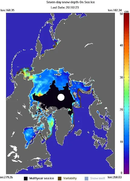
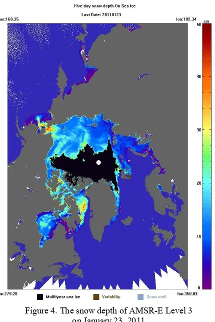
The vertical motion fields of the Colonia Glacier deliver information about the glacier’s behaviour before, during and after a GLOF event.. In the present case,
Using the output of the process, analyses of the different proximity relationships were done between existing safety facilities and the buildings located
We suggest a new data analysis technique that expands the time scope of the field long term monitoring of trees in arid environments and enable us to improve our understanding
