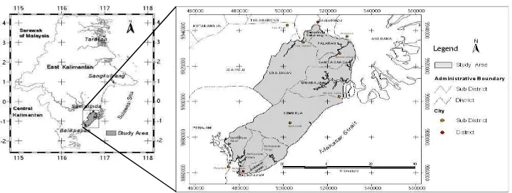
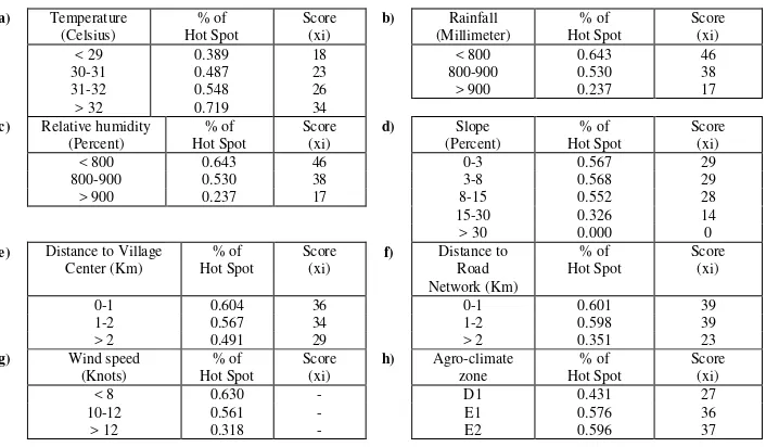
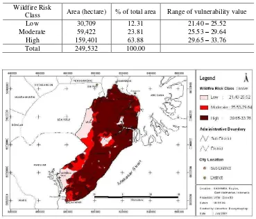
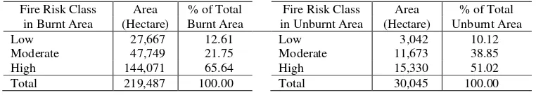
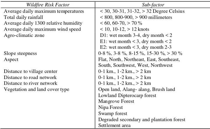
GIS-Based Method in Developing Wildfire Risk Model (Case Study in Sasamba, East Kalimantan, Indonesia)
Teks penuh
Gambar


Dokumen terkait
The BCN chose YDT as its partner because BCN was testing an enterprise-based approach to conservation, or the hypothesis that ‘if local people can benefit from using their
Timber trees need long time till harvest, so usually the incentive for local people to plant trees was low. Local people cannot afford to make investments in
In 2011, Malang District Forest Service has developed private forest program by Private forest Bussines Group Assistance with a hope that it can realize the
In this analysis, it must first determine the output, because this study aims to optimize the mining area for sectors outside mining activities or sustainable development, then
According to Terzaghi 1996, shear strength is also influenced by effective stress as the effect of pore water stress so that the equation becomes 1: t = 𝑐′+ 𝜎 − ꭒ𝑡𝑎𝑛∅′ 1 Where: t
Implementation of the Bayesian method, which was based on forming an informative prior distribution with LRSA results and updating the model with a limited number of NTHAs, led to
Based on 5, the global data traffic variable used a global mobile data forecast [28], which was identified using a data set multiplied by the incremental value in Table 1 in the year
