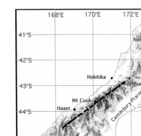
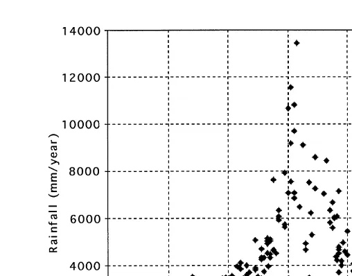
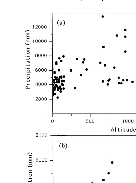
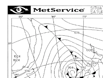
Directory UMM :Data Elmu:jurnal:A:Atmospheric Research:Vol52.Issue4.Jan2000:
Bebas
22
0
0
Teks penuh
Gambar
+7

Dokumen terkait