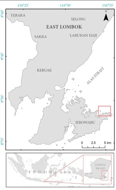
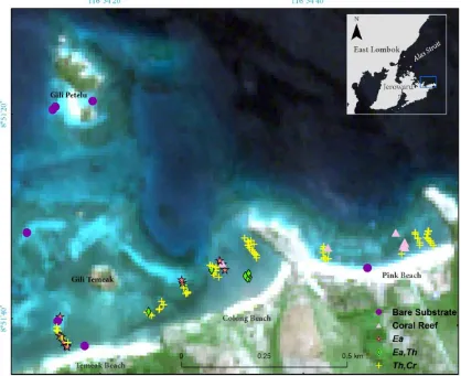
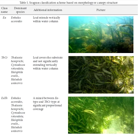
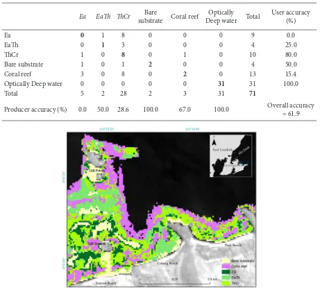
this PDF file Assessing the Capability of Sentinel2A Data for Mapping Seagrass Percent Cover in Jerowaru, East Lombok | Fauzan | Indonesian Journal of Geography 2 PB
Bebas
9
0
0
Teks penuh
Gambar
+3
Dokumen terkait