This LSP has therefore been prepared in accordance with the provisions of the Planning and Development Regulations 2015 and the requirements of the City of Swan's Local Planning Scheme No. The site is zoned as 'Residential Development' under the City of Swan's Local Planning Scheme No.17 (LPS17).
Structure Plan Area
Operation
Staging
Subdivision and Development Requirements
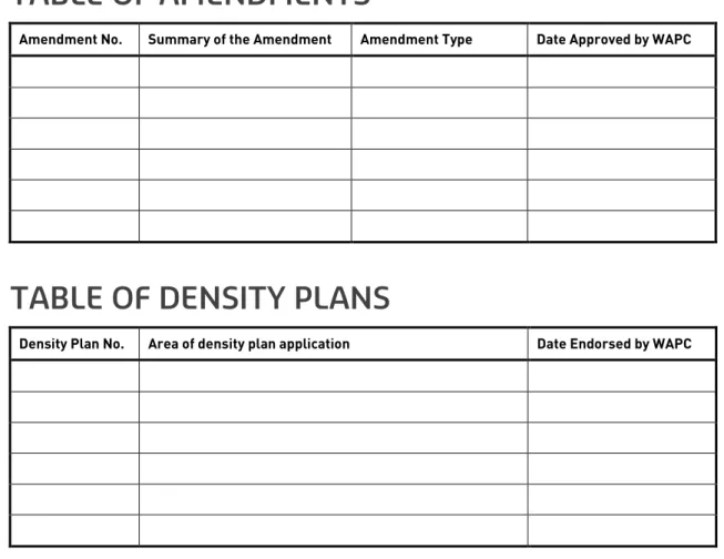
Locational Criteria for Density Distribution
Local Development Plans
Other Requirements
Additional Information
Introduction and Purpose
This Local Structure Plan (LSP) has been prepared on behalf of Satterley Property Group for land situated at Lot 1, 13255 and 13256 Railway Parade, Lots 2 and 3 Apple Street, Lots and 34 Orange Avenue and Lot 35 Rose Street, Upper Svane, which is the land contained within the inner edge of the line denoting the boundary of the local structure plan (LSP) on the LSP map. The LSP will guide future land use and development on the site and will form the framework for more detailed planning at the subdivision stage.
Land Description
- Location
- Area and Land Use
- Legal Description and Ownership
The area west of the subject site has a Bush Forever (Site 300) classification and is referred to as. Lot 327, on the northern periphery of the structure plan area, does not fall under Satterley Property Group's control but has been included to reflect the MRS town boundary.
Planning Framework
- Zoning and Reservations
- Directions 2031 and Beyond
- Draft Perth and Peel @ 3.5 Million
- City of Swan Urban Housing Strategy
- Policies
- Local Planning Policies
- Other Approvals and Decisions
- Pre-Lodgement Consultation
The LSP seeks to meet the following objectives set out by the strategy which are relevant to the subject site. The urban zone, where parts of the site located in the north-east of the site are being transferred from the "Rural" zone to the "Urban Deferred" zone - the changes were accepted and approved in June 2012.
Biodiversity and Natural Area Assets
- Flora and Vegetation
- Dieback
- Conservation Areas
- Fauna
- Wetlands
Due to the overall disturbed and degraded nature of the site and the low native flora species diversity, together with a high weed concentration, no threatened or priority ecological communities have been identified. A Level 1 Fauna Field Survey was undertaken during autumn 2016 for the entire LSP area, including the Ellen Brook foreshore area. The cleared and degraded nature of the vegetation within the development area maintains little to no understory vegetation considered suitable for supporting native fauna.
The nearest Black Cockatoo site is located within 'The Vines' approximately 1.3 km west of the subject site. Evidence of the European Red Fox (skeletal remains) and Rabbits (scats) have been observed in the area, but as introduced species they do not affect urban development. A Multiple Use (MU) category wetland is mapped over the majority of the site, spanning the southern and eastern portions of the LSP area.
No Resource Enhancement (RE) wetland has been identified within the LSP area, however an RE wetland has been mapped west of Ellen Brook Forshore outside the LSP area.
Landform and Soils
- Acid Sulphate Soil
- Contamination
Groundwater and Surface Water
- Surface Water
- Groundwater
The AAMGL depths were less than 2 meters at 10 of the 13 drilling sites, therefore backfill or subsurface drainage systems are likely to be required.
Bushfire Hazard
- Hazard Assessment
- Management Requirements
Heritage
Aboriginal Heritage Site DAA3525 Ellen Brook: Upper Swan affects all land within the Local Structure Plan area with the exception of Lot 2 Apple Street. It is proposed that ongoing consultation with relevant stakeholders be held as part of the detailed design phase to determine the potential significance of any impact on Aboriginal heritage sites.
Foreshore Area
Noise Management
Summary of Opportunities and Constraints
- Constraints
- Opportunities
The LSP is based on the fundamentals of a modified grid which provides for strong and legible connections throughout the development area with areas of amenity, which include the natural assets of the Ellen Brook, high quality POS areas, the Local Center and the Primary School. The layout forms a series of neighborhoods each with an identifiable center within a 5 minute/400m walk of the natural amenity of the creek and in close proximity to the Local Centre. The development is focused around the Local Center which is strategically located at the intersection of Apple Street and the neighborhood link, within close proximity to the centrally located Village Green link through the extension of Apple Street forming a significant town center environment with a high level of amenity.
The local road network is oriented north-south, east-west, providing preferred solar orientation and regular plots with strong and legible connections to the natural amenities offered by Ellen Brook. Medium density areas will be consolidated around the local center and immediately adjacent POS. Lot sizes will become progressively larger towards the periphery of the development area, allowing for a range of lifestyle choices.
The public open space aims to celebrate the natural heritage of the area, offering an enhanced natural environment within the banks of the Ellen Brook to landscaped areas within the development as an extension of the stream.
Land Use
Public Open Space
- Ellen Brook Foreshore Reserve
- Open Space – Drainage
- Local Playing Fields
- Landscape Strategy
The shared path will run along the banks of the Ellen Brook with links into the housing estate providing strategic public access to the Brook. Located adjacent to the Ellen Brook Foreshore, the public open space will provide areas of significant usable space and attract people to the development's primary environmental asset, emphasizing and significantly adding to the sense of place and community. An allowance of 1 drainage per 100 years will be predominantly provided along Ellen Brook, within the development buffer zone.
Additional areas of adjacent public open space have been provided on the eastern edge of the bank to align with the existing drainage channels and further enhance the amenity of the stream and its immediate surroundings. The retention of trees where appropriate in this area is considered to be very important to the overall outcome of the Ellen Brook embankment and adjacent public open space. The dual-use path system will link with the estate's public open space and footpath network, confirming the importance of the Ellen Brook and the foreshore to the local community.
The green link alignment will also provide a strong visual connection to the nearby Darling Mountains.
Residential
- Locational Criteria for Density Distribution
The R15 density code applies to residential areas fronting Apple Street (only for the section between Orange Street and Railway Parade), Orange Street and Rose Street. The site is located within 200m of the corridor connecting the general commercial area and the primary school site.
Movement Networks
- Existing Road Network
- Proposed Road Network
- Public Transport
- Pedestrians and Cycle Networks
Rose Street connects Railway Parade in the east to and ends at the Ellen Brook watercourse in the west. Avenue and the intersection with the north-south district connector and forms the 'main street' entrance to the proposed development. This section of road provides a transition from the urban core of the development to the Ellen Brook interface and is intended to be a highly pedestrianized area.
The proposed development aims to realign the Railway Parade from the north through the development area providing a central hub and logical hierarchy of routes with a link to the proposed Local Centre. It is proposed to widen the Rail Parade through this section to a 10m road pavement to accommodate the additional traffic generated by the future development of the LSP area and the traffic generated by the construction of the bridge connecting the suburb of Ellenbrook to the north-west. Ellen Brook provides a natural edge to the development boundary, which indicates that predominantly local traffic will use the road network west of the north-south neighborhood connector.
The railway line located east of the LSP is a freight route with no possibility of passenger traffic.
Water Management
- District Water Management Strategy
- Local Water Management Strategy
- Proposed Drainage Network and Infrastructure Requirements
The City of Swan assumes the future long-term responsibility for roads and stormwater infrastructure, including the ongoing operation and maintenance thereof after agreed handover by the developer. Construct and subsequently maintain/administer stormwater control measures until handover to Swan City (note 12 month deficiency liability period). Management/maintenance of landscape and artificial irrigation system for rainwater storage for a period of 2 years after practical completion.
Carry out post-development monitoring, including provision of suitable monitoring sites, for a period of 3 years after practical completion of development.
Education Facilities
Activity Centres and Employment
- Strategic and Secondary Centres
- District Centres
- Neighbourhood Centre
The LSP proposes an area for retail and commercial uses within a Neighborhood Center that is generally consistent with state and local government strategic planning guidelines and policies. A retail needs assessment has been undertaken which shows that the area is capable of supporting a 6000m2 (NLA) retail premises. Accordingly, the LSP proposes a Neighborhood Center at the intersection of Apple Street and the north-south Neighborhood Link, enabling easy access in a central location to its catchment area.
In accordance with Clause R31 in Element 8 of Liveable Neighborhoods, the local primary school was not adjacent to a center of activity but was located close enough to allow a logical and streamlined movement between the two land uses. The neighborhood center is envisioned to accommodate retail dwellings that may include, but are not limited to, a principal tenant such as a supermarket and ancillary dwellings such as a pharmacy, newsagent, liquor store and other specialty stores. A Neighborhood Center may include non-retail and community services such as offices, child care, a health center, a gym, and the like.
This is considered consistent with the requirements set forth under LN and SPP 4.2 – Activity Centers for Perth and Peel (SPP 4.2).
Infrastructure Coordination, Servicing and Staging
- Water
- Sewer
- Electricity
- Gas
- Telecommunications
- Earthworks
- Indicative Staging
It is envisaged that all plots within the LSP area will be serviced from Muchea substation via the MUC505 Fewster South HV feeder which has the capacity to service the initial stages of the development. It is understood, as is normal practice, that more pad placement sites will be required during development. The location of these locations will be determined during the implementation project and subdivision phase.
It is very likely that the expansions of the ATCO gas pipeline infrastructure will be implemented through a. This will be done either through the NBN fiber roll-out service or through an external private provider. Site staging is affected on settlement dates for the acquisition of lots that include the LSP area.
It is expected that the development will be built and marketed in stages of approx. 30 to 60 lots each.
Developer Contribution Arrangements