FUEGO
RED
2010
Santiago de Compostela, 6-8 de octubre de 2010
F
U
EG
O
R
ED
2
0
1
0
Jornadas Internacionales
INVESTIGACIÓN Y GESTIÓN PARA LA
PROTECCIÓN DEL SUELO Y RESTAURACIÓN
DE LOS ECOSISTEMAS FORESTALES
AFECTADOS POR INCENDIOS FORESTALES
International Workshop
RESEARCH AND POST-FIRE MANAGEMENT: SOIL PROTECTION AND
REHABILITATION TECHNIQUES FOR BURNT FOREST ECOSYSTEMS
A. Bento Gonçalvesa*, L. Lourençob**
a
Centro de Estudos em Geografia e Ordenamento do Território (CEGOT), Núcleo de Investigação em Geografia e Planeamento (NIGP), Departamento de Geografia, Minho University, Campus de Azurém, 4800-058 Guimarães (Portugal); b Centro de Estudos em Geografia e Ordenamento do Território (CEGOT), Núcleo de Investigação Científica de Incêndios Florestais (NICIF), Departamento de Geografia da Faculdade de Letras,
Coimbra University, 3004-530 Coimbra (Portugal) *[email protected],**[email protected]
Introduction
In Portugal, forest fires are becoming increasingly frequent as a result of socio-economic change and poor forest planning, with impacts on soil fertility and structure.
Wet Mediterranean regions are characterized by ecosystems with dense vegetation covers, which allow the fast spread of fire.
The Portuguese mountain are, in general, characterized by poorly developed Humic Cambisols where the only nutrient pool is located at the L, F and where present, H organic layers, which are burned down by the forest fires.
The recurrent forest fires are degrading an important part of Portuguese patrimony, the soils, which suffer important losses in sediments and nutrients after burn. It erodes the top soil layers, where is located the only nutrient pool of the majority of Portuguese soils. The loss of nutrients could affect soil fertility and have important implications for forest management.
Objectives
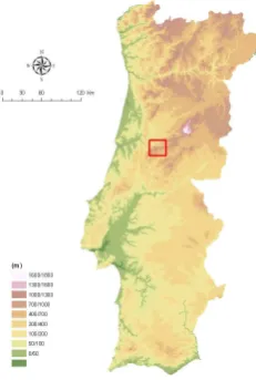
The aim of this poster is to present the main results relative to an old 2 years research in Lousã mountain (central Portugal) (Figure 1), about the erosion produced as a direct and/or indirect consequence of forest fires and its confrontation with other situations where the soils are protected both by forest and by undergrowth.
Figure 1. Field study area (Serra da Lousã)
Methodology
Figure 2. Plot scheme
Sums up, in general features, to the periodical visits to the experimental areas where the values were registered, the material collected and processed in the laboratory and statistical processing.
Results and conclusions
Rainfall. Throughout the studied period in the second year of analysis the occurred precipitation (953.5 mm) reached 94.4% of the normal precipitation in Coimbra2 (1010.4 mm, between 1951-80) and that quantitative got divided on a heterogeneous way into space and into time.
Overland flow. In spite of the fact that the overland flow depends directly upon the occurred precipitation, it also depends upon a series of other factors, such as the slope's declivity, the constitutive material of the slope, density of that material, the proximity of the rocky substratum, the existence of ravines, the existence and type of vegetation, the infiltration, the kind of overland flow, the drainage speed, etc.
Furthermore, the precipitation, recorded during a week or fortnight had, very often, different intensities thus originating, for the same precipitation quantities, different values of overland flow and of erosion material.
Thus, it is easily understood that to identical precipitation values had corresponded overland flow's values as different as the ones we found.
In this way, the largest water quantity of overland flow (l/m2) was observed in the burned areas being followed by fire-breaks and soils made ready for reforestation, through the earth clearing techniques: brush cutting and subsequent raking.
The plots that presented a lower surface flow were the ones set under shrub or tree cover.
Temperatures at soil level. As might be expected, due to a greater insulation, in a general way, the temperatures were higher in the slopes exposed to South and the minimum temperatures were lower in the slopes exposed to North.
The lowest temperatures, in certain conditions, might have helped the phenomenon’s of rocks disintegration at soil level, such as the crioclasty, or help the phenomena of individual dislocation of the particles in the slope, such as the creeping namely through the pipkrakes formation.
During the studied period, the minimum temperatures, though sometimes have reached negative values, situated themselves, in the coldest season, between zero and one positive. For this reason, the activity of the referred processes was minimum throughout the considered time. The slopes exposed to South helped mainly the processes connected to high temperatures, which, eventually during summer, can originate thermoclasty processes that help to prepare the material to be afterwards mobilized by the first rains. For that reason, the slopes with this exposure can present, in the beginning of the rainy season, a largest concentration of erosion material, than the slopes turned to North. In the same manner, they can present higher concentrations than the ones registered, with equal precipitation, at the end of the winter.
Among these two cases, there are more complex situations, where the fundamental seems to have been the alternating temperatures. The daily thermal amplitudes, with the consequent materials contraction and distension, led to the breaking of the rocks, namely when the temperatures were lower than 0° C and when there was ice and thaw formation. The phenomena above mentioned have a particular importance in dry periods, mainly very cold or very hot.
Eroded material. When the eroded material was analyzed, collected in the boxes and in suspension on the water of overland flow, in each plot of the different experimental areas, it was verified that, inside the same area, the differences were often significant, for similar conditions of rainfall and temperature.
Such as the overland flow, also the eroded material depended directly on the rainfall, though each plot, representing a very well defined situation, has answered with different amounts of material.
It was verified that the most serious situations, on erosion terms, were the ones of soil preparation for reforestation based upon the processes of brush cutting and of brush cutting associated with raking. It was also observed that the harrowing did not reveal itself dangerous, on erosive terms, and for this reason it should be more and more utilized.
Equally serious, though having less fine loose material was the situation noted in the fire-breaks, but, since the occupied area is more restricted, their consequences were lesser.
The less serious situation have been registered in the plots that had a vegetal cover, which not only reduces the effect of "splash", but also helps to settle down the land through its radicular systems.
The burned area presented a preoccupying situation, reaching identical values to the ones verified in the most fire-breaks, but with the aggravation of having suffered an accentuated increase relatively to the first year.
Calculation of the erosion normal rates. When this present calculation was performed, it was expected to give an idea, the most approached that can be possible, of the annual average rates of erosion, which allows among other analysis, a more accurate comparison between the different plots.
The normal precipitation (1951 - 1980) referring to the period from September to June was, on average, 97.3% (1010.4 mm) of the annual totality (1038.3 mm). In the 2 year period it was 91.83%, not differing too much from the normal one.
year with normal precipitation, believing that there was a linear relation between precipitation and eroded material, what can contain some error due to the ignorance of the variables behavior to such high values because the erosiveness of the summer rains, generally intense, seems to be superior than the calculated annual average.
The risk of erosion is considered serious, according to [2], when values are superior to 100 Ton / ha / year, moderate, when they are situated between 30 and 100 Ton / ha / year, light, when they varied between 11 and 30 Ton / ha / year and fairly good when they are inferior to 11 Ton / ha / year.
According to the referred limits, it was verified that there are three situations requiring preservation measures.
We dealt, as might be expected, with the plots set up in lands made ready for reforestation through the brush cutting clearing technique and the brush cutting associated with the raking. The same happened in the plot set up in fire-break in the East side, which, contrarily to the two previously referred, saw its erosion rate for a normal year increase, relatively to the first year [3], near 5.5 Ton/ha/year, what have revealed to be very preoccupying.
Though not reaching the 30 Ton/ha/year, there were situations which, either by approaching this limit (fire-break in the South side), or by having suffered an important addition in a year's time (burnt West side - 7.17 Ton/ha/year and burnt East side - 10.21 Ton/ha/year), revealed themselves equally preoccupying.
Insignificant were the values of the plots set up both on undergrowth and on forest.
Conclusion. The forest fires and the consequent mechanical preparation of the lands for reforestation can cause serious consequences due to the acceleration of soils destruction. The existence of a generalized increase of the erosion values relatively to the first year was proved, as a consequence of the precipitation's increase, the same was not verified regarding the erosion rates for a normal year, when only three situations saw an aggravation of their values.
The few situations where it was noted a diminishing of the values relatively to the first year, were due to the vegetation growth inside and outside some plots or to the progressive soil exhaustion, remaining over only the bare rock.
References
1. Lourenço, L., Monteiro, R. 1989. Quantificação da erosão produzida na serra da Lousã na sequência de incêndios florestais. Resultados preliminares. Grupo Mecânica de Fluidos, Coimbra, 45 p.
2. Díaz-Fierros, F. et al. 1982. Efectos erosivos de los incendios forestales en suelos de Galicia. Anales de Edafología y Agrobiología, 41: 627-639.
3. Lourenço, L., Bento Gonçalves, A. 1990. The study and measurement of surface flow and soil erosion on slopes affected by forest fires in the serra da Lousã. Proceedings, International Conference on Forest Fire Research, Coimbra p. C.05-1-13.
4. Lourenço, L., Bento Gonçalves, A., Monteiro, R. 1990. Avaliação da erosão dos solos produzida na sequência de incêndios florestais. II Congresso Florestal Nacional, Porto, 1990, II vol, p. 834-844.
5. Lourenço, L. 1993. Fenómenos de erosión/acumulación como consecuencia de incêndios forestales. El Cuaternario en España y Portugal. Actas de la II Reunión del Cuaternario Ibérico, Madrid, 1993, vol. II, p. 783-789.
6. Lourenço, L. 2004. Manifestações do Risco Dendrocaustológico. Colectâneas Cindínicas IV, Colecção Estudos nº 50. Núcleo de Investigação Científica de Incêndios Florestais e Faculdade de Letras da Universidade de Coimbra, Coimbra, 174 p.
http://www.nicif.pt/estudos%20cindinicos%204.htm.