v
Contents at a Glance
About the Authors ...
xi
About the Technical Reviewer ...
xiii
Acknowledgments ...
xv
Introduction ...
xvii
Chapter 1: Getting Started with Microsoft and Mapping
■
...
1
Chapter 2: Painless Hosting with Azure
■
...
11
Chapter 3: Geospatial with Azure SQL Database
■
...
29
Chapter 4: Hosting WCF Services on Windows Azure
■
...
47
Chapter 5: Map Visualization with Bing Maps for the Web
■
...
65
Chapter 6: Doing More with Bing Maps
■
...
79
Chapter 7: Bing Maps for WPF
■
...
101
Chapter 8: Bing Maps for Windows Store Apps
■
...
117
Chapter 9: Bing Maps for Windows Phone 8
■
...
135
Chapter 10: Power Map for Excel
■
...
147
xvii
Introduction
From the early days of mapping and road directions on the web to today’s proliferation of ubiquitous maps, location-aware recommendation and social applications, and vertical applications for nearly every sector, the last decade has seen an explosion in location-aware software and services.
We’re excited to share Microsoft’s map-enabling technologies with you. As we show you in Chapter 1, Microsoft is no newcomer to mapping the world; its efforts date back over a decade. Today, Microsoft offers map controls for its leading platforms—Windows Phone, Windows 7, Windows 8, and the Web using HTML and AJAX—as well as enabling geospatial data in its SQL Server and SQL Azure offerings. In addition, the base platform provided by .NET, Windows Communication Foundation (WCF), and Windows Azure gives you a robust hosting solution on which to build and deploy Web and networked applications.
This book gives you the essential information you need to know to use these technologies to build your first location-aware application on any one of Microsoft’s platforms; or several of them. While not an in-depth reference on either Windows Azure or WCF, we show you what you need to get started with Windows Azure and SQL Azure to host your application, and WCF to provide the communications backbone between your application clients and your server back end. Then we cover each of Microsoft’s map controls in detail, so you can learn how to craft your application for Windows 7, Windows 8, Windows Phone, or the web. Along the way, we provide references to other books and the web, so you can get more detail on the subjects that interest you the most.
We wrote this book for developers with some broad experience using ASP, C#, and .NET, but don’t expect you to be deeply proficient in the subject matter. Some experience with the Extensible Application Markup Language (XAML) helps, too, because of course it’s the foundation for creating GUIs using Windows Presentation Foundation (WPF) and for writing applications for Windows Store on Windows 8 and Windows 8.1.
1
Getting Started with Microsoft
and Mapping
Location and mapping play an increasingly important role in software today. The advent of location-aware social applications, web sites like Bing Maps, Google Maps, and Yelp, mobile mapping and navigation applications, and location-aware games like Shadow Cities by Grey Area have all increased customer demand for software that knows, presents, and uses your location in helpful ways.
Building these applications from scratch is not easy—in addition to the usual problems of scaling and software development in general, location-aware applications pose additional problems in the area of content (such as the underlying map, points of interest, traffic, and routing), and the back-end storage necessary to quickly index, store, and search data by its position on the earth. Open-source solutions exist; many database vendors have SQL extensions for storing data such as latitude and longitude, and there are user interface controls for a number of platforms, such as Google Maps for the Web and controls on Android and iOS. Only Microsoft, however, provides a soup-to-nuts solution for writing location-aware applications including:
Microsoft SQL Server, which provides support for geospatial types and operations, •
Windows Azure, which provides platform-as-a-service (PaaS) and infrastructure-as-a-service •
(IaaS) solutions for hosting your application’s services,
Bing Maps controls for presenting maps with your data on the web and in native applications •
on Windows and iOS,
Services provided for traffic and routing overlaid on Bing Maps controls. •
In this chapter, we introduce what Microsoft offers to you and how this book is organized. After reading this chapter, you’ll have a good understanding of how Microsoft technologies can help you build your location-aware application, how this book is organized, and where to turn next to learn the gritty details you need to build your application.
Mapping and Microsoft
2
Bing Maps for Developers
You may already be familiar with Bing Maps on the web, especially if you use Bing when you search for points of interest like restaurants and businesses. Although not as widely adopted in mash-ups and other applications as Google Maps, Bing Maps has a developer API comparable with Google Maps, letting you develop asynchronous JavaScript and XML (AJAX) applications for the Web. This AJAX API lets web developers build map-aware applications that can:
Display street and aerial maps of any region, letting the user zoom and pan the map presented, •
Annotate a displayed map with markers, lines, and regions organized in overlays, letting you •
add your data to the map,
Plot directions and traffic information provided by Bing Maps, •
Obtain indoor venue maps for many shopping districts and indoor venues, •
Geocode (determine the latitude and longitude for an address), and reverse geocode •
(determine an address for a latitude and longitude) to refine your user experience, and
Search for businesses using Bing. •
In addition to making a Web control available, Microsoft makes an embeddable map control available with similar features. This map control, which you can see in Figure 1-1, supports most of the same features as the AJAX version and is available for Windows 8 (Windows Store) applications, as well as for Windows Presentation Foundation (WPF), Windows Phone, and Apple iOS.
3
Learning how to use the various flavors of the Bing Maps control is a key part of this book, and we spend a lot of time discussing the various features available to you in the various flavors Microsoft offers. For more information about the control, see Chapters 5 and 6 (where we discuss the Web flavor of the control), Chapters 7 and 8 (where we discuss the Windows 8 and WPF versions of the control, respectively), and Chapter 9 (where we discuss using the control in Windows Phone applications).
Microsoft SQL Server for Location Applications
A growing number of databases support extensions for geospatial applications, and Microsoft SQL Server is no exception. In Microsoft SQL Server 2008, Microsoft introduced data types for both round-earth and planar (projective) mapping. In addition to data types to store geospatial data, Microsoft added support for Simple Feature Access (ISO 19125) support for two-dimensional geographic data, including approximately 70 methods from the specification. In 2012, with Microsoft SQL Server 2012, Microsoft significantly extended this support, adding new methods and new types of geometry for specific applications.
With its spatial extensions in Microsoft SQL Server, you can:
Store points, lines, polygons, and other shapes in a flat coordinate system using the
• geometry
spatial data type.
Store points, lines, polygons, and other shapes in a round-earth coordinate system using the •
geography data type.
Perform computations on collections of points, such as computing a polygon’s area or •
perimeter, determining if a point falls inside or outside a region, and determining the intersection between regions.
Build spatial indices over spatial data, letting you perform database searches by location •
quickly over thousands or millions of points.
You have access to Microsoft SQL Server’s location-based features both if you’re running stand-alone instances of Microsoft SQL Server as well as in the SQL Database Service on Windows Azure if you choose to host your application on Windows Azure.
We provide a gentle introduction to storing geospatial data using Microsoft SQL Server in Chapter 3. For a more thorough treatment for those with professional database experience, we recommend you check out a copy of Pro Spatial with SQL Server 2012 by Alistair Aitchison, also from Apress.
Windows Azure to Host Your Application
Most applications today require a back-end component to host data and services. Whether you’re building a Web application or just the back-end services to support a client application, Windows Azure gives you a platform to deploy your services.
Windows Azure is more than just a hosting service; it provides scalable infrastructure for deploying your services that includes:
Easy partitioning into storage, web, and worker hosts running Windows Server in one or more •
geographic regions for redundancy,
Relational storage through the SQL Database Service, •
NoSQL table storage through key-value pairs, as well as the storage of blobs and smaller data •
4
Inter-host messaging through the Windows Azure Service Bus, •
Support for Microsoft’s web hosting through Microsoft Internet Information Services (IIS), •
letting you serve static as well as dynamic content through Active Server Pages (ASP) with ASP. NET and ASP Model-View-Controller (MVC) (or, if you prefer, PHP or Node.js).
In this book, we discuss Windows Azure as it pertains to hosting location-aware applications in the cloud, especially as a host for running the SQL Database Service and Microsoft IIS. In Chapter 2, you’ll get started with your own trial Azure account and deploy a simple Bing Maps application for the web; in Chapters 3 and 4 you learn how to configure the SQL Database Service to store data for your application and construct Windows Communication Foundation (WCF) endpoints for your Web and native client applications. If that’s not enough about Windows Azure, for you, we recommend Windows Azure Platform by Tejaswi Redkar and Tony Guidici, also from Apress.
Maps Without Code: Power Maps
Sometimes you just need to visualize a data set on a map, either as part of developing a larger solution or just to examine a particular data set. While you can write custom data visualization code using the Bing Maps control for the Web or desktop, in many cases it’s easier to load your data into Microsoft Excel and use Power Maps to plot the data right on flat and globe maps of the earth. In Chapter 10, we show you what’s possible with Power Maps and Excel.
What You Need to Get Started
We assume you’re relatively proficient with writing applications for Microsoft platforms. Ideally, you’re a developer proficient with Microsoft technologies, and you’ve had some experience with C# and the .NET platform—either native or server-side apps—and are comfortable using Microsoft Visual Studio. We’re focused on making you proficient with the various location, mapping, and spatial facilities Microsoft makes available, rather than focusing on nuances of C# or building a native or Web-based application. At the same time, if we’re doing anything particularly clever with a language feature or an interface, we’ll be sure to explain what we’re doing and why, so you can benefit from our experience. Similarly, when we discuss the Bing Maps for iOS control, we assume you have some rudimentary iOS experience.
Of course, you’ll also need a way to develop for Microsoft platforms if you want to build on Microsoft’s
technologies in your application. At a minimum, you’ll need a copy of Microsoft Visual Studio: Visual Studio Express 2012 for Web is a good place to start for the web, and either Visual Studio Express 2012 for Windows 8, Windows Desktop, or Windows Phone for the native application development we discuss later in this book.
We’ve written these chapters to be mostly independent of each other, stitched together by the common theme of this book and a collection of sample applications that demonstrate what we’re helping you learn as you read this book. On a first reading, a good start would be to read the remainder of this chapter, and then skip directly to the chapter that interests you the most.
A Few Words on Terminology
Before we continue, it’s worth getting a few bits of terminology straight, because depending on where you look, you’re going to see some vocabulary that may be unfamiliar.
5
Second, there are a few cartographic notions worth reviewing. Any position on the Earth can be represented as a pair of coordinates—a latitude, indicating how far north or south of the equator the point is, and a longitude, indicating how far east or west of the prime meridian (which falls through Greenwich, UK) the point is. By convention, northern latitudes are positive; southern latitudes are negative, while eastern longitudes are positive and western longitudes are negative. (Be careful! People in the western hemisphere new to geospatial software often assume that western longitude is positive. It isn’t.)
The Earth is round, which poses some problems when we think about mapping the Earth. First, our coordinate system breaks down at the poles and the International Date Line—at the poles, the latitude is +90 or –90, while all longitudes coexist at the actual poles. Perhaps more perplexing in more circumstances is what happens to longitude at the International Date Line; it’s discontinuous there. At one point immediately to the west of the date line you’ll have a longitude approaching +180; cross the line in an easterly direction and the sign flips, with a longitude of –180. This is one reason for Microsoft SQL Server’s geography type; it takes these funky discontinuities in stride.
Another reason for the type, and a pitfall you’re probably already aware of, is that you can’t present a flat map of the Earth on a plane without distortions. Various projections (consisting of formulas mapping a point on a sphere to a point on a plane) of the sphere onto the plane exist; Bing Maps, like most maps you’re used to, uses the Mercator projection, which has two key advantages. It’s conformal, meaning that the shape of relatively small objects is preserved; it’s also cylindrical: at any point on the map, north and south are always up and down, and east and west are always left and right. However, the math of the projection gives some problems at the poles; Mercator maps don’t map the pole regions very well, which is why when you look at countries further north and south of the equator, they look bigger in area than they actually are.
While the Earth is round, it’s not perfectly round: it’s a little squashed at the poles. To model the shape more exactly than using a sphere, geographers introduce the notion of the datum, a mathematical shape that more closely represents the Earth. To precisely position a point on the Earth, I should give you not just its latitude and longitude (and elevation, if the position is above or below the surface of the Earth), but a reference to the datum the coordinates are in as well. Fortunately, nearly all systems today, including those you’ll use from Microsoft and the positions returned by GPS receivers and cell phones are in the World Geodetic System (WGS) 1984 datum, so you won’t have to do any fancy math to move coordinates from one datum to another datum under normal circumstances.
Note
■
Another datum you might encounter in your work is North American Datum 27 (NAD27), which is still in use
by some U.S governmental agencies like the Federal Communications Commission. If you're plotting data from another
source, it's crucial you find out what datum the coordinates are in and interconvert if necessary.
We touched on geocoding and reverse geocoding in a previous section as a feature of Bing Maps; to geocode a street address is to get the latitude and longitude for the street address, while to reverse geocode a latitude and longitude is to get the closest street address to the point. By their very nature, these are approximate transformations, in practice you may find if you geocode an address and go to that point with a Global Positioning System (GPS) receiver that you’re off by tens or hundreds of meters (even after taking into account the error in GPS), because addresses are often sequentially assigned to road segments assuming an equal spacing between addresses, rather than recognizing the nasty reality that parcel sizes may change, addresses may be skipped, and so on. If you’re developing an application for another country, geocoding may be more or less accurate than it is in the United States, because of how addresses get assigned; some in-location testing is probably in order.
6
Finally, this book is a book about writing software; the usual conventions apply for how you should read the print of the book, Words like this in a paragraph indicate a snippet of code such as a method or variable; when we present listings (which you don’t need to type in, as the source code is available from the Apress web site) to illustrate points, we’ll set them out like this:
Listing 1-1. Hello World, in C#.
public class Hello {
public static void Main() {
System.Console.WriteLine("Hello, World!"); }
}
Introducing the Sample Application
It doesn’t take much these days to come up with an application idea that can be improved by the judicious use of location—we think that’s why you bought this book! Throughout the book, we hang most of our examples on a suite of sample applications based on the same use case: tracking and reporting statistics about earthquakes. We show you how to do this using the SQL Database service on Azure, hosting the service on Azure, and presenting the data using the Web, Windows Presentation Foundation (WPF) for Windows 7.0, and as applications for Windows 8 using the Windows Store UI and Windows Phone, as well as showing the same data in Power Maps with Excel. In addition, we’ve created several smaller applications that show specific features of the Bing Maps API on specific clients, such as the reverse geocoding, routing, and traffic interfaces as well.
Before we dive into the next chapter and get you started with hosting your service on Azure, let’s take a moment and look at the overall architecture for our main sample application; that way, as you read this book you understand the fundamental points and can focus on the Microsoft mapping details along the way. Figures 1-2(a) and 1-2(b) show the WPF version of our sample application, first in its default state when launched and then after zooming in on a particular earthquake.
Figure 1-2. Our sample application, in (a) showing the entire world, in (b) after zooming in using the scrollwheel or pinch-to-zoom to see a particular area
7
The sample application is intentionally simple; its sole purpose is to provide a map populated with recent earthquakes around the world. You’ll see this example again and again in this book, first as an application for the Web, and later as a native application for WPF, Windows Store (for Windows 8), and finally as a Windows Phone application. (You’ll also see chunks of other sample applications, demonstrating other Bing Maps features such as traffic layers, routing, and geocoding.) When you launch the application, it immediately draws a map of the world and fetches recent earthquake data from our Azure service; you can zoom in on any area, pan the map, or hover over a marker to get more information about a specific earthquake record.
Figure 1-3 shows a block diagram of the overall architecture we’ve chosen for this sample application. It’s admittedly more than the back end for our earthquake monitoring clients requires, but it lets us share with you important details about setting up services for location-based applications, hosting on Windows Azure, writing applications that communicate between client and server, and of course the client applications themselves.
USGS
Figure 1-3. The architecture for our sample application
The components you see are:
The USGS provides the raw earthquake data. Served as a comma-delimited file (CSV) over •
HTTP, each file contains a list of earthquakes and data about each earthquake over the last 24-hour period.
The Harvester is a process running on Windows Azure that periodically polls the USGS for •
8
The SQL database storing our earthquake data runs on the Azure SQL Database Service as a •
single database, with rows for each earthquake harvested by the harvester.
The web server, running in Microsoft IIS, serves both the HTML and JavaScript for web clients •
using the service and provides a Windows Communication Foundation (WCF) service serving the same data to both web and native clients using JavaScript Object Notation (JSON) over the HyperText Transfer Protocol (HTTP).
Application clients come in two flavors: web and native. The web client loads its application •
directly from the web server as JavaScript with HTML and image resources; the native clients run locally on a Windows 7, Windows 8, or Windows Phone host. All clients use the same WCF bindings, making integration dead-simple for the Windows applications, and only a little more difficult for the iOS platforms.
It’s worth taking a few minutes to explain why we chose this architecture. First, there are more pieces than you’d need just to browse earthquake data from the USGS: you could just as easily pull the data directly from the USGS and display it on a map with Power Maps, which is what we do in Chapter 10. This is a reasonable approach, but not sufficient for our purposes, where we hope to show you how to build and deploy a Windows Azure service for your application.
In a real production service, your entire web service may live on Azure, or you may be dependent on legacy or enterprise services running in another data center. If that’s the case, you need to bridge the gap somehow. We chose to bridge this gap using our harvester process, because one of our goals is to show you how to use the geospatial features in Microsoft’s various database products. Our harvester polls the USGS and inserts earthquake records in our database; your bridge may do something similar, replicating an existing database. More likely—and more efficiently—your bridge running on Azure can make Web service calls to your legacy services, leaving the database on Azure for your client-specific operations not related to the legacy service. (In fact, your legacy server might also be a Microsoft SQL Server instance of some kind, and you might choose to host your geospatial data there.)
For large-scale services, you should consider replicating your SQL server on multiple hosts, either in your enterprise data center or in different zones of Microsoft Azure. We don’t explicitly discuss replication in this book; for that, you should consult any of the good books on Microsoft SQL Server administration. However, it’s important to recognize that the database can be a single point of failure for your entire service, so distributing this asset is a key component when building a large-scale service.
Equally important is distributing the front end to your service. As we discuss in the next chapter, when we explore Windows Azure in more detail, Azure has the notion of web hosts and worker hosts. Our harvester runs on a worker host, an instance of a machine responsible for doing batch computation, rather than serving client endpoints. In production environments, you’d replicate the web host providing the front end services multiple times, placing them behind one of Azure’s load balancers configured to distribute client requests among multiple hosts. When you do this, you need to remember that client-server requests should be stateless, that is, they should be atomic and not rely on a persistent connection or sequence. This lets the load balancer make the most of your service, and ensures that if a web server goes down (or its connection is interrupted during the course of normal services) that the failover to another service can happen with a minimum of difficulty and no sign to the user that a transaction failed.
9
Developing Your Application
Developing a location-aware application is similar in process to developing any application. If your development team is small, or a one-man operation, be prepared to wear a lot of hats: database administrator, Web service developer, and client application developer. If you’re building a larger application, or part of a team, a good way to divide and conquer the application development space is to partition it into three broad teams: content, cloud, and client:
The content team is responsible for identifying and capturing any content your application needs. •
For example, if your application is a restaurant table reservation service, this team is responsible for identifying the restaurants you serve (likely a sales function) as well as developing the database schema and database for that content. Or maybe you’re writing a location-aware game, and you need to capture locations that provide the setting and environment of the game; in that case, the content team is responsible for determining what data is germane to each setting, how it’s stored, and so forth. You’ll want content and database experts working together on this team.
The cloud team builds the web services necessary to support the clients. It reaches into the •
content database over a well-defined interface to get what it needs on the one side, and serves that content to clients through a well-defined interface (likely WCF-hosted) on the other. Developers on this team should have good understanding of Azure and service deployment, and be able to write server-side applications fluently.
The client team builds the clients that use the cloud team’s web service. The responsibilities •
of this team vary depending on the kind of clients you need to support; maybe all you need is a crackerjack ASP.NET programmer and a good web page designer, or maybe you need native application development teams to target a number of platforms.
Dividing your work this way makes sense even if you’re a small team; you can change roles depending on the phase of development you’re in or what needs doing that day. It’s easier to think about the complexities of a location-based application if you break down the pieces into manageable chunks, and these three chunks give you a good place to start. Of course, a larger effort may have multiple teams in each category; maybe you’ve got different client teams targeting the web, Apple iOS, and Windows Phone. Or maybe you’re in the business of producing a lot of content (think of a service like Yelp) with sophisticated requirements for collecting and storing the content your service offers.
10
Wrapping Up
While many firms provide the pieces you need to assemble a location-aware application for the web, desktop, or mobile client, only Microsoft offers an end-to-end solution that includes:
A database (Microsoft SQL Server) with geospatial support for flat-map and round-earth •
coordinate systems, capable of storing and querying points and regions.
A PaaS (Windows Azure) for hosting your database (using Azure’s SQL Database Service) and •
cloud computing requirements, including state-of-the-art Web hosting with Microsoft IIS.
Client-side map-rendering controls (Bing Maps) for the web, WPF, Windows Store, and •
Windows Phone applications.
Web services to support your application including traffic, routing, geocoding, and reverse •
geocoding features.
11
Painless Hosting with Azure
In this chapter we show you how to host a simple application that displays a Bing Map on Windows Azure, Microsoft’s cloud computing platform. Cloud computing provides agile IT for businesses and developers. If a business wanted to deploy a new web application, the traditional method of deployment would require that the business set up the necessary hardware, software, operations, and support team in order to host this application on premise. With cloud computing, all of the infrastructure needed to deploy that application would already be available on the cloud, thereby reducing the necessary setup time and money to deploy.
Why Windows Azure?
The main benefit of moving to the cloud is the savings in time and infrastructure for application deployment. You can focus on your application development and not the infrastructure. The backend is fully automated and handles the patching, updating, and maintenance of the operating system and applications. Windows Azure follows a pay-per-use model, where you only pay for the resources that your application uses; there is no upfront cost. One major concern in application deployment is the ability to survive hardware and system failures, and Windows Azure is designed with high availability in mind. Applications are replicated across multiple servers in different locations for fail-safe recovery. Microsoft delivers a 99.95% monthly SLA (Service-Level Agreement).
As is often the goal, your application may at times require scaling up as demands grow. Windows Azure is designed for elastic scale, therefore, multiple instances can be spun up as needed. Alternatively, the customer can drop the number of instances to zero when there is no demand. Since Windows Azure follows the pay-per-use model, you only pay for the number of instances that you use and the storage you consume. Another important benefit is that SQL Database (formerly SQL Azure), which is the storage component of Windows Azure, shares the same basic programming models with Microsoft SQL Server, thus if you are familiar with SQL Server product code base, your skills can be applied to working with SQL Database.
While a relatively new business for Microsoft, the growth of Windows Azure is a testament to the growing importance of cloud computing as well as Microsoft’s platform. As of April 2013, Microsoft announced that Windows Azure had crossed the $1 billion threshold (see http://bloom.bg/10JDhtG), with over 200,000 customers.
Cloud Computing Services
Cloud computing refers to the notion of placing computing services in a central data center, accessible by the Internet. The main types of cloud computing services are Infrastructure as a Service (IaaS), Platform as a Service (PaaS), and Software as a Service (SaaS).
IaaS provides the hardware necessary for deploying an application, however the onus is on the •
developer (customer) to patch, upgrade, and maintain the operating system.
With PaaS, in addition to the hardware, the operating system and runtime environment •
12
Finally, SaaS provides the entire end-to-end software application to the customer. The •
customer is only required to sign up for a given service, and the SaaS handles the entire application for her.
We should note that there are in fact other types of cloud services such as Security as a Service or IT as a Service offered by other cloud computing platforms. The types of services available with Windows Azure are virtual machines (VMs) (IaaS), cloud application services (PaaS), and websites (SaaS) as in Figure 2-1.
Figure 2-1. Compute Services offered by Windows Azure
Virtual Machines (IaaS)
Rather than requiring an actual on-premise physical machine, you can create VMs on demand—either from an image you supply or from a standard image. To create a VM, you simply specify which Virtual Hard Disk (VHD) to use and the size of the VM. Once you’ve done that, you define a VM role for your application. Essentially, Azure provides you with a server in the cloud that you can control and manage. You can deploy any available instance of Windows Server or Linux. Each VM will have your virtual hard desk (VHD) and it can contain your customized settings as well as your applications. You can make changes to these settings and applications while a VM is running, and the change is persisted such that the next time you create a VM from that VHD, the changes will be reflected. Alternatively, you can copy the changed VHD out of the cloud and run it locally.
There are different ways in which Windows Azure can be used. Firstly, you can use them to create inexpensive development and test platforms. Additionally, you can create and run applications that use any of the data
management options provided by Windows Azure in conjunction with either SQL Server or another DBMS running in your VM. Finally, you can even use VMs as an extension of an on-premise datacenter. Windows Azure’s VMs, in essence, provide the highest level of flexibility for those who would like to have access to many machines and full control of their management.
Cloud Services (PaaS)
13
There are two types of roles to choose from for cloud services: Web and Worker roles. A web role is for a front-end/web server. For example, you might have an ASP.NET enabled website. In this case, you use the Web role and upload the website code to the cloud. Azure will automatically deploy the website to the Azure Virtual Machine (VM) instances, and provide load balancing between the instances you’ve created.
Websites (SaaS)
Offering the last amount of flexibility are the SaaS Windows Azure Websites. This service allows you to build a scalable website using any operating system and ASP.Net, PHP, or Node.js and then deploy this website on the cloud. You manage the web environment using Microsoft Internet Information Service (IIS). You can either create a new website directly in the cloud, or you can move an existing IIS web site onto Windows Azure, as we will do in the example in this chapter. You can have multiple instances of the website running, and you can remove or add these instances even as the website is running. Additionally, Azure allows you to load balance the requests to the website across the various instances for higher performance.
As you have just read, Windows Azure provides you with the types of services that you can tailor to your needs. In fact, you can use one, two, or all three of these types of services in conjunction depending on your needs. Moreover, at all times Windows Azure has focused on providing a highly reliable cloud solution to you. As such, your VMs and applications are spread out across various locations and replicated for redundancy to safeguard against hardware failures and other such disasters.
At times you may want to have parts of your solution hosted on Azure but the remainder of it on premises. The AppFabric is the glue that connects these parts together by allowing you to integrate the Windows Azure applications with the on-premises application. You can leverage the Service Bus to enable communication between the cloud and on-premise applications. Alternatively, you can use the AppFabric’s Access Control Service to create highly secure authorization for applications. Essentially, the AppFabric is a framework for managing and monitoring the applications running in the cloud.
Windows Azure Data Management
Azure also offers data services that allow you to store your data on the cloud. As you can see in Figure 2-2, the types of storage options are blobs, tables, and SQL databases. They are accessible via REST API calls or standard HTTP calls. Before we describe each of these types of storage, it is important to note that once again Windows Azure allows you to only pay for the amount of storage you use per month. Moreover, while the storage can be accessed by your Azure applications, it can also be accessed by applications running on your own local machines.
14
Blobs
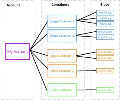
Blobs (Binary Large Objects) are unstructured text or binary data such as images, audio, or videos. This type of storage is inexpensive, and a single blob can be as large as one terabyte. Blobs are grouped into containers and your account can have an unlimited number of containers, and each container can contain an unlimited number of blobs. The only restriction is that the total size of all blobs be less than 100TBs for a single storage account. In Figure 2-3, there are 9 blobs in that one account, of which there are 3 types of containers (image, audio, and video), and 5 distinct containers.
Figure 2-3. Example of blob storage. Each account can have an unlimited number of containers, and containers can contain an unlimited number of blobs of the same type
Tables
15
SQL Databases
Finally, SQL databases are large amounts of structured and relational data. If you are familiar with using SQL Server then you are familiar with SQL Database. As with SQL Server, SQL Database can be accessed using a variety of data access tools such as ADO.NET or JDBC. SQL Database offers the added advantage of being a PaaS, in that while you can control the data and who can access it, Windows Azure takes care of managing all the hardware and infrastructure for you. Additionally, SQL Database federates the data across multiple servers, which is particularly useful for
performance if your database receives large quantities of access requests.
In our example in this book, we will be storing blobs of geo data on the cloud. For the moment, in this chapter’s example we will simply deploy an ASP.NET MVC on Azure.
Setting up Windows Azure
Getting started with Windows Azure is easy. You’ll sign up for an account, download the Windows Azure SDK to your computer so you can use Microsoft Visual Studio to develop your Windows Azure applications, and that’s it!
As you use the Windows Azure SDK, you can also model most of the Windows Azure features, including storage and hosting, right on your local development machine. This is especially handy when you’re just starting development, because it lets you experiment with Windows Azure and your code without taking the time to spin up one or more virtual machines to host your services.
Getting a Windows Azure Account
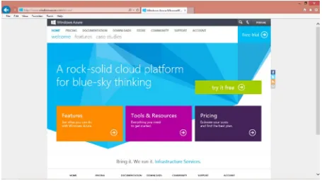
Before you can begin developing your application, you will need a Windows Azure account. Microsoft has made this a painless, straightforward process. You can begin with signing up for a trial at http://bit.ly/15tpYgF (http://www.windowsazure.com), as shown in Figure 2-5, with a single click.
16
Note
■
Microsoft experiments with different trial offers; when we wrote this, the trial was a three-month free trial—a
great deal! Your mileage may vary, however, and if you’re a member of MSDN, there may be a MSDN trial available as well.
You will be required to sign in with a Windows Live ID, which you can also sign up for if you do not yet have one. Once you have signed in, you will be redirected to the 90-day free trial page, as shown in Figure 2-6. You will need both a mobile phone as well as a credit card for signing up. You will not be charged on your credit card during the trial, it’s just for verification and as a means for Microsoft to avoid spam botting. You will begin by entering a mobile phone number, to which a verification code will be sent. Once you verify your account with the code, you will be redirected to the credit card sign in page. After entering your credit card information, your sign in is complete.
17
Getting the Windows Azure SDK
Now that you’ve obtained a Windows Azure Account, you will want to install the Windows Azure SDK on your development machine. In this book, we will be using Visual Studio 2012, ASP.NET, and C#. Of course, ASP.NET is not the only web hosting language you can use with Windows Azure; Figure 2-7 shows the different SDKs you can install on your machine for development. Click on .NET, to install the SDK. If your machine already has Visual Studio 2010 installed, that is also acceptable, but be sure to install the corresponding SDK when given the option. Alternatively, if your machine does not have Visual Studio installed, the one-click installation will also install the Web Express edition on your machine.
18
Hosting a Bing Map on Azure
To make sure you’ve set everything up correctly, let’s create a simple web page that just shows a map using the Bing Maps AJAX control.
Obtaining a Bing Maps Account
In order to work with Bing Maps, you will need to obtain Bing Maps account, if you do not already have one. You can do so at http://bit.ly/ZmFU3q(https://www.bingmapsportal.com). You will need to click on create in the New User box. Once again you will need to sign in with your Windows Live ID account. Once you do so, you will need to provide an account name, a contact name, a company name, an e-mail address, a phone number, and agree to the Bing Maps terms of use. Once you have saved this information, you now have a Bing Maps Account.
Obtaining a Bing Maps Key
Even though you have an account, you still require a key in order to use the Bing Maps API. You can do so at the same site from which you obtained the Bing Maps account. If you are not already signed in, you will be prompted to sign in with your Windows Live ID. Once you do so, you can obtain a key by clicking on Create or View Keys under My Account. You will be required to fill out the form in Figure 2-8. The application name is required, as well as the type of key. In this book, we use a Basic key which is used for non-trial applications that do not exceed 50,000 transactions of any type within a 24-hour period. A Basic Key must comply with the Bings Maps Terms of Use, which you can read at
http://bit.ly/16Bx1bS.
19
Once you submit the Create key form, you will then have a key you can use with the Bing Maps API. It should resemble this string:
XX_XXXxX_x_XXXXXXXX-XXXXXXXXX-1xXxXxXXXXXXxXXxx-xxXxXXXXxxx_xXXX
Note
■
Make sure you stick a copy of your Bing Maps Key someplace handy, as you’ll need it a lot when working
through the sample code in this book.
With this string you are now ready to use the Bing Maps API to build our sample application.
Building the Bing Map
Now that you have a Bing Map API key, you are ready to begin using the Bing Map API to build your map. Microsoft offers a Bing Map API interactive SDK at the Bing Maps portal, http://bit.ly/18HDak6. From this portal, you can choose the types of features you would like to add to your map and get the corresponding HTML code listing to create such a map by clicking on View HTML, as seen in Figure 2-9.
20
For our example, we use the basic map with the correct credentials. The credential is the Bing Map key we obtained in the previous section. You will replace the string “Your Bing Maps Key” with the key. Thus, your HTML listing will look like the code in Listing 2-1. You will then be able to save this listing as an HTML file and view it in a browser. We have saved this listing as Map.htm. This map has basic zoom functionality as well as the option to switch between road and aerial (Bird’s Eye) view.
Listing 2-1. Map.htm, HTML code for a basic Bing Map with valid credentials
<!DOCTYPE html PUBLIC "-//W3C//DTD XHTML 1.0 Transitional//EN" "http://www.w3.org/TR/xhtml1/DTD/xhtml1-transitional.dtd"> <html>
<head>
<title>Map with valid credentials</title>
<meta http-equiv="Content-Type" content="text/html; charset=utf-8"/> <script
type="text/javascript"
src="http://ecn.dev.virtualearth.net/mapcontrol/mapcontrol.ashx?v=7.0"> </script>
<script type="text/javascript"> var map = null;
21
function getMap() {
map = new Microsoft.Maps.Map(document.getElementById('myMap'), {
credentials:
'XX_XXXxX_x_XXXXXXXX-XXXXXXXXX-1xXxXxXXXXXXxXXxx-xxXxXXXXxxx_xXXX' });
}
</script> </head>
<body onload="getMap();">
<div id='myMap' style="position:relative; width:400px; height:400px;"></div> </body>
</html>
Hosting the Bing Map on Windows Azure
Now that you have created the map, we will show you how to programatically host it on Windows Azure.
In Visual Studio, create a new ASP.NET MVC 4 Web Application project for C#, as in Figure 2-10. We save the project as BingMapOnAzure.
Figure 2-10. Visual Studio 2012, create a ASP .NET MVC 4 Web Application
22
We will now modify this template code to host the Bing map you generated in the previous section. In the current template, there are different tabbed pages: Home, About, and Contact. We will modify the map over the About page. First, in the listing you will change the name of the page from About to Map in both the code listing and the About. cshtml file name to Map.cshtml in the Solution Explorer, as in Figure 2-12.
Figure 2-12. Change the webpage name and file name from About to Map
23
In _Layout.cshtml, change the action link parameters from About to Map, see Figure 2-13.
Figure 2-13. Change the link About to Map
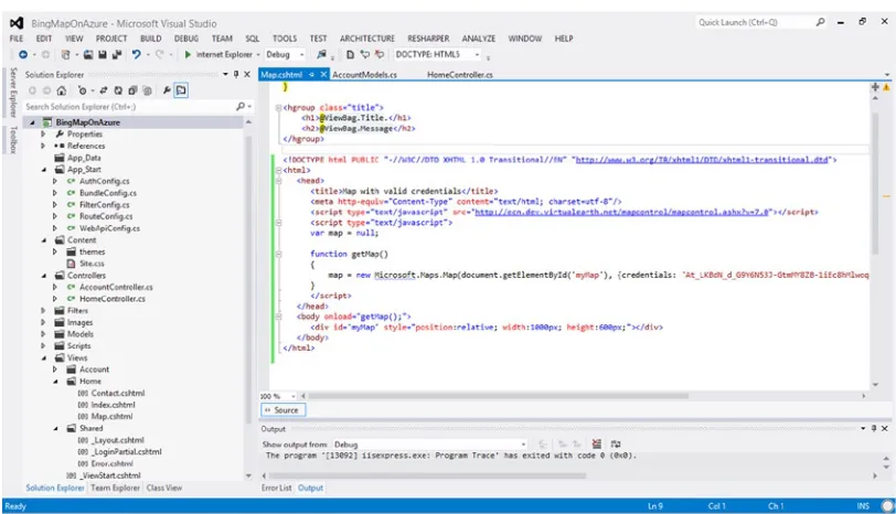
Figure 2-14. Map.cshtml with Bing map code listing from Listing 2-1
24
Now we will convert the code template to be Azure enabled to be able to deploy the project on Windows Azure. In order to do that, you right-click on the project in the Solution Explorer and select Add Windows Azure Cloud Service Project, as shown in Figure 2-15. By doing so, we have now added into the solution another project that by default is called BingMapOnAzure.Azure. This project will manage the deployment settings and configuration settings required to deploy on Azure. You can now run this project on Azure, or the Azure emulator that came with the Azure SDK you have installed on your machine.
Figure 2-15. To Azure enable the project, right-click on Add Windows Azure Cloud Service Project
25
The next step is to create your cloud service. In the Publish Sign In page and Settings, as in Figure 2-17, we named our cloud service BingMapOnAzure, and chose the location of West US. Click OK and then Publish and deployment to Azure will begin.
Figure 2-16. Windows Azure Publish Sign In page. Click Import to add your credentials
26
Note
■
The exclamation point
in the Windows Azure Activity Log beside the deployment status is not a warning or
caution sign, do not be alarmed by it. It is an unfortunate choice of icon to indicate that the deployment is ongoing.
Once the deployment is complete, you can click on the link for the website in Windows Azure Activity Log:
http://bingmaponazure.cloudapp.net, as in Figure 2-18.
Figure 2-18. Once the deployment is complete, you can click on the Website URL
27
Figure 2-19. Bing Map application
Wrapping Up
In this chapter we learned about hosting on Windows Azure. Windows Azure is a robust, easy to install, cost-effective solution for those looking to manage their own virtual machines in the cloud, deploy applications while leaving the management of the operating system to Azure, or simply host websites in the cloud. Using a cloud-based solution, you can avoid all the costs associated with hosting things on-premises such as hardware, infrastructure, and support team. Additionally, Azure follows a pay-per-usage model, where you only pay for what you use, thereby significantly reducing cost. Azure also was built with reliability and robustness in mind. Your data, and applications are replicated over several servers in various different physical locations, to protect you from any hardware failures or other disasters that could occur. The other advantage of Azure is the ease of use. Installation is done on a single click! Any developer who is familiar with .NET is already primed for programming to deploy in Azure. Alternatively, you can also develop in Node.js or even PHP.
29
Geospatial with Azure SQL Database
In this chapter, we will give you a brief overview of Azure’s SQL Database and how it can be used to host your geospatial data. We will then present a sample application that takes the geospatial earthquake data from
http://earthquake.usgs.gov/earthquakes/and stores it on the SQL Database.
SQL Database Overview
If you are familiar with SQL Server then transitioning to Azure SQL Database is straightforward as the latter is just the cloud-based implementation of a relational database that is built on top of Microsoft SQL Server. You will often find that SQL Database is referred to as SQL Azure in many books and online resources. For all intents and purposes, they are one and the same, and you can think of SQL Azure as the former name of SQL Database, and SQL Database as the updated version of SQL Azure.
There are a few key differences between SQL Server and SQL Database. With SQL Server, it is hosted on premise and you are responsible for the administration of both the database as well as the physical hardware. SQL Database abstracts the logical from the physical administration, so you are only responsible for the administration of the databases, logins, users, and roles. Hardware such as the hard drives, servers, and storage are all taken care of by Windows Azure. In addition to removing the responsibility of obtaining and maintaining hardware, the benefit of using SQL Database over SQL Server is that you have access to a service that is highly scalable, highly available, highly secure, and highly reliable. Scalability is made possible because SQL Database enables you to spin up as many virtual machines as you require. Availability is made possible because SQL Database handles the load balancing for you. And security and reliability are possible because SQL Database replicates your data across different locations and Windows Azure automatically handles the security for you.
Your databases may reside on different physical computers at the Microsoft data center. One key difference is that because your data is automatically replicated, and you do not have access to the computer’s file systems; the SQL Server backup and restore commands are not applicable to SQL Database. You are, however, permitted to copy your entire database to a new database in SQL Database. With on-premise SQL Server setups, you are responsible for preparing the server with the appropriate systems, data, and software to make it ready for network operation. SQL Database handles this provisioning process for you. And you can begin this process immediately after you create your Windows Azure account.
Accessing Data in SQL Database
There are two ways of accessing data in the SQL Database, as seen in Figure 3-1:
Application is hosted on premise and uses Tabular Data Streams (TDS) over a secure sockets •
layer (SSL) to transfer data from the SQL Database
Application is hosted on Windows Azure and the database also resides on Windows Azure •
30
Both options are viable options but come with different implications. When you host your application
on-premise, one major issue is network latency. Traditionally, both your application and your server would be hosted on-premise; however, if you move your server to the cloud, then you must consider the latency of trafficking the data between the server and the application. By hosting both your application and your database in Azure, you minimize the network latency of requests to the database.
SQL Database Architecture.Overview
The SQL Database architecture is divided into four layers: the client layer, the service layer, the platform layer, and the infrastructure layer. Figure 3-2 shows these layers.
31
The Client Layer
The client layer can reside either on premise or on Azure. This is the layer that is closest to your application. SQL Database provides the same tabular data stream (TDS) interface as SQL servers; thus, the tools and libraries are familiar, if you are familiar with SQL server.
The Service Layer
The service layer provides three functions: provisioning, billing and metering, and connection routing. • Provisioning: Provisions the databases with the necessary systems, data and software so that
the database is ready for network use.
• Billing and metering: The billing and metering is what monitors each Windows Azure account’s usage. This service is what allows multi-tenant support on SQL Database. • Connection routing: Your data may reside on numerous physical servers. The service layer is
what handles all the connections between your application and your data on the various servers.
32
The Platform Layer
The platform layer is where your data resides. It consists of many SQL server instances, each of which is managed by the SQL Database fabric. The SQL Database fabric is a distributed computing system made up of tightly integrated networks, servers, and storage. It handles the load balancing, automatic failover, and automatic replication of data between servers.
The Infrastructure Level
The infrastructure level handles the IT administration of the physical hardware and operating systems that support the services layer.
SQL Database Provisioning Model
As seen in Figure 3-3, a Windows Azure Platform can be associated with multiple SQL Database Servers and a SQL Database Server can be associated with multiple databases.
33
A SQL Database server is a logical group of databases and handles the administration between multiple databases. The SQL Database server includes logins similar to those in instances of SQL Server. During the provisioning process, each SQL Database server is assigned a unique domain name, such as servername.database. windows.net, where servername is the name of the SQL Database server.
The databases are what contain the data using tables, views, indices, and other stored procedures. During the provisioning process, a master database is created, and it keeps track of which logins have permission to create databases or other logins. You must be connected to master in order to CREATE, ALTER, or DROP logins.
Federations in SQL Database
A federation is a collection of database partitions that are defined by a federation scheme that in turn defines a federation distribution key, which determines the distribution of data across the federated database partitions. Essentially it is a horizontal partition of your database. For example, in a 100-row database, rows 1 through 50 can be in one partition and rows 51 to 100 can be in another partition. A federation is used to achieve greater scalability and performance from the database portion of your application.
Each database partition within a federation is known as a federation member and has its own schema, and contains the federated table rows that correspond to its range. For example, in our earlier example, the federated table will contain rows 1 to 50 for the federated member containing the range 1 to 50. Federated tables are tables that are spread across federation members. Each member can also contain reference tables, which are not federation aware. In other words, the reference table is wholly contained within a member and usually contains information that is referenced in relation to the federated table within that member.
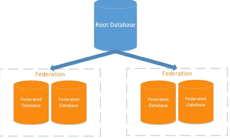
Federations are accessed through a federation root database. The root performs the routing to the appropriate federation members based on the given federation key value. Each root may contain multiple federations, each with its own federation scheme. The root database in Figure 3-4 points to two federations, each with two federated databases.
34
Geospatial representation in SQL Database
Microsoft has had support for geospatial types since SQL Server 2008. By extension, SQL Database can represent and store geospatial data. Before we describe how geospatial data is represented in SQL Database, we will give you an overview of spatial reference systems.
Spatial Reference Systems Overview
A spatial reference system (SRS) is a system to represent a point on the earth uniquely. There are, in fact, many spatial reference systems, so it follows that there are many ways a point on the earth may be represented. An SRS must be able to specify types of coordinates used (such as latitude/longitude or easting/northing coordinates, specify from where those coordinates are measured, the units of the coordinates, and the shape of the earth over which those coordinates extend.
The earth is not a simple sphere, but a complex shape. Its shape is called a geoid and represents the earth and only the earth. Because it is such a complicated shape to represent, it is approximated using different ellipsoids. Each approximation affects the accuracy at different positions on the earth. Once the correct model ellipsoid is chosen, it must also be aligned with the earth by using a frame of reference. There are again, various frames of references defined. Together, the reference ellipsoid and the reference frame form a geodetic datum, of which the most known one is the World Geodetic System of 1984 (WGS84).
Latitudes and longitudes are two of the more common ways of representing a point in space, it can be represented as a decimal (37.775192,−122.419381) or in degrees, minutes, and seconds (37° 46' 30.6906", -122° 25' 9.768"). The next challenge is to represent a 3D world on a 2D plane. That is where projection becomes important. Once again, there are different methods of projecting the earth onto a 2D plane of which the most common is the Mercator Projection. Both Bing and Google Maps use the Mercator projection.
SQL Database Spatial Data Types
Now that you have a slightly better idea of spatial references, we can show you how SQL Database supports this data. There are two types of spatial data supported by SQL Database: geometry and geography. The geometry data type supports planar or (flat-earth) data. The geography data type supports ellipsoidal (round-earth) data. Both the geometry and geography data types support various spatial data objects as depicted in Figure 3-5. The data objects can be categorized as follows:
• Single geometries: contain only one discrete geometric element. The single geometries represented by SQL Database are points (Point), curves (LineString, CircularString, and Compound String), and surfaces (Polygon and CurvePolygon).
35
Figure 3-5 depicts the different types of geometries that are supported by SQL Database.
While both geometry and geography data types support the same geometries, they differ in the way they represent the types. For example, both geometry and geography data types can represent an edge between two vertices, however, in the geometry type, the edge is a straight line, and in the geography type the edge is an elliptic arc.
SQL Database also provides methods for manipulating the spatial data types. There are methods for constructing geometry from Well-Known Text (WKT) Input:
• STGeomFromText: constructs any type of geometry instance from WKT input
• STPointFromText: constructs a geometry Point from WKT
• STMPointFromText: constructs a geometry MultiPoint from WKT
• STLineFromText: constructs a geometry LineString from WKT
• STMLineFromText: constructs a geometry MultiLineString from WKT
• STPolyFromText: constructs a geometry Polygon from WKT
• STMPolyFromText: constructs a geometry MultiPolygon from WKT
• STGeomColFromText: constructs a geometry GeometryCollection from WKT
There are also methods for constructing geometry from Well-Known Binary (WKB) Input,: which are the same functionality as the above methods other than the input: STGeomFromWKB, STPointFromWKB,
STMPointFromWKB, STLineFromWKB, STMLineFromWKB, STPolyFromWKB, STMPolyFromWKB, and
STGeomColFromWKB.
An example of how to call one of the above static methods is:
DECLARE @g geometry;
SET @g = geometry::STPointFromText('POINT (100 100)', 0); SELECT @g.ToString();
In the sample application below, we will be using this very spatial type in order to represent a latitude and longitude.
36
Setting up a SQL Database
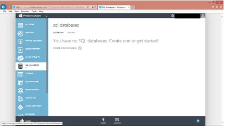
In this section we will describe how to setup a SQL Database. Much of the database can be setup and managed through the management portal. Alternatively, many tasks can be handled programmatically. For example, you may choose to create tables through the management portal associated with your Azure account, or you may create tables in your code. We will show you how to do both in this chapter. Complete the following steps to create a SQL Database:
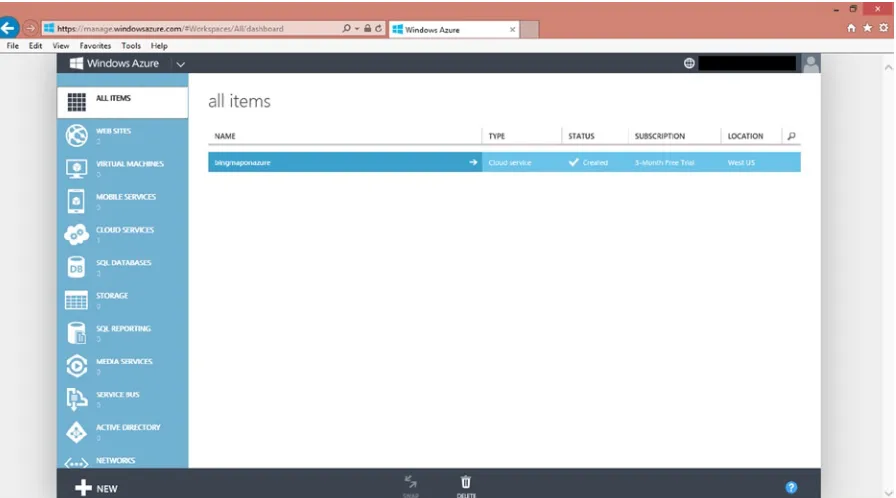
1. Log on to your management portal on the www.windowsazure.com. As always, you will need your Windows Live ID to login. Your management portal should appear as in Figure 3-6. If you followed the example in Chapter 2, then you should have one service listed under all items. In our case, it is the bingmapsonazure webpage we created in Chapter 2.
Figure 3-6. Management portal for Windows Azure. In addition to handling your cloud services, you can also manage your storage here
37
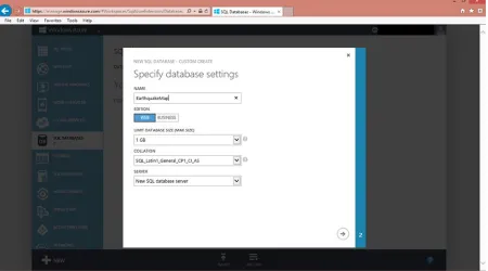
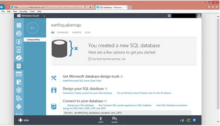
3. You should name the database and choose a server. In Figure 3-8, we have named the database EarthquakeMap and selected a New SQL database server. As explained earlier, once you complete the creation process, Azure will provide a servername for you in the provisioning process.
38
4. You will be asked to select a login name and password. Jot down what you’ve chosen, as you will be required to have the login information for interacting with the database.
5. Once you are done entering the server settings (login and password), you click on the check mark if you are satisfied with your choices, and you will have created your database! Your management portal will now list this database and server, as in Figure 3-9.
39
6. You now have to configure the firewall settings. You must add your IP to the list of allowable addresses by clicking Add to the Allowed IP Addresses and then clicking save
at the bottom of the page, as seen in Figure 3-10.
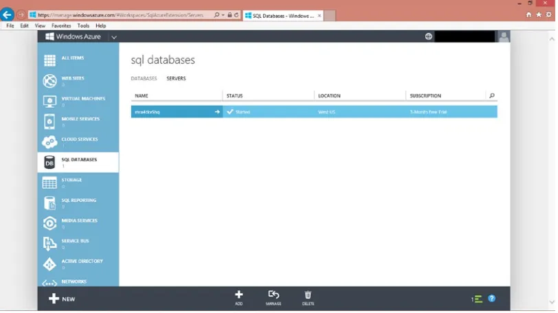
Figure 3-9. The management portal lists the databases and servers associated with your account
40
7. Go back to the SQL Database page by clicking the DB icon: .
8. Click on the white arrow listed by your database name to return to the management portal for the database.
Figure 3-11. The created database as listed by the SQL Database management portal
9. The management portal for that database will appear as in Figure 3-12. From this portal, you can design your database, connect to your database, and run queries on this database, among other services.
41
10. Select the MANAGE icon at the bottom of the page. You will be prompted for your login and password created in step 4.
11. Start a new query by clicking on the New Query icon near the top of the page:
Figure 3-13. Selecting New Query will allow you to query the newly created database
If you do not see this option, you may have to select Run Transact-SQL queries against your SQL database from Figure 3-11.
12. You enter the query and hit run. In the following code listing we show you an example of how you can create a new table for the newly created database:
-- Create the earthquakeData table.
IF NOT EXISTS (SELECT * FROM sys.objects
WHERE object_id = OBJECT_ID(N'[dbo].[EarthquakeData]') AND type in (N'U'))
BEGIN
CREATE TABLE [dbo].[EarthquakeData]( [DateTime] [datetime] NOT NULL, [Position] [Geography] NOT NULL, [Depth] [float] NOT NULL, [Magnitude] [float] NOT NULL, [MagType] [nvarchar](50) NOT NULL, [NbStation] [int] NOT NULL, [Gap] [int] NOT NULL, [Distance] [float] NOT NULL, [RMS] [float] NOT NULL,
[EventID] [nvarchar](50) NOT NULL, [Source] [float] NOT NULL,
[Version] [float] NOT NULL )
END; GO
13. Click on Run to run the query and you now have a server that has one database that has one table!!
Inserting geospatial data into a SQL Database
42
1. Start a new Microsoft Visual Studio 2012 Console Application project. We have named our project readGeospatialDataToSQL.
2. You will now need a class to hold all of the earthquake data. We create the class Earthquake.cs that appears as follows:
using System;
using Microsoft.Maps.MapControl.WPF; namespace readGeospatialDataToSQL {
public class Earthquake {
public DateTime When { get; set; } public Location Location { get; set; } public float Depth { get; set; } public float Magnitude { get; set; } public string MagType { get; set; } public int NbStation { get; set; } public int Gap { get; set; } public float Distance { get; set; } public float RMS { get; set; } public string Source { get; set; } public string EventID { get; set; } public float Version { get; set; } public string Title { get; set; } public string Description { get; set; }
43
public Earthquake(DateTime when, Location where, float depth, float magnitude, string magType,
3. Additionally you will require a CVS file reader, CVSFileReader.cs. You can find one at
http://www.blackbeltcoder.com/Articles/files/reading-and-writing-csv-files-in-c. We have refactored the code to only contain the reader, as we do not need a CVS writer for this sample.
4. Now you are ready to write the code to read in the CVS earthquake data file into the Earthquake object: private static List<Earthquake> _data = new List<Earthquake>(); that is a member of the class containing the
GetRecentEarthquakes() method.
public static void GetRecentEarthquakes() {
WebClient client = new WebClient();
Uri quakeDataURL = new Uri("http://earthquake.usgs.gov/earthquakes/feed/v0.1/ summary/2.5_day.csv");
string quakeDataFile = "quake.csv";
44
5. Finally, you can write the code to read the earthquake data into the SQL database. Earlier, we showed you how to create a table through the management portal. Here we will show you how to create the table programmatically. The SQL server login and password you created earlier will be useful. The username is a combination of the login and the server in the format <loginname>@<servername>, for example is myLogin and your server is myServername then your username will be myLogin@myServername.
45
Another interesting type is the geometry type, which is one of the geospatial types supported by SQL Database, as we described earlier. Here we used a single geometry, Point, to represent our latitude and longitude.
public static void insertQuakeDataToSQL() {
// Provide the following information string userName = myLogin@myServername; string password = myPassword;
string dataSource = "myServername.database.windows.net"; string sampleDatabaseName = "EarthquakeMap";
// Create a connection string for the sample database SqlConnectionStringBuilder connString2Builder;
connString2Builder = new SqlConnectionStringBuilder(); connString2Builder.DataSource = dataSource;
connString2Builder.InitialCatalog = sampleDatabaseName; connString2Builder.Encrypt = true;
connString2Builder.TrustServerCertificate = false; connString2Builder.UserID = userName;
connString2Builder.Password = password;
// Connect to the sample database and perform various operations
46
line.Location.Latitude + ", 4326), " +line.Depth + "," +
In this chapter you learned about hosting geospatial data on SQL Database. As you probably noted, transitioning from SQL Server to SQL Database is straightforward. One nice difference is the availability of the management portal. On the portal, you can create, manage, and delete databases. Of course, as an alternative to the management portal, you can still do many of the tasks, such as creating tables programmatically, rather than on the portal.
In our sample code in this chapter, we pulled geospatial data from the government earthquake site