SUSTAINABLE FISHERIES
MANAGEMENT PROJECT (SFMP)
Report on the Second Training of
Central Region Town and Country
Planning Department officers
i
This publication is available electronically in the following locations:
The Coastal Resources Center
http://www.crc.uri.edu/projects_page/ghanasfmp/
Ghanalinks.org
https://ghanalinks.org/elibrary search term: SFMP
USAID Development Clearing House
https://dec.usaid.gov/dec/content/search.aspx search term: Ghana SFMP
For more information on the Ghana Sustainable Fisheries Management Project, contact: USAID/Ghana Sustainable Fisheries Management Project
Coastal Resources Center
Graduate School of Oceanography University of Rhode Island
220 South Ferry Rd.
Narragansett, RI 02882 USA
Tel: 401-874-6224 Fax: 401-874-6920 Email: [email protected]
Citation: Spatial Solutions. (2017). Report on the Second Training of Central Region Town and Country Planning Department Officers, January 10 to 12, 2017. The
USAID/Ghana Sustainable Fisheries Management Project (SFMP). Narragansett, RI.: Coastal Resources Center, Graduate School of Oceanography, University of Rhode Island and Spatial Solutions. GH2014_SCI-62_SpS 20 pp.
Authority/Disclaimer:
Prepared for USAID/Ghana under Cooperative Agreement (AID-641-A-15-00001) awarded on October 22, 2014 to the University of Rhode Island and entitled; the USAID/Ghana Sustainable Fisheries Management Project (SFMP).
This document is made possible by the support of the American People through the United States Agency for International Development (USAID). The views expressed and opinions contained in this report are those of the SFMP team and are not intended as statements of policy of either USAID or the cooperating organizations. As such, the contents of this report are the sole responsibility of the SFMP Project team and do not necessarily reflect the views of USAID or the United States Government.
Detailed Partner Contact Information:
USAID/Ghana Sustainable Fisheries Management Project (SFMP) 10 Obodai St., Mempeasem, East Legon, Accra, Ghana
Telephone: +233 0302 542497 Fax: +233 0302 542498
Maurice Knight Chief of Party [email protected]
Kofi Agbogah Senior Fisheries Advisor [email protected] Nii Odenkey Abbey Communications Officer [email protected]
Bakari Nyari Monitoring and Evaluation Specialist [email protected] Brian Crawford Project Manager, CRC [email protected]
Ellis Ekekpi USAID AOR (acting) [email protected]
Kofi.Agbogah
SNV Netherlands Development Organisation #161, 10 Maseru Road,
E. Legon, Accra, Ghana 233 30 701 2440 Donkris Mevuta Kyei Yamoah
[email protected] Friends of the Nation Parks and Gardens Adiembra-Sekondi, Ghana 233 312 046 180
Resonance Global (formerly SSG Advisors) 182 Main Street
Burlington, VT 05401 +1 (802) 735-1162 Thomas Buck
Victoria C. Koomson
[email protected] CEWEFIA
B342 Bronyibima Estate Elmina, Ghana
233 024 427 8377 Lydia Sasu
Darkuman Junction, Kaneshie Odokor Highway
Accra, Ghana 233 302 315894
For additional information on partner activities:
CRC/URI: http://www.crc.uri.edu
CEWEFIA: http://cewefia.weebly.com/
DAA: http://womenthrive.org/development-action-association-daa Friends of the Nation: http://www.fonghana.org
Hen Mpoano: http://www.henmpoano.org
ACRONYMS
CEDECOM Central Regional Development Commission
CEWEFIA Central and Western Fishmongers Improvement Association FoN Friends of the Nation
GIS Geographic Information System GPS Global Positioning System
LUPMIS Land Use Planning and Management Information System QGIS Quantum Geographic Information System
SFMP Sustainable Fisheries Management Program TCPD Town and Country Planning Department
TABLE OF CONTENTS
ACRONYMS ... iii
TABLE OF CONTENTS ... iv
LIST OF FIGURES ... iv
INTRODUCTION ... 1
Objectives ... 1
Venue and Date ... 1
Format of Training ... 1
Participants ... 1
WELCOME ADDRESS AND BACKGROUND TO THE SFMP ... 2
OPENING REMARKS ... 3
TRAINING FACILITATION AND MODULES ... 3
EVALUATION OF PARTICIPANTS ... 4
GENERAL ASSESSMENT OF TRAINING WORKSHOP ... 4
ANNEX... 6
Annex 1: Training Agenda ... 6
Annex 2: Attendance... 7
Annex 3: Map products ... 10
LIST OF FIGURES
Figure 1: A cross-section of participants at the training ... 2Figure 2: A view of participants at the training ... 3
Figure 3: Training in session... 4
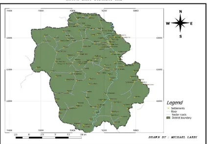
Figure 4 Agona West Municipal Map ... 10
Figure 5 Agona West Municipal Map ... 10
Figure 6 Agona East District Map ... 11
Figure 7 Agona East District... 11
Figure 8 Agona East District Map ... 12
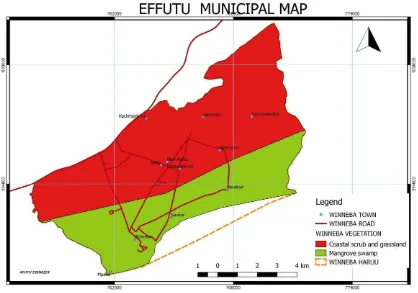
Figure 9 Effutu Municipal Map ... 12
Figure 10 Awutu Senya District Map ... 13
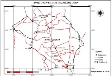
Figure 11 Awutu Senya East Municipal Map ... 13
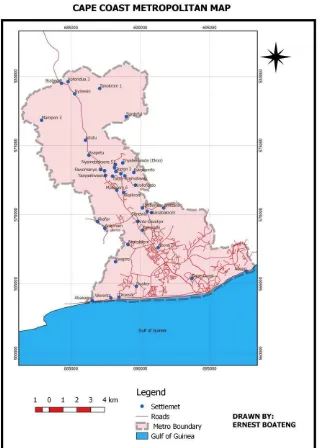
Figure 12 Cape Coast Metropolitan Map... 14
Figure 13 Gomoa East District Assembly ... 15
INTRODUCTION
The USAID-Ghana Sustainable Fisheries Management Project (SFMP) continues to provide support to the Town and Country Department in different capacities, though fisheries
focused. The project recognizes the important role the department plays in the planning of coastal resources including the limited coastal land and beach fronts.
Under this USAID funded project, the SFMP has established a GIS Data Hub at the Central Regional Office of the TCPD to build the capacity of Planners and Technical officers to incorporate coastal resource management in the preparation of Spatial Plans. The newly refurbished data hub is stocked with state-of-the-art facilities to serve two main purposes:
1. To serve as the central point for storing, retrieving, managing and sharing data across coastal districts
2. To provide regular trainings for regional and district staff.
The GIS trainings are aimed at activating the newly established GIS Data Hub to function as the model training center, not only for TCPD staff, but other sister land sector agencies and departments. The first series of trainings were organized in September, 2016 to build the capacity of 20 officers (8 Planners and 12 Technical officers) in basic GIS/GPS applications relevant to spatial planning.
Prior to the trainings a need assessment had been conducted to ascertain the background of prospective participants in GIS and general computing. This second training involved the second set of officers who were shortlisted based on the results of the assessment.
Objectives
The main objective of the training was to provide participants with fundamental skills in GIS, Remote Sensing and GPS data collection strategies for the effective planning and decision making relative to the management of coastal resources. The specific objectives for the training were:
To activate the GIS Data Hub as the data clearinghouse and training center for the region.
To have a basic, practical understanding of GIS concepts, techniques and real world applications.
To introduce the use of Quantum GIS for basic data collection and mapping purposes.
Venue and Date
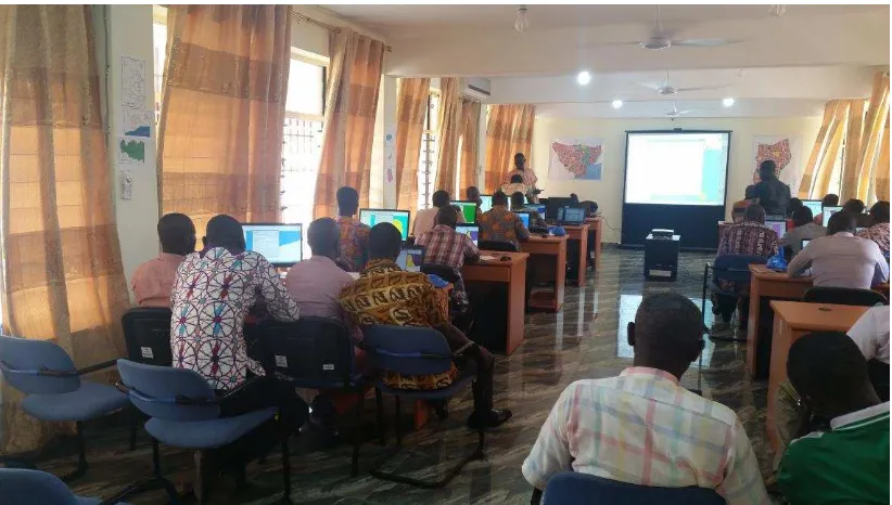
The training was organized in the Central Region GIS Data Hub at the Regional Town and Country Planning Department in Cape Coast from January 10 to 12, 2017.
Format of Training
The training adopted the class room training format with some presentations and practical hands-on exercises. Activities were designed to address issues practitioners need on their day-to-day basis.
Participants
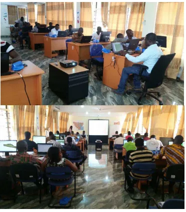
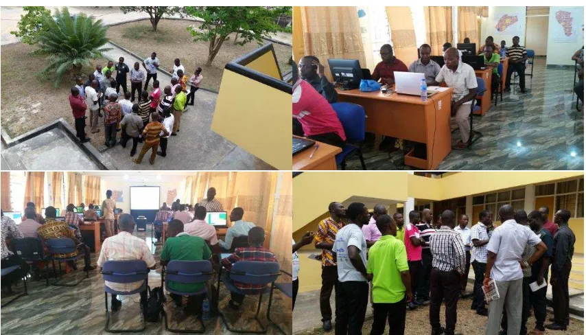
Figure 1: A cross-section of participants at the training
WELCOME ADDRESS AND BACKGROUND TO THE SFMP
The Director of Spatial Solutions Ltd, Mr. Peter Owusu- Donkor welcomed participants to the training workshop and explained the purpose and objectives of the training. In his
Figure 2: A view of participants at the training
OPENING REMARKS
Mr. Martey Korley, the Director of the Central region Town and Country Planning
Department, welcomed participants to the training workshop and encouraged participants to demonstrate diligence in order to take full advantage of the opportunity offered them. He commended USAID-SFMP project for the enormous support the region has received through the Data Hub and the series of trainings. He encouraged participants to judiciously make use of the knowledge acquired and continually practice the lessons to add value to their work.
TRAINING FACILITATION AND MODULES
The training workshop was facilitated by Mr. Richard John-Jones, the Hub Instructor of the Western Region GIS Data Hub and an Assistant Town Planning Officer; Mr. Justice Camillus Mensah, the GIS officer of SFMP and Hen Mpoano; Mr. Obed Agyapong, the Central region GIS Data Hub Coordinator and Munzamil Mohammed of Spatial Solutions. The modules for the training were inspired by the results of the Training needs assessment. The modules were however modified slightly to address some of the issues from the first training. Quantum GIS and the LUPMIS tools (built on Map Maker) were the main GIS software used for the
trainings. Participants were also provided with tutorial videos relevant to the modules treated.
Modules taught during the training are listed as follows;
Day 1
1. Introduction to basic computing.
2. Introduction to basic GIS and Remote sensing. 3. Installation of QGIS software.
4. How to extract district based datasets from national databases such as road networks, towns, vegetation, towns etc.
Day 2
1. Georeferencing scanned maps (planning schemes). 2. How to digitize from raster Data.
Day 3
1. Summary of previous lessons. 2. Introduction to GPS .
3. Data collection with the use of GPS (point, lines and polygon features). 4. How to import GIS data from GPS to QGIS using DNRGPS Software. 5. How to edit and clean data.
The material used for the event is found in the Manual for GIS Training of Central Regional TCPD Officers, which is online at
http://www.crc.uri.edu/download/GH2014_SCI060_SpS_FIN508.pdf
Figure 3: Training in session
EVALUATION OF PARTICIPANTS
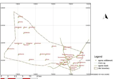
The knowledge gain of participants was assessed in a number of ways. Hands-on exercises, demonstration (by participants) and question and answer sessions were some of the ways the participants were evaluated. The map products from participants are shown in the Annex
GENERAL ASSESSMENT OF TRAINING WORKSHOP
Participants expressed their expectations for the next training and made some recommendations for the subsequent trainings.
Some of the expectations of the participants were as follows
to know how to import and use spatial data in excel formats
to know how to use GPS receivers and how data from the device could be imported into the QGIS software.
The participants also made the following recommendations
More information on the fundamentals of computing should be provided as part of the introduction to enable easy understanding of the course.
The facilitators should slow down in their explanation of some of the concepts and processes.
Handouts on the use of QGIS software could be given to facilitate the learning processes.
Practical exercises should be done more frequently to help participants grasp the concepts well.
Stable internet should be provided to enable some of the internet based steps to be learnt.
The period for the training should be extended.
This training should be extended to the other TCPD officers.
Revisit the use of GPS for collecting waypoints and transferring into the computer.
ANNEX
Annex 1: Training Agenda
Ghana Sustainable Fisheries Management Project (SFMP)
Second Training of Central Region Town and Country Planning Department Officers
10th-12th January, 2017
Central Regional GIS Data Hub, Cape Coast AGENDA
Training Session
Days (1, 2 and 3)
8:30-9:00am Registration of participants
9:00-12pm Session begins with
12:00pm-12:30 Snack Break
12:30-1:30pm Training continues
1:30-2:30pm Launch break
Annex 2: Attendance
GHANA SUSTAINABLE FISHERIES PROJECT-HM
PARTICIPANTS ROSTER INFORMATION
Required in English
Please Print
---
Title of Course: ___ TRAINING OF CENTRAL REGION TOWN AND COUNTRY PLANNING DEPARTMENT OFFICERS
Activity:
________TRAINING_________________________________________________________ ___________________
Date: _____10TH-12TH JANUARY, 2017__
Length of Course: Less than three days Three days or longer
First Name Surname Organization Email if available Phone
number
First Name Surname Organization Email if available Phone number
Sex Do you wish to receiv e messa ges on SFMP ?
M F Y N PHILIP PRAH FON X X FRANCIS OSEI GOMOA EAST X DESMOND TUTU REGIONAL
OFFICE
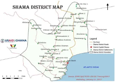
Annex 3: Map products
Figure 6 Agona East District Map
Figure 10 Awutu Senya District Map
Figure 13 Gomoa East District Assembly