Second, the image must include the spatial or patterned relationship of the object to the observer and to other objects. Such an analytical feat may be meaningless in the study of a door, but not in the study of the urban environment.
THREE CITIES
A systematic field reconnaissance of the area was made on foot by a trained observer, who mapped the presence of various
A lengthy interview was held with a small sample of city residents to evoke their own images of their physical environ-
It's a gritty, red-brick town, symbolized by the open space of Boston Common, the State House with its golden dome, and the view across the Charles River from the Cambridge side. One of the most interesting districts is the one that isn't there: the triangular region between Back Bay and the South End.
In addition, the central shopping activity makes an awkward right-angled turn at this same Boylston-Tremont crossing, weak-
Here they cross at right angles, but further out they appear to be parallel, springing at right angles, but further out they appear to be parallel, springing at right angles from a common baseline, Massachusetts Avenue.
Boston is a city of distinctive districts, and in most parts of the central area one knows where one is simply by the general char-
Here place is never in question. Yet this thematic vividness is typically associated with formlessness or confusing arrangement
Each aspect has an entirely different face: when thought of from below, the Artery is a massive green-painted wall, appearing
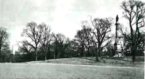
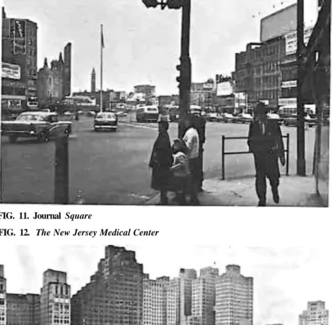
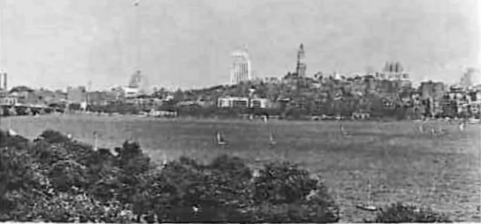
The most common answer to the symbolism question was nothing in the city at all, but rather the sight of the New York City skyline across the river. A big part of the distinctive feeling for Jersey City seemed to be that it was a place on the edge of something else.
THE CITY IMAGE AND ITS ELEMENTS
But Los Angeles' freeways on the edges of downtown are visually hidden by cutbacks or planted embankments. The second common cause of misalignment with the rest of the city was the sharp separation between a path and surrounding features. The surface entrances to the stations may be strategic nodes in the city, but they are connected through invisible conceptual connections.
It is a visually obvious tee, supported by the space, planting, traffic and importance of the elements put together. The isolation of Boston's North End by the Central Artery was distressing, in the eyes of residents and non-residents alike. The resulting thematic unity stood out in contrast to the rest of the city and was immediately recognizable.
Thus the border of the Back Bay is at the Charles River or at the Public Garden. The golden dome of Boston's statehouse appears to be one of the few exceptions to this evasion. It is hard to imagine the city without this great building coming to mind.
A great distortion, like a distortion of the shape of the Common, seemed to be reflected in the image of Boston.
CITY FORM
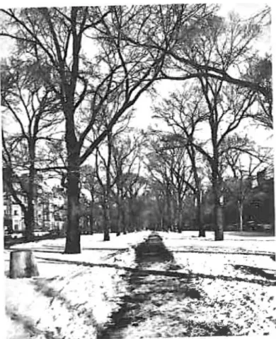
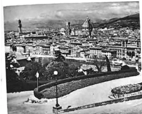
In this case, an environment must be adapted to the appropriate cultural type, or shaped in many ways to satisfy the different demands of the individuals who inhabit it. The city certainly has an economic, cultural and political history of staggering proportions, and the visual evidence of this past makes up much of the strong Florentine character. In the south, the open country penetrates almost into the heart of the city, creating a clear contrast, and from one of the last steep hills, a terrace gives a view "over" the urban core.
The visual environment becomes an integral part of the lives of its inhabitants. The city is by no means perfect, even in the limited sense of imageability; Nor does all the city's visual success lie in this one quality. But there seems to be a simple and automatic pleasure, a sense of satisfaction, presence and tightness, that comes from the mere sight of the city, or the chance to walk. Sandwich, New Hampshire, might be taken as another example, where the White Mountains sink into the undulating headwaters of the Merrimac and Piscataqua Rivers.
The effect is strongest in the "intervals," the flat plains at the base of the mountains, which are completely cleared, and which have that strange and powerful sense of special "place," exactly comparable to the sense of strong location in a city like Florence. On our own ground we can begin to adapt the environment itself to the perceptual pattern and symbolic process of the human being.
95 Designing the Paths
Objects along the path can be arranged to sharpen the effect of motion parallax or perspective, or the course of the path ahead can be made visible. The path's presence may be made apparent by tall landmarks along it, or by other clues. When a major edge is provided with many visual and circulation connections to the rest of the city structure, it becomes a feature that everything else can easily be coordinated with.
Beacon Hill is linked to the metropolitan core by the spatial region of the Common, and therein lies much of its appeal. This quality, like continuity, allows the necessary simplification of the image through omission and subsumption. An unusual journey becomes uncomfortable or dangerous;. interpersonal relationships can tend to compartmentalize themselves;. the scene becomes monotonous or restrictive.
The second technique is to use one or two very large dominant elements, to which many smaller things may be related: the establishment of settlements along a seacoast, for example; or the design of a linear city, depending on a basic communications backbone. It is also possible to address the issue of reversibility, that is, the fact that most paths are traveled in both directions.
A NEW SCALE
In the development of the image, education in seeing will be just as important as reforming what is seen. If art and audiences grow together, our cities will be a source of daily enjoyment for millions of residents.
SOME REFERENCES TO ORIENTATION
Many other authors, 5, 52, 76, in their description of the phenomenon of temporary disorientation in the modern city, speak of the accompanying feelings of distress. The unpleasant persistence of an original and incorrect organization of the environment is attested in many sources. Way-finding is the original function of the environmental image, and the basis for its emotional associations may be founded.
Indeed, the very naming and distinguishing of the environment makes it vivid, thereby adding to the depth and poetry of human experience. No one who has not experienced it can appreciate the living reality of myths. Only later did the canti names become attached to the streets, which were subsequently regulated and signposted in 1785.
Sapir gives an interesting example of this differential focus of attention, in the Southern Paiute language. It is the island's crowning point, both sociologically and topographically, the birthplace of the gods.
THE USE OF THE METHOD
We would like you to make a quick map of central Boston, inward or downtown from Massachusetts Avenue. Make it just as if you
Here, they were first confronted with a stack of photographs of the Boston area that systematically covered the entire borough, but were given to the subject in random order. Finally, these same volunteers were taken into the field to complete one of the earlier imaginary journeys: that from Massachusetts General Hospital to South Station. Five standard starting points were also chosen: the main entrance of the Massachusetts General Hospital, the Old North Church at the north end, the corner of Columbus Avenue and Warren Street, South Station and Atlington Square.
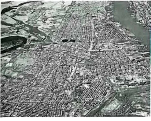
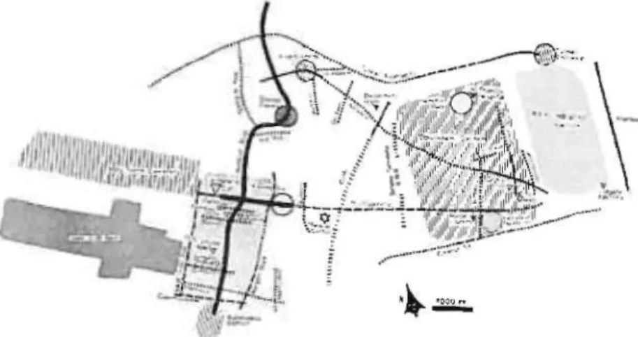
The field analysis was ultimately simplified to a systematic coverage of the area on foot by a trained observer, previously educated in the concept of city imageability. Figures 35 to 46 illustrate the images of the three cities as derived from the consensus of oral interviews and sketch maps, and from our own field exploration. The field analyzes in Boston and Los Angeles turned out to be surprisingly accurate predictions of the images from the oral interview material.
In poorly differentiated Jersey City, the field analysis predicted slightly less than two-thirds of the interview image, but even here there are very few significant elements in one source that do not appear in the other. The other photographs go to confirm the pattern, down to the concentration of unrecognizability in the South End, the base of the John Hancock Building, the West End-North Station area, and the side streets of the North End.
The Bottom image of derived from verbal interviews
The Boston sample was low in subjects coming from the North and West End, for example, a correlate of the class bias. Although these methods revealed much internal consistency, two main criticisms can be leveled against the adequacy of the sample interviewed. It would be impossible to generalize from that, and to say that a "true" public image of the city in question has been uncovered.
The sample was analyzed as a whole, and the background of the subjects was never taken into account except to note the general bias of the population. At the very least, the material shows correlations between the actions and the image communicated, and shows the strong emotional significance of the latter. On such an analysis, constantly modified and updated, a plan for the future visual form of the region can be based.
This again refers us to the fact that the image is not only the result of external features, but is also a product of the observer. A good example of this is the diagrammatic map of the London Underground system, prominently displayed in each station.
TWO EXAMPLES OF ANALYSIS
Let us look at the physical reality underlying these themes that appeared in the image of the Hill. On the other two sides, however, the borders have breached the sides of the Hill. Beacon Street is partly up the slopes, and the Common is essentially the same with the same topographical feature.
This undoubtedly contributes to the vagueness of the image on this side, as well as to the spatial unrest of Scollay Square. It can again be noted that these are primarily the features of the front. It is interesting to see the effect of the circulation channels, or lack thereof.
Louisburg Square is the other basic site, being a small residential cluster on the lower slopes of the front. The hill's connection to the West End via a sharp boundary, and the confusion of the transition to Scollay Square, has already been discussed.

BIBLIOGRAPHY
INDEX*
THE IMAGE OF THE CITY Kevin Lynch