• The only riv er w hich t he Lak e Toba as w at er source is Asahan River, em pt y env ironm ent al, socio and econom ical benefit s, part icularly in t he st udy area
Spe cific obj e ct iv e s t o be a ch ie ve d a r e : inform at ion, including verificat ion of t he ex ist ing dat a.
2 . M ETH OD ES
sources, bot h spat ial and non- spat ial from different inst it ut es, lik e m apping agency ,
Dat a ent ry and preparat ion are spat ial dat a input , obt aining spat ial dat a, spat ial referencing, dat a check , t ransform at ion and filt ering. Spat ial dat a analy sis are including classificat ion, r et rieval, classificat ion and m easur em ent , over lay, and analy sis. Dat a v isualizat ion is needed for out put . Measur e of er r or is needed t o find
MAPS: ecology, veget at ion, clim at e, soil and slope
BAKOSURTANAL
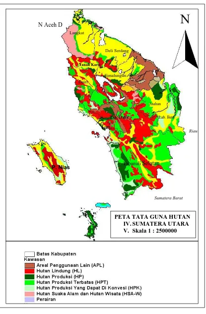
Pet a liput an lahan 1: 250000
Landsat ( archive) in Lapan for 50 USD.
The applicat ion of geoinfor m at ion in sust ainable m anagem ent of for est land - - - for est biom ass assessm ent and m odelling
- - - m anagem ent of t r ees r esour ces out side t he for est - - - for est land and clim at e change
N Aceh D
Langkat
Deli Serdang
Tanah Karo
Simalungun Dairi
Asahan
Lab. Batu Tap. Utara
Tap.
Riau
Tapanuli Selatan P. Nias
Sumatera Barat