isprsarchives XXXVIII 8 W20 56 2011
Teks penuh
Gambar
Garis besar
Dokumen terkait
The four steps of the procedure for geo-referenced urban terrain modeling after image acquisition are: extraction of camera orientation parameters, computation of depth
The knowledge based method utilizes all the available invariant or semi-invariant characteristics of the feature categories in a hierarchical, multi-logical
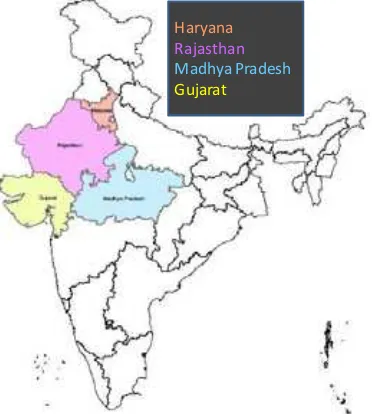
The present study emphasizes on the fluvio- geomorphological changes and the bank-line shifting of the Ganga river near Ballia and Rudrapur using IRS-1 D LISS III
forest areas along West Bengal, Bhutan, Arunachal Pradesh and Assam border in Eastern Himalaya using temporal satellite imagery of 1975, 1990 and 2009 and predicted forest cover
At first, research advances on radiation transfer modeling on multi-scale remote sensing data are presented: after a general overview of remote sensing radiation transfer
The analysis of Landsat TM images of 1975, 1990 and 2005 revealed that the vegetation cover in the core forest area surrounding the villages has not undergone substantial changes as
This allows you to weigh the weather conditions and build the scheme of early operational forecasting crop yields with a high renewal rate when there is a close relationship
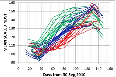
In this study, we analysed sev- eral years of high temporal frequency MODIS and TRMM satellite data sets of vegetation dynamics and rainfall, respectively, to seasonal and
