Geospatial
and
Human-Dimensions
Management
E F
t :
Settlement
Landscape Planning
for
Earthquake
Mitigation at
Sub
District of
Pengalengan,
Regency
of
Bandung*
(lit:i
Nurfatirttaltr,
alttl
Qtldariart l)rallttlkattlo2
lUndergraduate Student at Department of Landscape Architecture, Faculty of Agriculture,
Bogor Agricultural UniversitY
2Department of Landscape Architecture, Faculty of Agriculture, Bogor ABricultural University,
[email protected], qpramukanto@gmail'com
Alls'l'RA(l'I
As one of the big archipelagowhich lies onthe ring of fire zone and continental faults, earthquake often occur and cause fatal damage in Indonesia, include the earthquake occur in southern of West
.lava at Septem ber 2,2009 with magnitude 7,3 RS. Following those infrastructure damage caused by earthquake happened in all village of Pangalengan Sub District, a predetermine effort for
earth-quake mitigation should be developed. The objective of research is to prevent or reduce damage
caused by earthquake by arranging settlement landscape planning base on earthquake mitigation
at Sub district of Pangalengan, Regency of Bandung.
The research using modified METLAND (the Metropolitan Landscape Planning Model Study)
approach. This approach attempts to deal with preservation, protection, and development type of
land use recommendation, respectively. Sequence of those three-phase process used to generate
thefollowing categories: (1) critical natural resourcesto preserve soil, surface and underground water, (2) hazard zones to protect earthquake hazard region from development or used to be
limited, and (3) development for all areas to found suitable for development.
The result of study found that Pengalengan region predominantly characterized by suitable area for development, Those most safe area to built settlement and infrastructure identified as A's
typol-ogy area (Ministerial Decree of Public Works No. 21lPRT/2007). This typology is useful to develop
landscape planning for settlement area. The landscape plinning, consist of spatial arrangements
of settlement and infrastructure, evacuation and circulation, and green open space.
Keywords: settlement, earthquake mitigation, MEILAND critical natural resources, hazard zone,
development suitability, landscape planning
lntroduction
As one
of the
big archipelago which lies onthe
ringof fire
zone and continental faults, earthquakeoften
occurred and causedfatal
damagein
lndonesia.
The big earthquake with magnitude 7,3 RS occurred in southern of West Java at September 2,2OO9' The wavespread along to most part of West Java from Tasikmalaya to Jakarta'
One
of
areahit
bythe
earthquake is Pangalengan. Lossof
humanlife,
and damageof
buildings, homes,
infrastructure
causedby
earthquake happenedin
all
villageswithin
of
SubDistrict
Pangalengan. Those human deaths, lossof
propertiesand
damageto
structuresfollowing
the
earthquake disaster, causedby
lag
considerationto
disasterprevention factor into spatial planning. Spatial development on landscape hazard, such as
geologic fault, is subject that development to the hazard it self'
Following
those
damage,a
predetermine
effort
for
earthquakemitigation should
be developed through spatial planningframework.
The spatial planning, such as landscapeplanning,
that
considersnatural
hazardsthreatening
a
certain
area
as well
as the
vulnerability of this area should be developed.Objective
of
studY
The
objective
of
study is
to
prevent
or
reduce damage
causedby
earthquake
by arranging settlement landscape planning base on earthquake mitigation at Sub Districtof
Pangalengan, Regency of Bandung, West Java.
Method
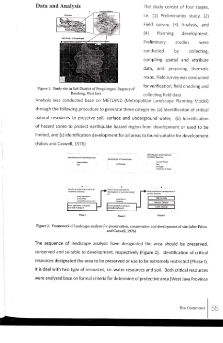
Study Site
The study site was located in Sub District of Pengalengan, Regency of Bandung, West Java' The site is laid
on
1O7"3O' 00" East Longitude-107'38'00"
East Longitude and O7"O7' OO"SouthLatitude-07o18'00"SouthLatitude(Figurel). ltwasconductedfromJune20l0
up to January 2011.
Geospatial and Human Dimensions on Naturat Resource Management
The
study
consistof four
stages,i.e. (1)
Preliminaries
study,
(2)Field survey,
(3)
Analysis,
and(4)
Planning
development.Preliminary
studies
wereconducted
by
collecting,compiling
spatial and
attribute [image:4.597.94.554.45.753.2]d
ata,
and
pre paring
the matic maps. Field survey was conductedFigure
i.
study site in Sub District of pengalengan, Regencyof
for verification' field checking and Bandung, West Java collectingfield
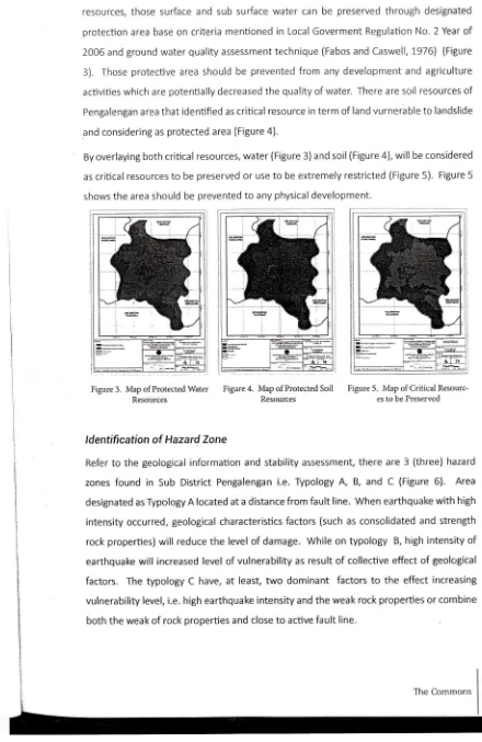
dataAnalysis was conducted base
on
METLAND(Metropolitan
Landscape planning Model)through the following procedure to generate three categories: (a) ldentification of critical
natural
resourcesto
preservesoil,
surfaceand
undergroundwater,
(b)
ldentificationof
hazard zonesto
protect
earthquake hazard regionfrom
developmentor
usedto
belimited, and (c) ldentification development for all areas to found suitable
for
development(Fabos and Caswell, 1976)
&ritk{io. d Crnic, [email protected]: wlisaod6
def, rili(.rbn., Ha:.d zon"l
lre;rili;rl;i oi Dsal;Iifr di.
6roundwaler 9re$n*rorStop€
Figure 2. Framework oflandscape ar.ralysis for preservation, conservation and development ofsite (afi.er Fabos
and Caswell, 1976)
The
sequenceof
landscape analysishave
designatedthe
area should
be
preserved, conserved and suitableto
development, respectively (Figure2).
ldentificationof
criticalresources designated the area
to
be preserved or useto
be extremely restricted (Phase l).It
is dealwith two
type of resources, i.e. water resources andsoil.
Both critical resources were analyzed base on for mal criteria for determine of protective area (West Java Province56
Regulation No. 2 Year of 2006 concerning Management of Protective Area), and in addition the criteria
for
assessing ground water quality (Fabos and Caswell, 1976) was aslo applied for water resources.The hazard zone (Phase
ll)
referto
earthquake vurnerability base on Guideline of Spatial Planningfor
Mountain
Eruption VulnerabilityArea, and
Earthquake Vulnerability Area (Ministerial Decree of Public Works No. 27/PRT/20O7). The earthquake vurnerability deal with two variables, i.e. geological information and stability assessment.The geological
information
consistof four
factors, i.e.
physicalrock
properties, slope, earthquake intensity,and structural
geology (exlstingfault).
Those geological factors were composedto
procedure earthquake vurnerability maps base on capability value andweigthed
mentioned on the guideline. Capability values refer to the stabilize capability of geologicalfactors to the earthquake. The weighted value referto
the levelof
importanceof geological factor to determine hazard zone.
The stabilities assessment dealt
with
determinethe
levelof
area stabilityto
earthquakehazard. Combination between capabilities value and weighted
for
each geological factor determines the score of suchfactor.
Base on cumulative score for all those four geologicalfactors
determine
the
levelof stability.
Levelof
stabilitiesof the
areato
earthquakecan be classified
into 6
(six) typologyof
land capabilities rating, i.e. A, B,c,
D, E, and Fas
mentioned in
the guideline.
Those typologiesof
land capabilities rating reflect theEarthquake Vurnerability.
The area classified as
As
typology was suitableto
development (phaselll).
The remain area designated as hazard zone. Planning development was dealt with the area designated as suitable areafor
settlement (the A'stypology).
The landscape plan organized spatialarrangement for settlement, public facilities (such as school, health, sport), infrastructure,
evacuation zone, circulation, and green open space.
Besult And
Discussion
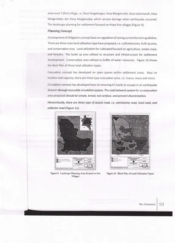
ldentification
of
Critical Besource
for
protection
ldentification
of critical
resourcefor
protection
referto
water
and soilprotection.
Sub District of Pa nga lengan is located in u p stream of CiTa ru m river basin. There are some waterresouces, such as lake, water spring and wetland
area.
since pengalengan predominantlylaid
on
rechargingarea, protection
of
those
water
resourcesis needed.
As
criticalGeospatiat and Human Dimensions
resources,
those
surface and sub surfacewater
canbe
preservedthrough
designatedprotection area base on
criteria
mentionedin
Local Goverment Regulation No. 2 Year of 2006 and ground water quality assessment technique (Fabos and Caswell,1976)
(Figure3).
Those protective area shouldbe
preventedfrom
any development and agricultureactivitieswhicharepotentiallydecreasedthequalityof water. Therearesoil
resourcesofPengalengan area that identified as critical resource in term of land vurnerable to landslide .and considering as protected area (Figure 4).
By overlaying both critical resources, water (Figure 3) and soil (Figure ), will be considered as critical resources
to
be preserved or useto
be extremely restricted (Figure5).
Figure 5shows the area should be prevented to any physical development.
;;;
---
._--?"*i=-
--tr-Figure 5. Map of Critical
[image:6.597.88.528.49.726.2]Resourc-es to be Preserved
Figure 3. Map of Protected Water
Resources
Figure 4. Map of Protected Soil Resources
ldentification of
Hazard Zone
Refer
to
the
geologicalinformation
and stability assessment,there
are3 (three)
hazardzones
found in
SubDistrict
Pengalengani.e.
TypologyA,
B, and
C
(Figure6).
Area designated as Typology A located at a distance from faultline.
When earthquakewith
highintensity occurred, geological characteristics factors (such as consolidated and strength rock properties)
will
reducethe
levelof
damage. While ontypology
B, high intensityof
earthquake
will
increased level of vulnerability as resultof
collective effectof
geologicalfactors.
Thetypology
C have,at
least,two dominant
factorsto the
effect
increasingldentification
of
LandSuitable
for
Development
By considering the guideline (Ministerial Decree
of
Public Works No. 2UPRT /2OOl), thosethree
hazard zones exist in study area have different typologyof
Land Capability Rating. The area classifed as Typology A isthe
most lagest area in Sub District Pengalengan.lt
iscover about 24.O78,-/2 ha (88%)
of total
area.
Referto
the
guideline,the
typology A issuitable to development. lt is recommeded that the area can be developed as settlement, public facilities (such as bussiness area and office area),
tourism
area, production forest, communityforest, agriculture area (such as paddyfield, annualand perennialcrop, animal,fishery) and mining area as
well.
By considering to the area which is classified as Typology Ato
bethe
most safety area within the earthquake vulnerability area, the other typology(B and C)
will
be considered as unsofety area (Figure 7). [image:7.598.140.531.59.547.2]ldentification
of
land
suitable
for
development
also
consider topographical
factor. Considering slope classification (Noor, 206) designated land suitability to any developmentuse. Byoverlayingasetof
map,i.e.MapofCritical
ResourcestobePreserved(Figure5), Map of Savety Areato
Earthquake (Figure 71, and Slope Class Map,the
Land sultablefor
development can be deslgnated as shown in Figure 8.Figure 6. Map of Earthquake
Vumerability Area (Typology of
Land CapabilityRating)
Figure 7. Map of Savety Area to Earthquake
Figure 8. Map of Suitable Area to Development
,to
.J()Landscape Planning
for Settlement
Development
of
landscapeplanning
for
Settlement
consideredthe
area
suitableto
development (Figure
8).
Existing land use before earthquake(at
September2,
2OO9 |almost coincide with the area designated as suitable land to development (Figure 8). Those
GeospatiaL and Human Dimensions
area cover 5 (five)village, i.e. Desa Pangalengan, Desa Margamukti, Desa Sukamanah, Desa
Margamekar, dan Desa Margamulya, which serious damage
when
earthquake occurred. The landscape planning for settlement focused on those five villages (Figure 9).Planning
Concept
Development of Mitigation concept base on regulalion of zoning as mentioned in guideline. There are three main land utilization type have proposed, i.e. cultivated area, built up area, and conservation area. Land utilization for cultivated focused on agriculture, estate crops,
and
forestry.
Thebuitd up
area utilizedto
structure
and infrastructurefor
settlementdevelopment.
Conservation area utilized as buffer ofwater resources.
Figure L0 showsthe Back Plan of those land utilization types.
Evacuation concept has developed
on
open
spaceswithin
settlement
areas.
Base onlocation and capacity, there are three type evacuation zone, i.e. macro, meso and micro. Circulation concept has developed base on ensuring it's
easilyto
escape in an earthquakedisaster through accessible circulation system. The rood network systemfor an evocuotion
area proposed should be simple, brood, not confuse, ond prevent disorientotion.
[image:8.599.16.586.20.812.2]Hierarchicolly, there ore three type
of
access rood, i.e. community rood, local rood, ond collector rood (Figure 11).Figure 9. Landscape Planning Area focused on five Villages
Figure 10. Block Plan of Land Utilization Types
The greenery concept has proposed
to
preventorredrrce
damage caused by earthquakeand
to
support
in
disasterrelief
aswell.
There are4
(four)
vegetationfunctions
haveproposed (Figure 12), i.e. (a) cultivated
crop
(suchtaro,
yam, potatoes, cassava, sweetpotatoes etc) as source
offood
during disasterreliel
(b) conservation plantto
protect the water catchment area and vulnerable land to mass movement, (c) border plant to navigatethe refugee through the circulation network, (d) shading plant
toprotectthe
refugee/rom
[image:9.599.105.522.45.502.2] [image:9.599.94.542.191.705.2]exposure to sun and climate amelioration.
Figure
ll.
Circulation NetworkPlan
Figure 12. Greenery planLandscape
Planning
Landscape plan has developed
to
prevent earthquakewithin settlement
area consistof
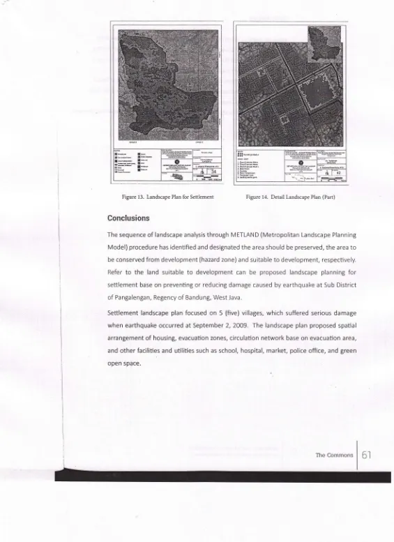
spatial arrangement of housing, evacuation zones, circulation network base on evacuation area, other facilities and utilities, such as school, hospital, market, police office, and green open space (Figure 13 and 14).
Figure 12. Greenery Plan
Geospatial and Human Dimensions on Natural Resource Management
t *- l-.
Ab.-j- ah,-I,--r.* I'--*r-sr.r* aLb
:3-*- r"*
sr.d I*"
g
At:,4
&
!!! h,dFe.
I
Al
tzFigure 13. Landscape Plan forSettlement Figure 14. Detail Lal dscape Plan (Part)
Conclusions
The sequence of landscape analysis through METLAND
(Metropolitan
Landscape PlanningModel) procedure has identified and designated the area should be preserved, the area
to
be conserved from development (hazard zone) and suitable to development, respectively.
Refer
to
the
land
suitableto
development can
be
proposed
landscapeplanning for
settlement base on preventing or reducing damage caused by earthquake at Sub District of Pangalengan, Regency of Bandung, West lava.Settlement landscape plan focused
on 5
(five) villages,which
suffered serious damagewhen earthquake occurred at September 2,2OO9. The landscape plan proposed spatial
arrangement
of
housing, evacuation zones, circulation network base on evacuation area,and
otherfacilities
and utilities such as school, hospital, market, police office, and green open space. [image:10.597.17.582.28.805.2]Refurerrces