JURIDICAL ANALYSIS ON KARST MINING IN GUNUNGKIDUL
REGENCY OF YOGYAKARTA SPECIAL REGION
UNDERGRADUATE THESIS
By:
NAME
: DICKY KURNIAWAN
STUDENT NUMBER
: 20120610261
FACULTY
: LAW
MAJOR
: INTERNATIONAL PROGRAM
FOR LAW AND SHARIA
FIELD OF STUDY
: ADMINISTRATIVE LAW
FACULTY OF LAW
i
JURIDICAL ANALYSIS ON KARST MINING IN GUNUNGKIDUL
REGENCY OF YOGYAKARTA SPECIAL REGION
UNDERGRADUATE THESIS
By:
NAME
: DICKY KURNIAWAN
STUDENT NUMBER
: 20120610261
FACULTY
: LAW
MAJOR
: INTERNATIONAL PROGRAM
FOR LAW AND SHARIA
FIELD OF STUDY
: ADMINISTRATIVE LAW
FACULTY OF LAW
iii
MOTTO PAGE
“God does not force anyone to do beyond what is within his capacity.
Everyone will get the reward he earns and will be responsible for the evil he
does” (Al
-Baqarah 2:286)
“O you belived! Stand out firmly for justice, as witnesses to Alloh, even as
against yourselves, or your parents, or your kin, and whether it be (against)
rich or poor: For Alloh can best protect both” (An-Nisa 4:135)
“Knowledge is that which benefits, not that which is memorized” (
Imam Shafi'i)
“Non scholae sed vitae disci
mus,
We don’t learn for school but for life” (Rene
iv
DEDICATION PAGE
This Undergraduate Thesis dedicate to
My Mother Suyati
My Wife Nur Wulandari, S.Si
Beloved Sister Raras Martya Utami
v
FOREWORD
Alhamdulillahirabbil’alamin, all the praise
be to Alloh, the Lord of the
universe, the most gracious, the almighty, who has given me His blessing and
guidance for accomplishing my undergraduate thesis under the title
―
JURIDICAL ANALYSIS ON KARST MINING IN GUNUNGKIDUL
REGENCY OF YOGYAKARTA SPECIAL REGION
‖
My sincere thanks are addressed to both advisors, Bapak H. Nasrullah,
S.H.,S.Ag.,MCL, and Bapak Sunarno, S.H, M.Hum., (Ph.D. Cand) who guided
me with patient, wisdom, and compassion. I also exprees my deepest gratitude to
all lectures at the Faculty of Law UMY who had inspired me to reach my future.
My appreciations are also given to all staffs at the Faculty of Law for their
assistance during my study at Universitas Muhammadiah Yogyakarta
To my respectful mother Ibu Suyati and my beloved wife Nur Wulandari,
S.Si, I owe your unlimited love and support without both of you this thesis will
never be in its existence.
Finally, thank you to all my beloved brothers and sistersat Yayasan Permata
Cendekia Gunungkidul for their support and love, and my highest gratitude to
IPOLianS, especially batch 2012 who gave me their motivation and inspiration to
fininsh my undergraduate thesis.
vi
TABLE OF CONTENTS
ABSTRACT………...
APPROVAL PAGE………...
ENDORSEMEN………..………...
DECLARATION OF RESEARCH AUTHENTICITY……….
MOTTO
PAGE………..
DEDICATION PAGE………
FOREWORD………..………..
TABLE OF CONTENTS……….
LIST OF STATUTES………..
LIST OF ABBREVIATIONS………..
LIST OF TABLE ………...
...
CHAPTER I INTRODUCTION………
A.
Background………
B.
Reasearch Question………
C.
The Objective of Study………..
D.
The Advantages of Reasearch………
CHAPTER II LITERATURE
REVIEW………
A.
Karst………...
B.
Conservation………..
C.
Geoconservation
………...
D.
Mining………
ii
iii
iv
v
vi
vii
viii
ix
xii
xiii
xiv
1
1
8
8
8
10
10
14
16
vii
CHAPTER III RESEARCH METHOD………
A.
Type of Research………...
B.
Types of
Data and Legal Material………..
C.
Research Location and Informant/Respondent………..
D.
Legal Research Approach
………
.
E.
Technique of Collecting Data………
F.
Method of Data Analysis………..
G.
Outline………
CHAPTER IV FINDINGS AND ANALYSIS
………
A.
The Development of Karst Management Regulations………...
1.
Law No 26 Year 2007 on Spatial……….
2.
The Decree of Minister of Energy and Mineral Resources of
Republic Indonesia No. 1456 of 2000 on Guidelines for The
Management of The Kast……….
3.
The Government Regulation of the Republic of Indonesia No 26
of 2008 on The National Spatial Plan………..
4.
The Regulation of Minister Energy and Mineral Resources of the
Republic of Indonesia Number 17 o
f 2012………..
5.
The Decree of The Minister of Energy and Mineral Resourcesof
Republic of Indonesia Number 3045 k/40/mem/2014 on the
determination of Gunungsewu Karst Landform
Area………
B.
Karst Management and Local Regulation of Gunungkidul Regency
20
20
21
22
23
23
24
24
26
26
26
28
31
33
35
viii
and Yog
yakarta SpecialProvince………..
1.
Karst Management in Gunungkidul Spatial Plan Regulation……..
2.
The Impact of Law No 23 of 2014 on Local Governance………...
3.
Spatial Plan Regulation of Yogyakarta Special Province…………
C.
The Legal Basis of Karst Mining In
Gunungkidul Regency………….
D.
The Obstacles of Karst Conservation in Gunungkidul Regency……...
CHAPTER V CONCLUSION AND RECUMENDATION
………...
A.
Conclusion……….
B.
Reco
mendation………...
REFERENCES………...
36
40
43
44
46
52
52
52
53
ix
List of Statutes
A.
The Decision of Ministry of Energy and Mineral Resources No.3045
k/40/MEM/2014 on The Determination of Gunungsewu Karst Landform
Area
B.
Ministry
of
Energy
and
Mineral
Resources
decree
Number
1456.K/20/MM/2000 section. 12 Paragraph 1 on The Management of
Karst zone
C.
Government Regulation Number 23 Year 2010 on the Implementation of
Business Activities of Mineral and Coal
D.
The decision of ministry energy and Mineral Resources no. 1456 of 2000
on the Guidline for The Management of Karst zone
E.
The Regulation of Ministry of Energy and Natural Resousces No. 17 of
2012 on The Determination of Karst Landform Area
F.
Provincial Regulation of Yogyakarta Special Region No. 2 of 2012 on
Spatial and Regional Province Planing on 2009-2029
G.
Governor Regulation No. 31 Year 2015 on The Procedures for Granting
mining License Metals, non-Metals and Rocks.
H.
Regulation of Gunungkidul District No. 6 in 2011 concerning Spatial
Plans (Rencana Tata Ruang Wilayah/RTRW) Gunungkidul district
x
List of Abbreviations
AMDAL
: Analisis Mengenai Dampak Lingkungan
IPR
: Izin Pertambangan Rakyat
IUP
: Izin Usaha Pertambangan
IUP
: Izin Usaha Pertambangan
IUPK
: Izin Usaha Pertambangan Khusus
KPP
: Kawasan Peruntukan Pertambangan
RTRW
: Rencana Tata Ruang Wilayah
UKL
: Upaya Pengelolaan Lingkungan
UPL
: Upaya Pemantauan Lingkungan
WALHI
: Wahana Lingkungan Hidup Indonesia
WIUP
: Wilayah Izin Usaha Pertambangan
xi
List of Table
ii
ABSTRACT
Mining and conservation are two controversial issues related to the natural
resources management as found in the case of karst mining zone at Gunungkidul
regency, Yogyakarta special region. The rocky area of Gunungkidul which is
mostly comprised of karst has supported its people economically and the
ecologically. They have used the karst for three purposes: as raw material of home
industries, as ecosystem buffering for clean water supply, and in general as
controlling agent of climate change. This research was aimed at analysing law
aspect of karst protection with the specific emphasis on the consistency and
conformity of karst mining regulation in regard to its conservation.The research
used empirical and normative legal research methods. The data were collected
from in-depth interview and library research. The data were analyzed by using
qualitative descriptive method. The research found that there were some particular
karst zones that had been eliminated from karst protected zone in Gunungsewu,
especially in Gunungkidul. Then the mining activities are still being conducted
under the prevailing laws. The research also found a serious unconformity of kart
mining regulations Law No. 23 of 2014 concerning the right of Local Government
to issue mining permits and Law No. 4 Year 2009 on Mineral and Coal Mining
which authorizes the regent/mayor to establish Regional Mining Business License
(WIUP) and Mining Business License (IUP). The researcher concluded that there
have been inconsistency and unconformity of laws in the mining of kart at
Gunungkidul regency, Yogyakarta special region. As the results, its conservation
purpose has not been reached at all.
1
CHAPTER 1
INTRODUCTION
A.
Background
Gunungkidul is one of the districts in Special Region of Yogyakarta, with
Wonosari as its capital. Its total land area is about 1.485,36 km
2or 46,63 % of
Yogyakarta.
1Administratively, this regency consists of 18 subdistricts and
139 villages. In 2012 the population of Gunungkidul was approximately
684.740 comprising of 331.220 males and 353.520 females. It has hot
temperature with the highest rainfall occurs on January (499.78 mm) and the
lowest one is on August and September (0.06 mm).
2More than half of Gunungkidul land are in the rocky area with karts
sediment (757,13Km
2). This zone covers 14 sub-districts namely;
1.
Karangmojo
2.
Nglipar
3.
Paliyan
4.
Panggang
5.
Playen
6.
Ponjong
7.
Purwosari
8.
Rongkop
1
Pemerintah Kabupaten Gunungkidul, Kondisi Umum, 2012,
http://www.gunungkidulkab.go.id/home.php?id=78&mode=content, Accessed on
November-06-2015 at 4.24 PM.
2 Central Bureau of Statistics of Gunung Kidul Regency, ―Profile of Regency of Gunungkidul‖, 13 Agust 2015,
2
9.
Girisubo
10.
Saptosari
11.
Semanu
12.
Tanjungsari
13.
Tepus
14.
Wonosari
The Minister of Energy and Mineral Resources Decree Number
1456.K/20/MM/2000,stated that karst zone has some strategic values for the
people and the nature it self such as:
a.
The economic values: related to agriculture, forestry, mining, water
management and tourism.
b.
Scientific purposes: concerning geoscience, speleology, geology,
archeology, paleontology .
c.
Humanity advantages: referring to the beauty, recreation, education, and
spiritual elements of religion or belief.
3Karst zone has played very important role for sustaining natural
environment with its several ecosystem functions as clean water reservoir,
source of construction raw materials, and agent of climate-change controlling
system. Moreover, the karst zone has some various potentials to be developed
for future asset, e.g.underground resources, biological resources, and other
things that can be used by the people. Karst zone also serves function as the
ecosystem of the jungle which creates water reservoir, especially groundwater
3
Article 3, The Karst Region Value, The Decison of the Minister of Energy and Mineral Resources No. 1456 K/20/ MBM/2000 on Guidelines for the Management of Karts Area
3
and bedrock of carbon. Thus, when there is damage to the environmental in
the karst zone like mining activities, the amount of underground water surely
will decrease.
4Gunungsewu karst zone, part of Gunungkidul regency, has the most
unique hydrogeologic structure since it is composed predominantly of reef
limestone. Physically limestone can substitute karst and calcit layer as
aquifers.
5Gunungsewu karst zone also has unique geological component
which functions as a natural regulator of the water reservoir and has scientific
purposes.
6It means that Karst zone is very important for the ecosystem and
scientific research as well as for the tourism aspect of its outstanding scenic
beauty.
Other karst zones also have highly economic value by exploiting their
natural resources in a proper manner so as it brings benefit to mankind. Such
view is in line with the idea proposed by David Ricardo that exploitation in
perspective manner of the natural resources can make those resources become
the engine of growth that are transforming resources into "man-madecapital"
which in turn will result higher productivity.
7In this regard, the people around
karst zonehave chosen mining activity for supporting their family as the area
is not fertile enough for agriculture, it is very dried and barren.
4Eko Budiyanto, ―Peran Penting Kawasan Karst‖
http://geo.fis.unesa.ac.id/web/index.php/en/geomorfologi-karst/133-peran-penting-kawasan-karst
Acessed on November-06-2015 at 06.26 AM.
5
Kusumayudha SB ,2004,Intriduction to Karst Hydrogeology, Karts Study Center UPN "Veteran" Yogyakarta, UPN "Veteran" Yogyakarta Publisher, Yogyakarta, p137 5
6
The consideration point a Regulation of the Minister of Energy and Mineral Resources of the Republic of Indonesia number 17 of 2012 on The Determination of Karst Landform Area.
7
4
Based on the data from the Department of Industrial, Trade, Cooperative
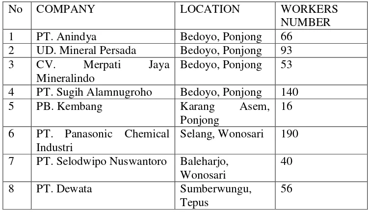
and Mining of Gunungkidul, there were more than 1884 people who work in
karst mining sector.
8This figure would be much higher if the government
registered those of illegal miners. Officially, there are 19 mining companies
registered in the local government while other companies remain illegal.
9This
data proved that the mining sector in Gunungkidul has been the main sources
of income for the people who live surrounding the karst zone and there is lack
of law enforcement to the illegal mining companies.
The main threat in the conservation of karst zone is wrong mind-set of the
people. They view the karst zone
as ―money ma
ker
‖.
10The economic reasons
have led them to exploit the area without considering its impact to the nature.
They believe that the natural resources should be utilized for the benefit of
mankind.
11As the results the conflict between economic interest and
conservation purpose cannot be avoided. There should be serious effort to
synchronize the economic interest and human life with the earth and the
environment conservation.
12The protection and management of environment need to be developed with
an integrated system, in the form of national protection policy and natural
resources management which supported by legal enforcement form central
8
Departement of Industry, trade, cooperatives and mining energy and mineral resousces Gunungkidul region, 2013, the number of people dependent on the mining sector in Gunungkidul.
9 Ibid,
10Ning Fitri, ―Darurat Air dan Terancamnya Kawasan Karst WALHI Jawa Tengah Menolak‖,
http://www.walhi.or.id/darurat-air-dan-terancamnya-kawasan-karst-walhi-jawa-tengah-menolak.html. Acessed on November-06-2015 06.02 AM.
11
Samsul Wahidin, 2014, Dimensi Hukum Perlindungan & Pengelolaan Lingkungan Hidup, Yogyakarta, Pustaka Pelajar p.18.
5
government and local authorities. Karst zone must be protected because karst
has not only economic function as mining material but also plays the role
asecosystem chain for today and the future.
Through some efforts to conserve the karst zone has been made by local
government and NGO, the impact of legal and illegal mining at Gunungkidul
still can be avoided.
The followings are the regulations issued by central government regarding
the karst zone mining activities:
1.
The Decision of Minister of Energy and Mineral Resources No. 1456 of
2000 on the Guideline for The Management of Karst zone.
2.
The Government Regulation No. 26 of 2008 on National Spatial Plan.
3.
The Regulation of Minister of Energy and Natural Resources No. 17 of
2012 concerning The Determination of Karst Landform Area
4.
The Decision of Minister of Energy and Mineral Resources No.3045
k/40/MEM/2014 on The Determination of Gunungsewu Karst Landform
Area
In the decision of the Minister Energy and Mineral Resources No.
1456 of 2000 on the Guideline for The Management of Karst zone, it can be
seen that karst zone is divided into three classifications. First, the protected
area where all mining activities are strictly prohibited except non-mining
activities which do not causeany damage to the karst. Second, the mining area
where mining activity is allowedas long as the companies fulfil some
6
karst zonemining activities where legal companies are allowed to do their
mining as long as it is in accordance with prevailing legislation.
13The decrees No.1456 of 2000 can create multiple and different
interpretation among the people and local authorities in which the protected
area can be easily transferred into mining zone. It means local authorities can
issue new mining permit on their own. This authority can be abused by
shifting the classification types of mining zone from protected area into non
protected/mining area.
The Government Regulation No. 26 of 2008 on National Spatial Plan
supports the conservation of karst zone, because it has deleted the
classification of karst zone. In this regulation the cave and karst zone are
included into the geological natural preservation.
14The impact of this
regulation makes karst zone become prohibited area to be mined.
Furthermore, the Minister of Energy and Mineral Resources issued the
Minister of Energy and Mineral Resources Regulation No. 17 of 2012 that
stated the karst zone as the National conservation area.
15To strengthen the
regulation, The Minister of Energy and Mineral Resources also issued the
Decision
of
Minister
of
Energy
and
Mineral
Resources
No.
3045/K/40/MEM/2014 which established Gunungsewu areas as national
conservation of karst zone as well as other kart zones in 14 subdistricts of
13
The decision of ministry energy and Mineral Resources no. 1456 of 2000 on the Guidline for The Management of Karst Area section. 12
14
Government Regulation No. 26 of 2008 on National spatial land plan Article 60 paragraph 2 points C and F.
15
7
Gunungkidul. By this time, the struggle to protect or conserve the karst has
come true.
16The environmental management does not mean to maintain the entire
nature as natural circumstances but to control, save, and preserve the
environment.
17With some consideration especially the highest regulation and
the condition of mining activity that has been conducted from a long time and
referring to the damage of karst zone, the Governor of Yogyakarta special
region then issued the Governor Regulation No. 31 of 2015 regarding the
Procedures for Giving Regional Mining Permit Mineral Metal, non-metal and
Rocks.
The regulation above is clarified by the head of Energy and Mineral
Resources and Public Work Service of Special Region of Yogyakarta Mr.
Yunan (ESDM DPU DIY) that the legal basis for karst mining activities at
Gunungkidul is the special Region Yogyakarta Regulation.
18The addendum
of Ministry Regulation made by Governor/Local authorities then become
interesting issue since both regulations deal with conservation area of mining
zone.
16
The Decision of Ministry of Energy and Mineral Resources No.3045 k/40/MEM/2014 on The Determination of Gunungsewu Karst Landform Area.
17
Djanius Djamin, 2007, Pengawasan & Pelaksanan Undang-Undang Lingkungan Hidup, suatu analisis social.
18
Tujuh anggota dewan tagih janji,
8
B.
Research Questions
Based on the above background the research problem are formulated as follow;
1.
What are the regulations of karst mining activities at Gunungkidul and
how those regulation applied?
2.
What are the obstacles in applying the conservation regulations on karst
area in Gunungkidul?
C.
The Objective of Study
The research objectives are;
1.
To know what regulations have been issued in related to karts mining
activities.
2.
To find out the way how karst mining regulations are applied.
3.
To analyze the obstacles in applying the karst conservation regulations.
D.
The Advantages of Research
Among the advantages which could be reached from this research are:
1.
Theoretical Advantages
This research provides depth information on the conformity of the
regulation of karst protection with the regulation of karst mining at
Gunungkidul Regency. It also evaluates all regulations related to legal
issue that is being applied.
1919
9
It is also expected to produce an argument that will be used to
resolve the related issue, and contribute some suggestions to the
government for revising regulations on a related issue.
2.
Practical Advantages
The research provides ratio legis and
ontological basis
of the
regulation issues. By studying the
ratio legis and
ontological basis,the
philosophical basis of a regulation will be found. Through reasoning and
ontological treasuring, a clash between the philosophical basis of
legislation and other regulations or with an issue that is being faced can be
identified.
20In this research there are two kinds of contradictory matters;
the conservation and mining activity which occur at the same place.
This research develops the understanding on how the impact of
karst mining regulation to the effort of the Indonesian government to
establish the karst zone as a geological conservation area. This research
also shares and improves the knowledge on the principle of management
and protection of karst zone.
20
10
CHAPTER II
LITERATURE REVIEW
A.
Karst
The term "Karst" refers to a distinctive type of area that had developed
from the dissolving action of water on soluble bedrock, primary
limestone, and marble but also dolostone, gypsum and halite. Karst
landscapes are characterized by fluted and pitted rock surface, shafts,
sinkholes, sinking streams, spring, subsurface drainage systems, and
caves. The unique features and three-dimensional nature of karst
landscapes are the results of complex interplay between geology, climate,
topography, hydrology, and biological factors over long time scale.
Globally, examples of karst topography can be found at all latitudes and
elevations, with rock types potentially containing karst covering
approximately 20% of earth's land surface.
1Karst zone is an area that has characteristic typical relief and
drainage, especially caused by intensive rocks dissolving. Limestone is a
rock that often to the occurrence of karst, karst landscape has sinkholes,
sinking streams, caves, and spring. The term ―karst‖ is derived from a
Slavic word that means barren, stony ground. It is also the name of a
region in Slovenia near the border with Italy that is well known for its
sinkholes and spring. Geologist has adopted karst as the term for all such
1 Tim Stokes, Paul Griffiths and Carol Ramsey, 2010, ―Karst Geomorphology, Hydrology, and Management‖,
https://www.for.gov.bc.ca/hfd/pubs/docs/lmh/Lmh66/Lmh66_ch11.pdf, Acessed on
11
terrain. The term ‖karst‖
refers to the whole landscape, not a single or
spring. Karst landscape most commonly developed on limestone, but can
develop into several other types of rocks, such as dolostone (Magnesium
carbonate or the mineral dolomite) gypsum, and salt. Precipitation
infiltrates into the soil and flows into the subsurface from higher elevation
generally toward a lower elevation. Weak acid found naturally in rain and
soil water slowly dissolve the tiny fractures in the soluble bedrock,
enlarging the joint and bedding planes.
2Karst zone is the natural
reservation area and has a potential as unrenewable natural resources and
also has the unique natural phenomena and rare, thus the utilization of
natural resources space for construction or mining must be carefully done
to protect the environment and not causes some damage.
3The karst region
—
landscape of the carbonate rocks (limestone and
dolomite) which shows the morphological form of karst hills, valleys,
dolina and cave
—
has quantitative economic values that derived from
direct benefits, such as recreation activities, and from indirect benefits,
such as the ecosystem services of water preservation, erosion control,
biodiversity conservation, an agent of controlling the climate change.
4Besides of that karst zones also have various potential resources for
2 Kenthuky Geological Survey,2012, ―Introduction to Karst Ground Water‖,
https://www.uky.edu/KGS/water/general/karst/karst_landscape.htm Acessed on
November-11-2015 at 10.00 AM
3 Hatma Suryatmojo, 2002, ―Konservasi tanah di kawasan karst Gunungkidul‖,
http://www.mayong.staff.ugm.ac.id/artikel_pdf/konservasi%20tanah%20di%20kawasan%20karst
%20gunung%20kidul.pdf Acessed November-11-2015 at 12.55 AM
4
12
development such as land, biological resources, and landscape either at
surface or subsurface.
5The karst zone is very unfavorable to mostly plants as seen from
the land condition, limited nutrient and water, and too hot weather
especially during dry season. Plants that live in this area will undergo an
adaptation on the environment. Here are the multi-functions of karst;
1.
Water Resources
Without a doubt, water is the most commonly used
resources in karst zones. Although the lack of surface water is
commonly characteristic of karst zones, they also contain some of
the largest water producing wells and springs in the world. Until the
development of well-drilling technologies, communities generally
inhabit along the margins of karst zones, down stream from large
springs that provided water for drinking, agriculture, and other uses.
The cavernous nature of karst aquifer allows considerable volumes
of water to be stored underground. This is especially valuable in arid
climates where evaporation is high.
2.
Mineral Resources
Prehistoric people found shelter and mineral resources in
caves for flint (also known as chert) to make stone tools and for
sulfate minerals and clays for medicines and paint pigment. In
Europe, a soft speleothem known as moonmilk was used as poultice,
13
an antacid, to induce mother milk, and to remedy other medical
woes. The most common mineral resources extracted from karst
zones is the quarried rock itself. Limestone, dolomite, marble,
gypsum, travertine, and salt are all mined in large quantities
throughout the world.
3.
Earth History
Karst has an important role in increasing our understanding
of the history of past climates and environments on earth. Sediments
and speleothem or mineral deposit in caves are among the richest
sources of paleoclimate information, providing adetailed record of
fluctuations in regional temperature, atmospheric gasses, rainfall, ice
ages, sea level changes, and plants and animals that once inhabited
the areas during the past several hundred thousand years.
4.
Ecology
Many species of bats, including those that form some of the
world largest colonies, hang in the caves. Nectar-feeding bats are
important pollinators, and a number of economical and
ecologically important plants might not survive without them.
Insectivorous bathmakes up the largest known colonies of
mammals in the world. Population from some of these colonies
may far less complex than those on the surface, biologist study
these animals for insights into evolution and ecosystem
14
5.
Archaeology and Culture
From early times in human development, caves have served
first as shelters, and later, as resources reservoirs and religious
sites. Many of the world’s greatest archaeological sites have been
found in caves, where fragile materials that would easily be
destroyed in other setting have been preserved.
6.
Recreation
Karst zones provide three main types of recreational
setting: commercial caves, wild caves, and scenic areas. For many
people, their only exposure to the karst environment occurs when
they visit commercial caves. There, they can view delicate and
grand mineral displays, valuated chambers, hidden rivers, and
other underground wonders.
6B. Conservation
The main focus in the protection of natural areas across the globe has
been in the context of preserving landscape beauty, natural heritage, unique
biological habitat. More recently, geology has emerged at the forefront of
interest for many protected areas (Eder and Patzak).
7According to law No
4 of 1982, natural resource conservation is the management natural
resources to ensure its use wisely and for renewable continuity of the stock
6 American Geological Institute, 2001, ―Living With Karst‖,
http://www.agiweb.org/environment/publications/karst.pdf acessed November-11-2015 at 5.23 PM
7
15
and to improve the quality of values and diversity.
8Conservation also can be
viewed from economical aspect and ecological where conservation from
economical aspect means as theat tempt to allocate natural resources. In term
of ecology, conservation is the allocation of natural resources for now and
future. Conservation also can beinterpreted as the action to keep the
existence of something which is available in continuously sustainable either
quality and quantity.
9In Indonesia, conservation activities should have been held in
coordination with the government and society, including the communities,
privateorganization or NGO, University, and others parties. Conservation
national strategy was formulated into three implementation schemes;
1.
The protection of life supporting system,
2.
Preserving the diversity of plant species and animal and their
ecosystem,
3.
The use of sustainable organic resources and their ecosystem.
Conservation is regulating the use of the biosphere by human beings in
order to obtain results that are sustainable for the present generation as well
as to preserve the potential for the needs of future generations
.108
Law no 4 of 1984 Article 1 Paragraph 4, concerning on The Principal Management of Environment.
9Mochamad Hadi, ―Konservasi Sumberdaya Alam dan Lingkungan‖,
http://core.ac.uk/download/pdf/11702495.pdf Accessed on November-11-2015 at 2.02 PM
10 Ajie Rocan, 2014, ―Pengertian konservasi‖,
http://birocan.dephut.go.id/ikk/webrocan/index.php/informasi/berita/42-pengertian-konservasi
16
C. Geoconservation
Geoconservation, now a growing activity, is defined by Prosser (2013)
as ―action taken with the intent of co
nserving and enhancing geological,
geomorphological and soil features, processes, sites and specimens,
including associated promotional and awareness-raising activities, and the
recording and rescue of data or specimens from features and sites threatened
w
ith loss or damage‖.
11Conserving geodiversity is part of the core business
of nature conservation (understood as the protection, preservation,
management or enchantment and the improvement of understanding and
appreciation of flora, fauna, and geological and geomorphological features.
Geodiversity is essentially the abiotic part of the natural world; it is
intimately linked with biodiversity and is the physical setting for life itself. It
may be defined as the natural range or diversity of geological features
(Rock, mineral, fossil, structures), geomorphological features (landforms
and process), soil and water that compose and shape the physical
landscaping, concrete, or other human landform and products.
Earth heritage resources have been exploited by humans for thousand of
years, but the integrity and accessibility of these resources may be
threatened in various ways. The principal threats can be summarized as:
1.
Loss of geological exposures and/or information,
2.
Damage to the physical area and its geomorphological features and
process,
11
17
3.
Damage to soil features and process,
4.
Damage to groundwater and surface water,
5.
Lack of public understanding about geodiversity, and why it is
valuable to society for its contribution to economic life, science,
wildlife, leisure, and recreation.
12D. Mining
Mining could be interpreted as an activity, technology and business
related to the mining industry ranging from prospecting, exploration,
evaluation, mining, processing, refining, transportation to marketing. The
mining business is a mineral or coal exploitation business covering some or
all phases of activities in general inspection, exploration, feasibility study,
construction, mining, processing and purification, transportation and sales as
well as post-mining.
13The legal basis on the mining sector is the 1945
constitutions article 33 paragraph 3 which stipulates that earth and water and
natural resources are controlled by the state and used for the greatest
prosperity of the people.
14According to Law No. 11 of 1967, mining materials are classified into
three types; Group A (the so-called strategic materials), Group B (vital
ingredient), and Group C (material does not strategic and vital). Group A
materials are goods that are essential for the defense, security and strategic
to ensure the country's economy and mostly only allowed to be owned by
12Tim Holt Wilson, 2015, ―Introducting Geoconservation‖,
http://www.ukwildlife.com/index.php/conserving-geodiversity/introducing-geoconservation/ accessed November-11-2015 at 6.20 PM
13
Article 1, Mineral and Coal Mining Act 2009 14
18
the government, such as oil, uranium, and plutonium. Meanwhile, the Class
B material can guarantee the life of many people, for example, gold, silver,
iron and copper. Group C materials are materials that do not belong to
Group A and B
15.
Mineral mining is the mining of mineral groups in the form of ore or
rocks outside geothermal, oil and gas as well as ground water.
16There are
four types of mineral mining groups, namely:
a.
Radioactive mineral mining
b.
Metal mineral mining
c.
Non-metal mineral mining
d.
Rock mining
The mining licensing system was regulated in Article 35 of Mineral and
Coal Mining Act 2009. It is mentioned that there are three kinds of
permit/licence in the mining business,
17namely:
a.
Izin Usaha Pertambangan or Mining Business Permit hereinafter
referred to as IUP, is a permit to carry on a mining business.
b.
Izin Pertambangan Rakyat or Smallholder mining permit hereinafter
referred to as IPR, is a permit to carry on a mining business in the
smallholder mining area with limited area and investment.
15
Law no. 11 of 1967 on The Principal of Mining, section 3. 16
Gatot Supramono, 2012, Hukum Pertambangan Mineral dan Batubara di Indonesia, Jakarta, PT. Rineka Cipta, p.16
17
19
c.
Izin Usaha Pertambangan Khusus
or Special Mining Business Permit
hereinafter referred to as IUPK, is business permit to carry on a mining
20
CHAPTER III
RESEARCH METHOD
A.
The type of research
This research uses empirical legal research and normative legal
research. In the empirical legal research, the data of research are
collected through interview namely the the head of village and the
miners.
Then the normative legal research refers the library research,
comparing the data with the regulations issued for karst protection, such
as The Regulation of Ministry of Energy and Mineral Resources No. 17
of 2012 on The Determination of Karst Landform Area and The
Decision of Minister of Energy and Mineral Resources No.3045
k/40/MEM/2014 on The Determination of Gunungsewu Karst
Landform Area as the main regulation of karst conservation. Then
comparing to the Governor Regulation No. 31 of 2015 on The
Procedure for Giving Regional Permit as the legal basis of karst mining
permit on Gunungkidul, Yogyakarta, and related information from
21
B.
Types of data and Legal Material
In this research the primary data were collected through interview
(local authorities,mining managers and workers, head of the village,and
people living around the mining zone) then the findings were compared
with secondary data or legal material. A legal material as research
material was taken from the literature in the form of primary legal
material, secondary legal material, and tertiary legal material.
1. Source of data:
a.
Primary Data: Interview the head of village and groups of people,
mining manager, and mining workers who are closely bound with
mining regulations in karst mining area.
b. Secondary Data, consist of:
1)
Primary legal materials: legislation, ministry decree, and
ministrial regulation:
a)
The decision of Minister of Energy and Mineral Resources
No. 1456 of 2000 on Guidelines for Management of Karst
b)
Government Regulation No. 26 of 2008 on the National
Spatial Plan
c)
Regulation of the Minister of Energy and Mineral Resources
of the Republic of Indonesia Number 17 0f 2012 on
22
d)
The decision of Minister of Energy and Mineral Resources
no. 3045 K/ 40/ MEM/ 2014 on The Determination of
Gunungsewu Karst Landform Area
e)
Governor Regulation of Special Region of Yogyakarta No.
31 of 2015 on The Procedures for Giving Regional Mining
Permit Mineral Metal, non-metal and Rocks
2)
Secondary legal materials :
a)
The scientific books
b)
Journals and related literature
c)
The results of related studies
d)
The doctrine, opinions and testimony from legal experts both
written and unwritten
3)
Tertiary legal Material: legal dictionary
C.
Research Location and Informant/Respondent
This research was conducted at Gunungkidul, Yogyakarta.
Gunungkidul has very widely potential karst zone. More than a half of
Gunungkidul total area consists of Karst zone. In some area, there are
so many massively mining activities. This research discusses the
obstacle of the conservation effort made by the government, especially
23
D.
The legal research approaches
The research used statute approach that requires the researcher to
investigate all regulations issued by central or local authorities.Whitin
the statute approach, the researcher will examine not only the form of
legislation but also cross check its material content. Researcher studied
the ontological basis, the philosophical reason, the ratio legisfor the
issuing the rules and reglations. In the method of statue approach, the
researcher should have the skill and through understanding on the
hierarchy, and principles of the legislation.
E.
Technique of Collecting Data
The data were collected through interview of local authorities,
mining managers and workers,and people living around the mining zone,
including the head of village. Library research was also used for data
collecting related to the issue of rules and regulation of the mining,
conservation, and the obstacles encountered during the implementation
of the minister degrees or governor decisions.
F.
Method of Data Analysis
The data were analyzed by using qualitative descriptive analysis
namely: the collected data were classified and elaborated through
descriptive qualitative analysis with the applicable law comprehensively.
The qualitative descriptive is the research method based on the
descriptive data either in verbal or written documents. In the qualitative
24
with the source of the data. His interpretations on the interview results or
what was stated by the respondent in written should be cross examined
with other data. In this method, the researcher is responsible not only to
reveal and interpret the truth but also to explain the background of the
problems.
1G.
Outline
In this undergraduate thesis, the author elaboratest he topic
systematically by divided it into five chapters. Chapter one: introduction
where the author elaborates pertinent information prelude to the topic
such as background, problem formulation, research objective, research
benefits, also an overview of the chapters.
Chapter two is a literature review. In this chapter the author
presentslibrary reviews. The definition of karst, function of karst, the
definition of conservation, the definition of geodiversity, the definition
of mining, and characteristic of mining are among the details given.
The next chapter is about research method. In this chapter, the
author explains abouttype of research, types of data and material law,
source of data, legal research approach, data collection, and data
analysis.
Chapter four shows the result and discussion. The author first
presents the results of the research then continues to the analysis of karst
management regulation in Gunungkidul together with its obstacles
1
25
The last chapter is chapter five which contains the conclusion and
suggestion for improvement of regulation application and for further
26
CHAPTER IV
FINDING AND ANALYSIS
A
. The Development of Karst Management Regulation
The management of a karst zone has been main concern of authorities
starting from local Governments up to the central Government. In order to
harmonize between economic and conservation interests, they have issued
several regulations as follows;
1.
Law No. 26 of 2007 on The Spatial
2.
The Decree of the Minister of Energy and Mineral Resources No. 1456 of
2000 On Guidelines for the Management of the Karst
3.
Government Regulation No. 26 of 2008 on the National Spatial Plan
4.
The Regulation of Ministry Energy and Mineral Resources of the Republic
of Indonesia Number 17 of 2012 concerning on The Determination of
Karst Landform Area
5.
The Decree of the Minister of Energy and Mineral Resources Number
3045 k/40/MEM/2014 on The Determination Gunungsewu Landform Area
1.
Law No. 26 Year 2007 on the Spatial
The Law Number 26 of 2007 on Spatial is juridical of spatial planning
and determination of the region, including protected areas in Indonesia.
1Referring to Article 4 of the Act, the classification of spatial planning is
27
divided based on the system of main function area, administrative area,
region activities and the strategic value of the regions. The spatial planning
which is based on the main function of the region is differentiated into
protected area and cultivation area
.
The first one is protected area (kawasanlindung). Thisis to protect the
environmental sustainability including natural resources and artificial
resources. Whereas, the cultivation area (kawasan budidaya) is an area
categorized by its function as the primary site for cultivation and the
potential of natural resources, human resources, and artificial resources.
According to Article 5 paragraph (3) the administrative region
consists of the arrangement of the national territory, the provincial spatial
planning and managing of district/ city. Such divisions are in line with the
paradigm adopted by this law i.e. decentralization in the arrangement of
space, namely the granting the authority to define and design a system of
spatial planning based on the situation and conditions of each region.
2One of the interested provisions in this law is Article 73 regarding
the imposing of criminal sanctions against officials who issued permit
which is not in accordance with the spatial plan. Although on the one hand
these provision has positive impact, but on the other side the imposing of
this punishment is precisely handcuff officials in performing their liberty
2
28
in the form of "Freisermessen or discretionary deed which became one of
the legal instruments of government in executing its tasks and duties.
32.
The Decison of the Minister of Energy and Mineral Resources No.
1456 K/20/ MBM/2000 on Guidelines for the Management of Karts
Area
Karst region has a huge potential, namely the potential of the
unique biodiversity, distinctive and endemic. The karst zone has a strategic
value, namely economic, ecological, humanitarian and scientific value.
However, utilization of the karst zone in an uncontrolled manner may
threaten the sustainability of the karst zone
.4Because of karst zone has
some strategic value, the regulation stated that in Article 2, that the
management of karst zone has objectives to improve the protection of
karst zone and improve the lives of people in the karst zone. The
livelihood of the community in the karst zone depends on two main
sectors, namely mining and tourism. In some locations where there is
tourism potential, people choose to modify it as a tourist destination.
Whereas for the areas that do not have tourism potential, the people prefer
to utilize it as mining site. Therefore in Article 3 point a, it was written
3
Juniarso Ridwan & Achmad Sodik. (2013). Hukum Tata Ruang dalam Konsep Kebijakan Otonomi Daerah, Bandung, Penerbit Nuansa. p.160
4 Kementrian Lingkungan Hidup, ―Pengelolaan Kawasan Karst‖, 4-Agust-2004,
http://www.menlh.go.id/workshop-nasional-pengelolaan-kawasan-karst/ accessed on on
29
that the karst zone has economic value, which is related to the agriculture,
forestry, mining, water management and tourism.
5In Article 11 it is stated that the classification division of karst zone is
based on the function and its constituent elements. It is precisely categorized
into zone I, II, III.
6In Article 12, Paragraph 1 mentiones that the first class karst zone is an
area that contained one or more of the following criteria:
a.
Functioning as an aquifer, underground rivers, lake or underground
lakes that to existence sufficient hydrologic function;
b.
Having the caves and underground rivers that set to active form either
horizontal or vertical network that his system is adequate hydrologic
function and science;
c.
Having active speleothem or historical relics, thus potentially to be
developed into a tourist attraction and cultural;
d.
Home of typical flora and fauna forsocial, economic, cultural as well as
scienctific functions.
7The utilisations mentioned in article 14 Paragraph 1 and 2 are;
a.
No mining activity in the first class karst zone,
5
Article 3, The Karst Region Value, The Decison of the Minister of Energy and Mineral Resources No. 1456 K/20/ MBM/2000 on Guidelines for the Management of Karts Area
6
Article 11, The Decison of the Minister of Energy and Mineral Resources No. 1456 K/20/ MBM/2000 on Guidelines for the Management of Karts Area
7
30
b.
Other activities done in the first zone should not potentially interfere the
karstification process of or damage the karst forms under and above the
surface.
It is meant that in the first class karst zone all potentially endangered
activities are prohibited, without any exception the mining activities. The second
class karst zone according to article 11 paragraph 2 is an area that posses one or
all of the following criteria;
a.
Has function as a supplier of the underground water, rain water catchment
areas which affect his ride down the face of the underground water in the
region of kars, so still support general functions of hydrology:
b.
Has network of alleys formed by underground streams and caverns results that
are already dry, have a speleothem that has been inactive or damaged, as well
as a place of residence remains the fauna they give value and economic
benefits.
8For the utilization of the land, the people should refer to article 14
paragraph 3 regarding karst zone of class II. When the people want to use zone II,
they should fulfill environmental analysis or AMDAL or UKL and UPL in
accordance with the legislation guidelines. It means that in the karst zone class II
mining activities are allowed after conducting several plausibility analysis to
gurantee that the activities do not endanger the environment.
8
31
The third zone is the areas which do not belong to the first and the second
catogories. Its utilization is regulated under article 14 paragraph 4. In this region,
th people can do activities with the provisions of the rules and regulations.
3.
Regulationof The Government of The Republic of Indonesia Number
26 of 2008 on National Spatial Plan
The National Protected Area based on The Regulation of The
Government of Republic Indonesia Number 26 of 2008 on National
Spatial Plan covers the area:
a.
local protection area;
b.
the area of the sanctuary of nature, conservation, and cultural heritage;
c.
the region prones to natural disasters;
d.
protected areas of geology;
e.
other protected areas.
The karst zone is the area which has the karstification process.
Karstification is a series of processes ranging from lifted up limestone into
surface earth due to endogenous processes as well as dissolving occurs in
geological time and space to finally produce a karst land.
9Therefore, based
on the Article 53The Regulation of The Government of Republic
Indonesia Number 26 of 2008, karst zone is defined as an area of the
32
uniqueness of the area and geological processes
10because it has a unique
type of geology and has traces of past geological structure.
11Therefore the
area of karst zone is protected as national conservation area. This
regulation comes into effect and changes the first, second, and third
classification of zone. This rule affirms that the whole karst zones fall into
national protection zones and mining activities are strictly prohibited.
To support this regulation, the local authorityof of Gunungkidul
issued a circular to ban the entire mining in its 11 Sub-Districts. In
compensation for the lost of mining work, District Government then gave
fresh water fish farming to the people.
12According to Executive Director
of
Wahana Lingkungan Hidup Indonesia (WALHI) DIY,Mr.Suparlan, the
Regency Circular No 540/0196 dated February 7, 2011was about the
termination of mining activities in the Gunungkidul karts area and this has
already been in accordance with government regulation No. 26 in 2008 on
National Territory Spatial Plans
13.
10
Article 53, The Regulation of The Government Of Republic Indonesia Number 26 of 2008 of National Spatial Plan,the criteria of geological natural reserve Area.
11
Article 60, The Regulation of The Government Of Republic Indonesia Number 26 of 2008 of National Spatial Plan, the criteria of uniqueness of the rocks and fossils.
12 Markus Yuwono, ―Gunungkidul Tertutup Untuk Pertambangan Karst‖, Okezone.news.com. Home, News, Nusantara, Minggu-13-Februari-2011,
http://news.okezone.com/read/2011/02/13/340/424342/gunungkidul-tertutup-untuk-pertambangan-karst
33
4.
The Regulation of the Minister of Energy and Mineral Resources of
the Republic of Indonesia No. 17 of 2012 on The determination karst
landform area
The conservation effort of karst zone is reconfirmed by this
regulation. Article 3, Regulation of the Minister of Energy and Mineral
Resources of the Republic of Indonesia No. 17 of 2012 stated the karst
zoneas geological protected area and became part of national protected
area.
14This regulation clarifies the classification wich karst can be
cultivated or must be protected. Then Article 4 states that the karst
protected area should have eksokarst (Karst on the surface) and endokarst
(karst on the subsurface). This area has functions as the research site to
develop the science, and also has the hydrological and ecological fuction
to support the life around karst zone.
15This regulation provides guidelines
for the determination of the which karst can be cultivated and must be
protected
16.
This regulation puts the authority to the Governor, Regent/Mayor
to determine the karst zone. The area is devided into two ways, i.e. the
14
Article 3, The Regulation of the Minister of energy and Mineral Resources of the Republic of Indonesia No. 17 year 2012.
15
Article 6, The Regulation of the Minister of energy and Mineral Resources of the Republic of Indonesia No. 17 year 2012, The criteria karst protected area.
16
Rudy Suhendar, Kepala Pusat Sumber Daya Air Tanah dan Geologi Lingkungan (PAG), Badan Geologi, Kementerian Energi dan Sumber Daya Mineral (KESDM), ―Kebijakan Pengelolaan karst di Indonesia‖, Geomagz, April-13-2015,
34
investigation and determination of the area of karst zone.
17The
investigation process can be carried out in several ways, namely:
a.
Inventory the form of eksokarst and endokarst
b.
Mapping the form of eksokarst and endokarst
It is found in Article 7 that the Governor with his authority is
responsible for investigating the eksokarst and endokarst.
18In doing his
authority, the Governor can cooperate with:
a.
Government Research Agencies or local governments
b.
Colleges or universities
c.
Business entity
19Based on the investigations by Public Works Housing and Energy and
Mineral Resources Province, Governor submitted the proposal of
determination of karst zone to the Minister of Energy and Mineral
Resources.
20Determination of karst landform zones were carried out by
the appropriate Minister which is based on the proposal of the Governor of
Yogyakarta Special Province.
2117
Article 5 Regulation of the Minister of energy and Mineral Resources of the Republic of Indonesia No. 17 year 2012
18
Article 7, The Procedure for Determination Karst Landform, The Regulation of the Minister of Energy and Mineral Resources of the Republic of Indonesia No. 17 of 2012
19
Article 8, The Procedure for Determination Karst Landform, The Regulation of the Minister of Energy and Mineral Resources of the Republic of Indonesia No. 17 of 2012
20
Article 10, The Procedure for Determination Karst Landform, The Regulation of the Minister of Energy and Mineral Resources of the Republic of Indonesia No. 17 of 2012
21
35
5.
The Decision of the Minister of Energy and Mineral Resources of The
Republic
of
Indonesia
No.
3045
K/40/MEM/2014
on
The
Determination of The Gunungsewu Karst Landform Area.
To response Regulations of the Minister of Energy and Mineral
resources No. 17 of 2012 on the Determination of the Karst zone, then the
Government of the Special Region of Yogyakarta through Public Works
Housing and Energy Mineral Resources made a map of the area of karst
zone.
According to Puja Krismanto, The Head Division of General
Mining, Energy and Mineral Resources field, Department Public Works,
Housing, Energy and Mineral Resources Yogyakarta, in proposing the
establishment of Karst zone Regions of Gunungkidul and Bantul Districts
to the Minister, the Governor of Yogyakarta has eliminated the existing
karst mining from the map of the Karst Region of Gunungsewu. The
reason is that, the mining activities have been practiced since a long time
ago and in a large scale it has changed the topography and distrupted the
process of karstification and the subsurface water system of karst zone.
The exception of the existing mining with some requirements make the
mining area possible to be cultivated in limited time but the area should
not be expanded.
22Some of his considerations, among others;
22
36
a.
Area Giripanggung just has uniqueness criteria eksokarst, endokarst
the uniqueness category include the existence of watery cave or
underground rivers are not found in the area.
b.
Area Saptosari does not contain eksokarst or endokarst. Some caves
are discovered by fossil or dry cave. In addition the caves do not have
scientific value for the development of science in the future.
Because the eksokarts, endokarst and uniqueness karstification, as well
as the potential of the watery cave or underground rivers were not found,
then this blocks is not considered as significant for hydrogeological
function. Hydro geological function referred to the regulation of the
Minister of Energy and Mineral resources No. 17 of 2012 is as numerical
groundwater.
23B. Karst Management in Local Regulation of Gunungkidul Regency and
Yogyakarta Special Province.
1.
Karst Management in Gunungkidul Spatial Plan Regulation
The local regulation of Gunungkidul district divides karst zone into
protected area and cultivation area.
a.
Government regulation of Gunungkidul Regency on protected area
Based on local regulations of Gunungkidul Regency No. 6 of
2011 on Spatial Plan Gunungkidul 2010-2030, the protected areas
mentioned in Article 27 Paragraph (2)are as follows;
1) Spatial pattern plan areas including;
37
a)
The designation of protected areas
b) The determination of the area of cultivation
2) The protected area as referred toparagraph (1) consists of;
a)
The area of protected forest
b) The area wich provides protection to the subsurface area.
c)
Local Protection Area
d) The area of the sanctuary of nature, conservation and cultural
heritage
e)
The disaster-prone area
f)
<