isprs archives XLI B1 169 2016
Teks penuh
Gambar
Dokumen terkait
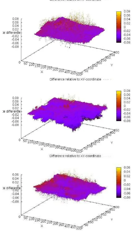
The produced 3D point clouds are gridded to 6 mm resolution from which topographic parameters such as slope, aspect and roughness are derived.. At a later project stage these
Aside from texture mapping 3D building reconstruction from aerial images involv- ing parametric shapes, point cloud segmentation or the simplifi- cation of digital surface models
The results of the research showed that (1) false colour images have a slightly higher percentage of successful interpretation than natural colour images, (2)
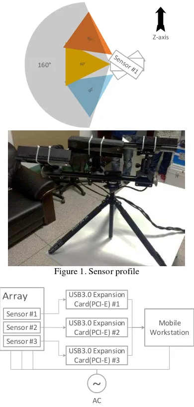
Using these points as reference to orient the point clouds, they were realized in a The International Archives of the Photogrammetry, Remote Sensing and Spatial
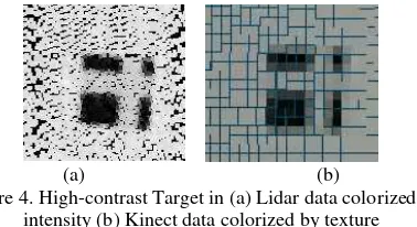
To identify the intensity images objects as certain 3D land cover classes, we define nine categories from bottom to up as water bodies, bare soil, lawn, road,
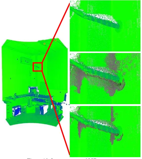
Performance of each filtering algorithm was evaluated qualitatively and quantitatively. In qualitative evaluation, filtered point clouds were overlaid with the
In addition, the regulations require that digital camera systems used for mapping purposes should be certified using a rigorous mapping systems certification and
Based on construction of MRF energy function, spectral and directional features are extracted for on-board urban point clouds.. The MRF energy function is consisted of unary and
