CONTEST OF WEB-BASED GEOSPATIAL APPLICATIONS FOR STUDENTS AND
YOUNG SCIENTISTS
F. Tsaia* and K. Chob
aCenter for Space and Remote Sensing Research, National Central University,
300 Zhongda Road, Zhongli Taoyuan 320, Taiwan [email protected]
bResearch and Information Center, Tokai University,
2-28-4, Tomigaya, Shibuya-ku, Tokyo, 151-0063, Japan [email protected]
KEY WORDS:WEBCON, Web-GIS, web contest, promotion to young people, internet-based application
ABSTRACT:
The Asian Association on Remote Sensing (AARS) organizes a web contest (WEBCON) of photogrammetry, remote sensing and spatial information sciences in the annual meeting of Asian Conference on Remote Sensing (ACRS) every year. The purpose of WEBCON is to promote the development of web and other forms of internet services of the internet related to geo-information sciences and to attract more students and young scientists participating in the related fields of study and applications. Since 2011, WEBCON has become one of the major events in ACRS and successfully increased the interest in the research, development and applications of photogrammetry, remote sensing and spatial information sciences among students and young scientist. The success of WEBCON is an excellent example of promoting the profession of spatial information to young people.
1. INTRODUCTION
Google Maps, Google Earth and other Web geographic informa-tion systems or internet-based virtual globes provide the public easy access to satellite and aerial images and other geo-spatial in-formation of any place around the world. This type of geographic information platform and service has significantly increased the awareness, publicity, and usability of geo-spatial data and their applications. By providing internet-based web-embedded or stand-alone systems for representing and visualizing geo-spatial and other data in specific mark-up languages (Ballagh et al., 2011), these systems also enables developers to implement elaborative and fancy interfaces for their sophisticated applications (Shep-pard and Cizek, 2009; Wu et al., 2011). As discussed in a previ-ous study (Goodchild, 2008), the use of digital contents of geo-spatial information is diversified and can be interpreted in very different spatial concepts. In a dramatic way, these technologies have turned the “world-wide-web” into a revolutionary “web-wide world” (Butler, 2006).
In academic, the concept of virtual globe has also been rapidly adopted as an effective teaching platform or tool in different dis-ciplines (Goodchild, 2006; Patterson, 2007). In addition, efforts have also been put into the research and development of uti-lizing these new platforms for assorted applications in different fields. Although vaporwares are not uncommon in the informa-tion industry, the nature of web-GIS and virtual globe types geo-spatial systems has seemed to make them easy to adopt and gain a solid user base among technical and non-technical people (Butler, 2006; Miller, 2006), in particular, students and young scientists since these new generations are more eager to try and accept new concepts and technologies.
However, a commonly criticized weakness of these virtual globe systems is that they seem to be (utilized) just as “geo-browsers” for presenting, visualizing, or exploiting a variety of geo-spatial data sets (Yu and Gong, 2012) with limited functionalities. In ad-dition, as the development of Google Earth API has been put into abeyance and its support is discontinued in the spring of 2016, an
obvious question is “What comes next?” or “What can we do to keep up the good trend?”
2. WEBCON
In order to promote students and young scientists activities as well as to increase their participation in incorporating new tech-nologies into the research and development of next generation geo-spatial applications and services, the Asian Association on Remote Sensing (AARS), in cooperation with a few ISPRS work-ing groups (WG-VI/1, 2 & 5), has been organizwork-ing a web contest (WEBCON) of photogrammetry, remote sensing and spatial in-formation sciences in the annual meeting of Asian Conference on Remote Sensing (ACRS) since 2011. The primary objective of the contest is two-fold. First of all, it aims to promote the devel-opment of web (and later extended to other forms of internet ser-vices) materials which may give us a future vision of the internet related to spatial information sciences. Secondly, it is expected that the activity will attract more students and young scientists participating in the field of photogrammetry, remote sensing and spatial information sciences, whether in academic researches, in-dustrial and enterprise practices, or general applications. There-fore, the contest is open to students and young scientists and pro-fessionals under age of 35 who are registered to ACRS.
Interested students and young scientists formed teams to partici-pate in the WEBCON. A team typically consisted of one to three individuals. Each team needs to submit a written proposal of their “project” (along with supporting multimedia materials) and im-plement a working web site and/or client software or Apps. In addition to the basic information of the team members, the pro-posal typically includes the following items:
1. Title of the project.
2. Design concept and objective.
3. Outline of the web material: brief description of system re-quirement, framework, scheme or functions.
The International Archives of the Photogrammetry, Remote Sensing and Spatial Information Sciences, Volume XLI-B6, 2016 XXIII ISPRS Congress, 12–19 July 2016, Prague, Czech Republic
This contribution has been peer-reviewed.
4. URL of implemented homepage
5. Other information
In the WEBCON special session of ACRS, each team is given 20 minutes to present their web contents and results (including brief live or recorded demonstration). Then an interactive session is held for all teams to demonstrate their systems and works to and discuss with the audience in details. Each year, two to three prizes donated by sponsors were awarded to the best teams of the contest selected by an evaluating committee. The judges evaluate the works according to the following criteria (not necessarily in that order):
• Originality
• General utility and importance of output
• Scalability and elegance of design
• Clarity, efficiency and portability of implementation
3. ACHIEVEMENTS
Since its inception, dozens of individuals or teams have partic-ipated in the ACRS WEBCON from 2011 to 2015. The event also attracts more than 100 audience every year. Apart from coming from different countries and institutes, the background of the participanting teams are also diversified, covering a wide range of disciplines. The topics presented by the participating teams comprise different aspects of geo-spatial information sci-ences and their applications and services. Summarizing the five WEBCON presentations and results, a few important findings are described below.
The contents of the presented materials follow the most advanced trends of photogrammetry, remote sensing and spatial informa-tion sciences development. However, their topics and charac-teristics were diversified. For example, the gold award of the first WEBCON (in ACRS2011) was an online application sys-tem of ionosphere model for single-frequency GPS positioning (Tsai et al., 2013), while the gold award of the latest WEBCON5 (in ACRS2015) was a web system to help complete homework (graphic diary) during summer break for elementary school stu-dents in Japan. The former involves in the web-based implemen-tation of a developed complex GPS positioning algorithm; the later requires online operation of geo-tag information retrieval, image analysis (pattern and content recognition), and template-based document generation.
In general, most of the presented WEBCON projects were ap-plication oriented. In terms of fields (discipline) of apap-plications, environment-related fields seems to be the most presented topics. However, there were also topics and applications related to social sciences. For example, a web-based online panoramic system for digital cultural heritage applications was presented and won the silver award in WEBCON4 (in ACRS2014).
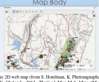
Most of the presented projects implemented two-dimensional (2D) or three-dimensional (3D) web interfaces. For example, Figure-1 displays the interfaces of a mining web map and a multi-temporal 3D campus modeling system presented in WEBCON2 (in ACRS-2012). However, as the ICT (Information and Communications Technology) evolves, the style and format of the presented con-tests has also extended from conventional web-based presenta-tion and data explorapresenta-tion to sophisticated on-line spatial applica-tions and services. In recent years, Apps for mobile devices have seem to become a “must-have” feature of the presented WEB-CON projects.
(a) 2D web map (from S. Homhuan, K. Phetrungnapha, W. Chalaruk, 2012, Thailand Mae Moh Mine “Map Web Apps”, in WEBCON2)
(b) 3D web (from C. Lo, 2012, Historical Representa-tion of Multi-temporal NCU using Three-Dimensional Building Models, in WEBCON2)
Figure 1: Two-dimensional (a) and three-dimensional (b) web interfaces.
4. CONCLUSION
In order to promote new geo-spatial technologies to the students and young scientists, AARS (in cooperation with ISPRS WG-VI/1, 2 & 5) organizes a web contest (WEBCON) in the Asian Conference on Remote Sensing (ACRS) since 2011. The con-test has established its reputation as one of the major events in ACRS. More importantly, the event has successfully increased the interest in the research, development, and applications of pho-togrammetry, remote sensing and spatial information sciences to students and young scientists and professionals. Based on the current achievements, future WEBCON will continue to encour-age “makers” of the “3S” technologies and bridge them with ad-vanced ICT and domain knowledges. The success of WEBCON is an excellent example of promoting the profession of spatial in-formation to young people. It is expected that the WEBCON will be a continuing success in ACRS and encourage more students and young scientists to enter related disciplines of photogramme-try, remote sensing and spatial information sciences in the next generations.
References
Ballagh, L. M., Raup, B. P., Duerr, R. E., Khalsa, S. J. S., Helm, C., Fowler, D. and Gupte, A., 2011. Representing scientific data sets in KML: Methods and challenges. Computers and Geosciences 37(1), pp. 57–64.
Butler, D., 2006. Virtual globes: The web-wide world. Nature 439, pp. 776–778.
Goodchild, M. F., 2006. The fourth r: rethinking GIS education. ArcNews 28(3), pp. 1.
The International Archives of the Photogrammetry, Remote Sensing and Spatial Information Sciences, Volume XLI-B6, 2016 XXIII ISPRS Congress, 12–19 July 2016, Prague, Czech Republic
This contribution has been peer-reviewed.
Goodchild, M. F., 2008. The use cases of digital earth. Interna-tional Journal of Digital Earth 1(1), pp. 31–42.
Miller, C. C., 2006. A beast in the field: The Google Maps mashup as GIS/2. Cartographica 41(3), pp. 187–199.
Patterson, T. C., 2007. Google Earth as a (not just) geography education tool. Journal of Geography 106(4), pp. 145–152.
Sheppard, S. R. J. and Cizek, P., 2009. The ethics of Google Earth: Crossing thresholds from spatial data to landscape vi-sualisation. Journal of Environmental Management 90(6), pp. 2102–2117.
Tsai, L.-C., Wu, J. and Liu, C.-H., 2013. Application of the Tai-Wan ionospheric model to single-frequency ionospheric de-lay corrections for GPS positioning. GPS Solutions 17(3), pp. 337–346.
Wu, H., He, Z. and Gong, J., 2011. A virtual globe-based 3d visu-alization and interactive framework for public participation in urban planning processes. Computers, Environment and Urban Systems 34(4), pp. 291–298.
Yu, L. and Gong, P., 2012. Google earth as a virtual globe tool for earth science applications at the global scale: progress and perspectives. International Journal of Remote Sensing 33(12), pp. 3966–3986.
The International Archives of the Photogrammetry, Remote Sensing and Spatial Information Sciences, Volume XLI-B6, 2016 XXIII ISPRS Congress, 12–19 July 2016, Prague, Czech Republic
This contribution has been peer-reviewed.