isprs annals IV 4 W2 175 2017
Teks penuh
Gambar
Garis besar
Dokumen terkait
This paper introduced a new Apache Spark-based framework for spatial data processing is proposed, which includes 4 layers: spatial data storage, spatial RDDs,
The proposed framework is composed of two parts: data management and data processing as shown in Figure 1. In the data management part, the Lidar data can be directly fetched
For example, ESRI’s commercial product ArcGIS has an estimated 615 stand-alone tools in 18 categories (Gao and Goodchild 2013), plus hundreds of other interactive
Thus, based on the ship type attribute for each vessel, initial data filtering considering both the vessels most likely to carry migrants (cargo and fishing) as well as
Geohashing is a data encoding technique to produce spatial bounding boxes used for binning of nearby points based on Z-order curves (Morton, 1966). Unlike many of the other
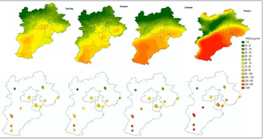
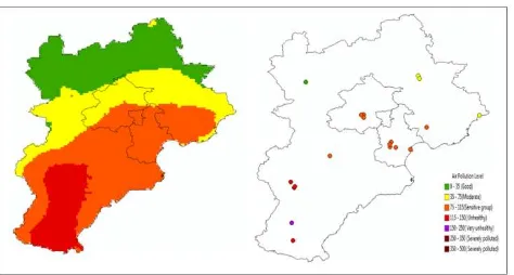
In order to handle missing values in time series, as well as the lack of considering temporal properties in machine learning models, we propose a spatiotemporal prediction
Looking now at the metrics of computational cost, efficiency, and utility we see that the Geohash and Hilbert SFC are pretty competitive and the choice between the two,
Following the successful first International Symposium on Spatiotemporal Computing held in July 2015 (ISSC’2015) at George Mason University, Fairfax, VA, the second International
