The 2nd International Conference on Science, Technology, and Humanity ISSN: 2477-3328
Combination of Mobile Infrastructure Based Routing
Protocol and RSU-Advertisement Routing Protocol in
Urban VANET
Dedi Gunawan, Yusuf Sulistyo Nugroho
Faculty of Communication and Informatics Universitas Muhammadiyah Surakarta
Jl. A. Yani Tromol Pos 1 Kartasura, Surakarta, Indonesia
[email protected] [email protected]
Abstract
Vehicular ad hoc network (VANET) is a subclass of mobile ad hoc network (MANET), in which it is used to support intelligent transportation system. Generally, the main problem in VANET is in routing protocol. This is a challenging task due to the fact that moving object with certain direction and speed always changes the network topology quickly. Some routing protocols actually have been proposed to deal with routing complexity. In this paper we proposed new approach which was combining the existing routing protocol in order to reduce the dropping package in dynamic environment. By combining mobile infrastructure base routing (MIBR) and advertisement routing, the packet loss could be reduced. MIBR used certain type of vehicle on the road as the priority of routing hop. While, placing fixed wireless infrastructure in the roadside (RSU) would be helpful in case of traffic jam, since it could forward the package to the most far targeted vehicle when other vehicle hop experiences stuck.
Keywords: vehicular ad hoc network, advertisement routing, mobile infrastructure base routing, wireless infrastructure.
1.
Introduction
The development of vehicular ad hoc network (VANET) is basically derived from dedicated short range communication (DSRC) technique where the communication among vehicle can be established easily and efficiently even in high mobility condition. VANET can be considered as a mobile Ad Hoc network (MANET) subclass; however, it has different characteristics with MANET. In VANET, every node is constrained on the road and direction; in addition VANET also gives some advantages on its application such as providing information to car’s drivers about traffics, weather, and emergency warning (SouandTonguz 2011). In VANET, each vehicle plays as node where they are communicating to each other. The high density and mobility of vehicle makes the communication process more complex and hard to find an effective solution for routing the data (Venkateshetal 2014).
The 2nd International Conference on Science, Technology, and Humanity ISSN: 2477-3328
delay becomes more unbearable; in addition, it is not suitable to handle a lot of applications. To deal with those problems, we have to know and analyze the characteristics of VANET. As it is mentioned above, VANET is constrained on its road and direction where the traffic light at the intersection or junction takes part in vehicles movement. In addition, there are many types of vehicles such as trucks, busses, cars and motorbikes on the road. Moreover, those types of vehicles like bus may derive advantages for forwarding packet.
Bus is the public transport mode which has well-arranged schedule and has strong power compared to other vehicles. In big cities, bus normally has special line on the road. Based on this idea, we can use bus as forwarding nodes. Considering that the traffic may experience jam or congestion, we also propose to put wireless fixed infrastructure in junction or intersection. The wireless fixed infrastructure will be very helpful when the data in certain cars buffered is full. This car can forward the packets to the wireless fixed infrastructure to avoid dropping the packets during communication process.
2.
Environment Design
2.1 Vehicle to vehicle communication
Since there are several types of vehicles such as cars and buses, all of these vehicles will use wireless network interface, GPS, On board unit (OBU), and speed sensor. However, the ordinary car will only have one wireless network interface (R1) while, the buses will have two wireless interface (R1, R2). The communication between car to other cars and RSU will use wireless network R1. However, the communication between buses to other buses will use wireless interface R2. Car and bus may communicate to each other by using wireless interface R1 as well as to communicate with the RSU.
2.2 Vehicle to RSU communication
The communication between vehicle and RSU will use interface one (R1). Road side unit (RSU) is working when the packet will be sent to the destination and the buffer of the neighboring vehicle cannot carry the packets. This neighbor will directly forward it to the RSU and RSU will find another vehicle, which is close to the target, to avoid dropping packets (Chaurasia and Verma 2011).
2.3 RSU to RSU and Base station communication
The 2nd International Conference on Science, Technology, and Humanity ISSN: 2477-3328
Figure 1.VANET environment
http://www.cs.nthu.edu.tw/~jungchuk/research.html
2.4 Assumption
On Board unit: on board unit consists of GPS and Maps. The GPS system is used to identify the current location of the car and other cars as well, while the Maps takes part on the visualization of real road condition. Furthermore, it should show the other cars speed on the screen.
Wireless interface on car: the wireless device should be installed to each car. The wireless is used to communicate to each other either receiving or transferring packets.
Speed sensor: it deals with the speed measurement. When the car moves, the speed will be recorded and broadcasted to other cars. Therefore, other cars may know the neighboring cars’ speed.
Road Side Unit (RSU): this will be used to buffer and forward every packet to avoid dropping packets. RSU may communicate to other RSUs.
3G/UMTS base station: it has wide broadcast area so that it can be used to broadcast information from one city to another and it has high capacity to buffer transferred packet.
3.
Solution
The 2nd International Conference on Science, Technology, and Humanity ISSN: 2477-3328
hand, the cars would only be installed with one wireless interface and its transmission range was the same with R1.
Suppose vehicles moved uniformly in the road and the average gap between two vehicles was X, we might predict that the average distance between two buses was X/20%. As it was mentioned above, buses only took 20% from the total amount of vehicles. Based on the illustration, we had to improve the network connectivity range of buses that it should be at least five times over those vehicles. However, when the distance between them was close to the maximum broadcast range, connection between them would be hard to establish as it was mentioned before that traffic on the road took part on VANET.
Let say that when the traffic light was green, those cars that were moving in the same direction would be closer to each other. We might group them in to clusters where in a cluster there would be a bus and several cars. Since the buses were dispatched periodically it made the network relatively dispersive. In this case, the distance between those adjacent cars was less than the maximum transmission range which meant the expectation between two clusters was min (T*V,L) where T was the period of traffic red, L was the segment length and V was the velocity. Since R1 was the transmission range between buses and cars and R2 was stronger than R1, the buses were able to provide better multi-hop communication and it could be considered as mobile backbone. RSU would take in charge when there were a lot of packets on the network and the destination address was very far from the source node or there were no others vehicles as the next hop. For example, when a bus as the mobile backbone received a lot of packets but the destination target was too far from the bus, and there were no other cars around it, the bus could forward the packet to the RSU and it would find the next hope rather than dropping the packet.
3.1 Routing and Forwarding
Based on that case, we would like to use Mobile infrastructure based VANET routing protocol (MIBR). MIBR routing protocol is location based reactive routing (JieLuoXin et al. 2010). The concept of MIBR is using buses as the mobile backbone. There are two main ideas of MIBR, the first is selecting the optimal hop that consists of road segment and estimating transmission quality and followed by forwarding packets efficiently hop-by-hop in every road segment along the selected route.
3.1.1 Routing
MIBR adopts road segments based routing approach with street awareness. Hence, the packets will be forwarded between vehicles based on street map topology. In MIBR, road segments are selected one by one, it is due to the fact that the quality of transmission on each road segments is different. When a node wants to forward the packets, it has to consider the forwarding road segment and it has to check the entire neighbor routing table and choose the best neighbor with minimal hop count from the destination. The first thing that node has to do before forwarding packets is estimating the hop count.
The 2nd International Conference on Science, Technology, and Humanity ISSN: 2477-3328
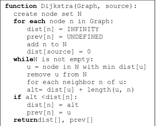
check the route table. Routing strategy is not only focusing on the vehicle but also considering the RSU’s routing. RSU-advertisement is the one of the RSU routing strategy. In this routing strategy, RSU will rebroadcast the message to vehicles that has fastest speed and go to the same direction with the targeted destination.
Figure 2. Pseudocode of Djikstra algorithm
3.1.2 Forwarding
In forwarding technique, bus is preferable priority to forward the packets on the road segment or it is called “bus first”. However, it does not mean that in MIBR bus is always the first priority in forwarding packets because there are some conditions that should be considered. In MIBR, every car sends beacon of packet which contains its location and type of vehicle, either bus or ordinary car, periodically. Each car also maintains table that consists of its neighbor information and when a car wants to forward packets it will select one of those neighbors to forward them. In addition, if there are no buses close to the car, it can use neighbor car as the next forwarding target. Nevertheless, if the buffer of the neighbor is full, it can forward the packets into RSU and RSU will take the rest of routing.
In short, the forwarding method has some conditions. First, if there are any buses at the segment road in the neighbor table, choose the closest bus in the junction after the next junction, otherwise, choose the ordinary car in the next junction. Second, if there is no other vehicle in the neighbor table on the next road segment and the packet is now in the bus, choose a bus which is close to the next junction, otherwise, choose ordinary car which is close to the next junction. Third, if there is no other vehicle in the neighbor table on the next road segment and the packet is now at the car, the forwarding method will choose a bus which is close to the junction; if not available, choose a vehicle which is closest to the next junction. And the last, if there is no other car which is suitable for forwarding nodes, send the packet to RSU instead of dropping the packets.
3.2Prove Of Solutions
Based on the explanation above, Jie Luo Xin et al. in 2010 provided some mathematical formulation to prove the solution, which was provided bellow. In selecting the minimal routing
The 2nd International Conference on Science, Technology, and Humanity ISSN: 2477-3328
hop by using bus as the backbone network we had to estimate the density of the vehicle. To make it clear, there were some definitions to describe the problems; they were:
Xi : route length of bus i
Lj : length of road segment j
Nj : expected number of bus on the segment j
Cj : estimation of hop count for road segment j
If bus i had route length Xi, and bus i was on the road segment j. Therefore, the probability of
bus i on the road j was Lj/Xi. As a result, we could estimate the number of bus on the segment
j, that was:
= ∑ , ∗�� (1)
, = { 1 if bus line i was on the road j and 0 if bus line i did not contain on road j
As the bus departure periodically, we could predict the distance between buses with another bus in segment j by �
� . When the bus density in road segment j was high enough, it did not need
any ordinary car to forward packets. The average distance between buses could be denoted as D where = � . Hence, in this condition we estimated the hop count by:
� = �� , > � . (2)
However, when the bus density was not enough to forward packets, we could use ordinary car as the forwarding target in the road segment j and we could formulate hop count with the formula
� = �∗� ∗ �� , < � . (3)
Routing algorithm would not choose them in case the hop count was too large due to disconnection of road segment.
4.
Conclusion
The 2nd International Conference on Science, Technology, and Humanity ISSN: 2477-3328
References
Venkatesh, AIndra, R Murali. (2014). Routing Protocols for Vehicular Adhoc Networks (VANETs): A Review. Journal of Emerging Trends in Computing and Information Sciences. 24-43
Jie Luo Xin, Xing Gu Tong and Zhao Wei Yan. (2010). A Mobile Infrastructure Based VANET Routing Protocol in the Urban Environment. International Conference on Communications and Mobile Computing.
Brijesh Kumar Chaurasia and Shekhar Verma. (2011) Infrastructure based Authentication in VANETs. International Journal of Multimedia and Ubiquitous Engineering. Vol. 6, No. 2
Tarik Taleb and Abderrahim Benslimane. (2010).Design Guidelines for a Network Architecture Integrating VANET with 3G & Beyond Networks. IEEE Globecom proceedings