isprs archives XLI B5 693 2016
Teks penuh
Gambar

Dokumen terkait
Because SURE generated usable dense point clouds for all dates only with the evening acquisition and we want to compare fairly with PhotoScan, we performed the statistical analysis
The alignment of smartphone point cloud on the laser scanning point cloud is performed in two steps; (1) a course re-scaling and alignment is performed by applying a
Scans were taken every 5 m along the lock, which provided 9 point clouds. As shown on Fig. We note that placing the sonar deeper would limit these angles and distances, leading to
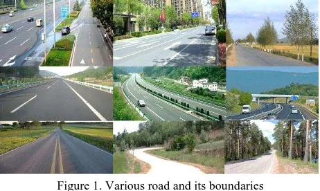
Therefore, file management for the Thousand-hand Bodhisattva 3D information documentation project should clear the collection range partitioning and engineering
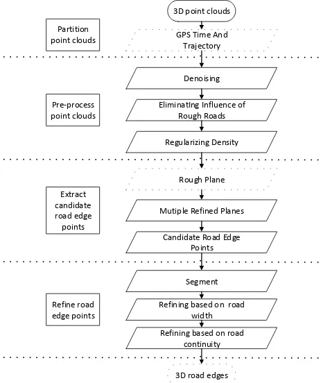
Then, the trajectory filtering with expected accuracy method is used to filter the sub-trajectories according to the similarity between GPS tracking points and
Using these points as reference to orient the point clouds, they were realized in a The International Archives of the Photogrammetry, Remote Sensing and Spatial
KEY WORDS: Unmanned Arial Vehicle Photogrammetry, Remote sensing, 3D point clouds and surface models, Wetland delineation and classification, Wetland health
Additionally, the reference data or selected points or objects thereof may be used as ground control points for a point cloud adjustment of the mobile mapping point clouds
