Indonesian Journal of Geography Vol. 49, No.1, June 2017 (35 - 41) DOI: http://dx.doi.org/10.22146/ijg.2323, website: https://jurnal.ugm.ac.id/ijg © 2017 Faculty of Geography UGM and he Indonesian Geographers Association
Regional Management of Areas with Indications of Urban Sprawl
in the Surrounding Areas of Universitas Muhammadiyah,
Yogya-karta, Indonesia
Sri Rum Giyasih
Received: 09 02 2017 / Accepted: 21 04 2016 / Published online: 30 06 2017 © 2017 Faculty of Geography UGM and he Indonesian Geographers Association
Abstract his research was conducted in the surrounding areas of a university, Universitas Muhammadiyah Yogyakarta (UMY), which is administratively located in Tamantiro Village, Kasihan District, Bantul Regency, the Special Region of Yogyakarta, Indonesia. It aims to formulate the regional management of the surrounding areas as they have been presenting the indications of urban sprawl. It used a qualitative method with research data obtained from in-depth interviews to 22 informants including governmental agencies (7 informants), academics (6 informants), entrepreneurs (5 informants), and villagers (4 informants). he informants were sampled using purposive sampling method. Data pro-cessing and analysis were conducted using qualitative descriptive method, i.e. (1) data reduction, (2) data presentation, and (3) data conclusion. Data validation and reliability tests were conducted using source triangulation method. he results show that the stakeholders proposed various management strategies to improve the positive impacts and, at the same time, reduce the negative impacts of urban sprawl. hese management strategies include (1) consistency in imple-menting spatial planning regulation, (2) spatial synergism in development planning, implementation, and monitoring, (3) assistance to the native people and the migrants, and (4) integration between the university and the village.
Abstrak Penelitian ini dilakukan di kawasan sekitar Kampus UMY yang secara administratif termasuk di dalam Desa Tamantirto, Kecamatan Kasihan, Kabupaten Bantul, Provinsi Daerah Istimewa Yogyakarta, Indonesia. Penelitian ini bertujuan untuk merumuskan pengelolaan wilayah di sekitar Kampus UMY yang mengalami gejala urban sprawl. Pe-nelitian ini menggunakan metode kualitatif. Teknik pengumpulan data dilakukan dengan cara wawancara mendalam kepada 22 informan yang terdiri dari unsur pemerintah (7 informan), akademisi (6 informan), pelaku usaha (5 infor-man), dan masyarakat umum (4 informan). Pengambilan sampel informan dilakukan dengan metode purposive samping. Metode pengolahan dan analisis data dilakukan secara deskriptif kualitatif dengan cara: (1)reduksi data, (2)penyajian data, dan (3)penarikan kesimpulan. Metode uji validitas dan reliabilitas data dilakukan dengan metode trianggulasi. Ada-pun metode trianggulasi yang digunakan adalah triangulasi sumber. Hasil penelitian menunjukkan bahwa dalam rangka untuk meningkatkan dampak positif serta untuk mengurangi dampak negatif gejala urban sprawl maka para stakeholders mengusulkan untuk: (1)konsisten dalam melaksanakan aturan penataan ruang, (2)sinergisme spasial dalam perencanaan,
pelaksanaan, dan pemantauan pembangunan, (3) pembinaan kepada penduduk baik penduduk asli maupun penduduk pendatang, dan (4) integrasi kampus dan kampung.
Keywords: areas around UMY, indications of urban sprawl, outskirts, regional management.
Kata kunci: gejala urban sprawl, kawasan sekitar kampus UMY, pengelolaan wilayah, pinggiran kota.
1.Introduction
his research deines the indications of urban sprawl as the outward spreading of urban physical features [Brian, 2016; Morote and Hernandez, 2016]. hese indications are part of urban expansion [Oeslati et al., 2015; Dadi et al.,2016; Ewing, et al.,2017]. Spatially, they present in three spatial patterns, namely: (1) concentric or low-density continuous development, (2) ribbon/linear/axial development, and (3) leapfrog or checkerboard development. Concentric development involves the slowest spreading of urban area among the other signs of urban sprawl. It spreads slowly depending on
Sri Rum Giyasih
Faculty of Geography, Universitas Gadjah Mada, Indonesia Correspondent e-mail: rum_ugm@yahoo.co.uk
the outer part of urban physical feature. [Woltjer, 2014; Wei and Knox, 2015; Winarso et al.,2015; Shatkin, 2016]. he role of transportation is thereby less signiicant in this type of urban sprawl.
Linear development shows uneven spreading to the outer side of a city. his type of urban expansion spreads rapidly along the transportation lines. In other words, areas along the transportation lines receive the heaviest pressure from population growth and the expansion of urban functions because they ofer the highest degree of physical accessibility [Kiggundu, 2014; Nazarnia, et al., 2016; Osman et al., 2016; Setyono, dkk, 2016; Weilermann et al., 2017].
[Anjarsariningtyas et al., 2016; Dupras et al., 2016] because it disrupts vegetation coverage that functions as the lungs of the outskirts and maintains the stability of microclimate. Furthermore, it also causes immediate negative impacts on agricultural activities due to the encroachment of productive and technically irrigated agricultural lands [Harini et al, 2014; Sriartha and Giyarsih, 2015; Sudrajat, 2016]. On one side, the encroachment reduces the extent of available agricultural land. On the other side, it also leads to further disruptions to agricultural land, for example, to the performance of irrigation channel [Yunus, 2008; Giyarsih, 2010; Giyarsih, 2012; Giyarsih, 2014].
In term of physical dimension, urban sprawl can be identiied using three indicators, namely: (1) land use characteristics, (2) building characteristics, and (3) circulation characteristics [Smiles, 1985, in Yunus, 2008; Surya, 2016]. Smiles [1985] further explained that urban land use is characterized by the predominance of built-up area (building coverage) over vegetation coverage. As for building characteristics, an area is deemed experiencing urban sprawl when the existing buildings are in high density and are functioned majorly for urban activities. In addition, an area is classiied to having experienced urban sprawl when its circulation is characterized by a high transportation network density. In term of non-physical dimension, urban sprawl is indicated by the outward spreading of urban socioeconomic nature. An area is categorized as experiencing urban sprawl when its livelihood structure shows a change, i.e. the number of farmers decreases or, in other words, the number of people working in industrial and service sector increases [Giyarsih and Alfana, 2013], or when the behavior of its people changes from rural to urban behavior. he behavioral change includes, for example, a transition from communal society (paguyuban/ gemeinschat), which is commonly found in a rural life, to associational society (patembayatan/gesselschat).
A communal society does not prioritize material values in interpersonal relationships; it relies on kinships. Meanwhile, in associational society, material values become the benchmark of conducting life, i.e. as the orientation of the society. he initially strong kinship in a rural area has been fading due to the introduction of new life values that emphasize more on formal interpersonal relationship [Yunus, 2008]. he aforementioned description postulates that the outskirts of Yogyakarta have been experiencing regional transformation. Nowadays, the outskirts are experiencing rapid population growth and economic development [Giyarsih and Alfana, 2013; Skog and Stelnnes, 2016]. his phenomenon is found around Universitas Muhammadiyah Yogyakarta (UMY), which is administratively located in Tamantirto Village, Kasihan District, Bantul Regency, the Special Region of Yogyakarta, Indonesia. he urban sprawl occurring around the university shows speciic spatial pattern
and process that inevitably bring various positive and negative consequences to the other surrounding areas. Following this background, the research aims to formulate the regional management of areas around UMY that have been presenting indications of urban sprawl. he results expectedly ofer both academic beneits and empirical-practical beneits. From academic point of view, this research contributes to scientiic development especially in the ield of urban geography. Meanwhile, from empirical-practical perspective, this research contributes to the development of the thinking pattern of related stakeholders in formulating regional development policy.
2.he Methods
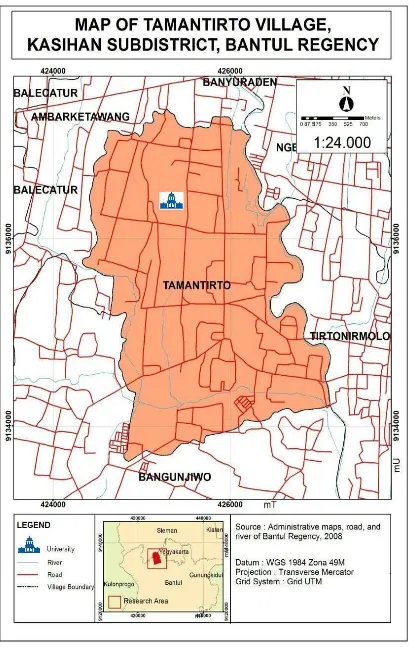
his research was conducted in areas surrounding UMY, i.e. a university located administratively in Tamantiro Village, Kasihan District, Bantul Regency (see Figure 1). hese areas were selected as a research site because they have been presenting the indications of urban sprawl, as characterized by their physical and socioeconomic growth. his qualitative research obtained data from in-depth interviews to 22 informants including governmental agencies (7 informants), academics (6 informants), entrepreneurs (5 informants), and villagers (4 informants). he informants were sampled using purposive sampling method. Meanwhile, the informants in each of these categories were sampled using snowball sampling technique. he size of samples in this snowball technique was not determined initially; however, the snowball stopped when the sampled informants in each category provided repeated (saturated) answers [Sugiyono, 2007]. hen, the research data was processed and analyzed in three steps, as stated by Moleong [2005], namely data reduction, data presentation, and data conclusion. Data analysis was conducted not only ater data collection but also since the irst step of data collection and throughout the research. Every data collection was immediately followed by data processing and analysis. Data validation and reliability tests were conducted using source triangulation method, i.e. crosschecking informants.
3. Result and Discussion
subchapters describe these four regional management strategies in areas with indications of urban sprawl.
Consistency in Implementing Spatial Planning Regulation
he physical indications of urban sprawl are characterized by the conversion of agricultural to non-agricultural land. Before the indications of urban sprawl exist in an area, the land use is predominated by vegetation coverage. However, urban sprawl causes the predominant land use to change from vegetation coverage to building coverage or built-up area. Massive agricultural to non-agricultural land conversion occurring around the university brings negative consequences, for example, to food security system both around the university and in a wider regional constellation. On one side, this land conversion reduces the extent of agricultural land; on the other side, it disrupts the remaining agricultural land, as stated by one of the informants. “he [harvest] result from the past and present agriculture is diferent. It used to be more. he harvest used to be up to 13 sacks. But now, ater the construction of many buildings close to my rice ield, the harvest is only 10 sacks. he cause is, well, the irrigation channel does not work well. Also, my rice ield is borderd by buildings. My rice ield, of course, receives less sunshine.” (Interview to V1/informant from villagers on August 19, 2016)
his research found that the indications of urban sprawl have brought negative consequences to the conversion of agricultural to non-agricultural land as well as to food security. hese indings are in line with Brookield et al., [1991] and Sriartha and Giyarsih [2015]. Unless there are no strategies to decelerate the agricultural land conversion in areas around the university, the remaining agricultural land will eventually disappear. his inding is in line with Yunus [2001], Harini [2012], Sutaryono [2012], Sudrajat [2016], and Tian et al. [2017]. One of the strategies proposed by the stakeholders to solve this problem is by implementing the spatial planning regulation consistently.
It is no longer a secret that the documents of spatial planning (Spatial Planning or Detailed Spatial Area Plans) in several areas in Indonesia are only stored in the bookshelves ater their issuance by the representatives of related regencies/cities and provinces. Bantul Regency issued the Local Regulation No. 04 in 2011 on the Spatial Planning of Bantul Regency in 2010-2030. his document regulates the location of agricultural land permitted/prohibited to be converted to non-agricultural land. Nowadays, the Government of Bantul Regency strictly implements the regulation on the prohibition of agricultural land conversion on the green belt. Some areas around the university are part of a green belt. An interview to the following informant shows that land conversion is diicult to decelerate. “[Some areas in] Tamantirto are part of a green belt, for example, the west part of Ngebel Hamlet. [he rice ields
located in the] green belt are not allowed to be drained.
“Some of the villagers in this area tried to drain their rice ields, which are located on the green belt, but the process, of course, stopped in the National Land Agency (Badan Pertanahan Nasional-BPN).” (Interview to G1/ informant from government agencies, on August 2, 2016)
“Not every rice ield is allowed to be drained. he rice ields located on the green belt are not allowed to be drained, for example, in the west part of Ngebel Hamlet.” (Interview to G2/informant from government agencies, on August 19, 2016).
hese interviews prove that the agricultural land draining in Bantul Regency is very diicult to proceed. he process starts ater the Oice of Public Works, Bantul Regency issues a permission letter for land conversion. his letter is then proposed to the National Land Agency of Bantul Regency for veriication. If this agricultural land is not located on the green belt, the next process will be ield observation. On the contrary, if the land is part of the green belt, the conversion proposal will be rejected directly by the National Land Agency of Bantul Regency. his process is part of the strategy applied by the Government of Bantul Regency to maintain the food security in related areas. Empirically, there are indeed violations to this regulation. his research found that the draining prohibition is violated because ield observations showed that rice ields located on the green belt were converted into buildings, as explained by the following interview. “Here, some areas are part of the green belt. Many people asked for draining permission to me, but I refused them and, then, I asked them to directly propose to the Government of Bantul Regency. hey said that the proposal for draining permission was rejected, but they kept building the land anyway. I cannot disallow them because the situation always turns back to me, they asked me whether I can provide them a piece of land for their houses. So, what should I do then?” (Interview to G3/informat from government agencies, on August 3, 2016)
moratorium] lasts until December 31, 2016. [he decree is for] Sewon, Kasihan, Banguntapan, Pleret, and Bantul District.” (Interview to G4/informant from government agencies on August 11, 2016)
Spatial Synergism in Development Planning, Implementation, and Monitoring
According to Yunus [2008], spatial synergism is a strategy to integrate several areas so that the inal products obtained through this synergism are better than those obtained through the performance of each area. Furthermore, Yunus [2008] also stated that the irst strategy to formulate a spatial synergism is an agreement on the vision of the synergism itself. he next strategy is formulating the missions to achieve the previously decided vision. he areas participating in this spatial synergism must have a strong commitment to conduct the interregional cooperation and to implement the formulated missions consistently and consequently. As for the areas around the university that are part of the outskirts of Yogyakarta City, the spatial synergism can be in the form of interregional economic zone that is developed by areas on the outskirts that have diferent production factors. his factor diference may create a complementarity that promotes trade and investment. he geographical proximity is the key factor in minimizing transportation cost.
In a wider constellation, the outskirts of Yogyakarta City are part of the Special Region of Yogyakarta. Muta’ali [1998] stated that the regional development of areas experiencing the indications of urban sprawl consists of three main entities, namely economic, geographic, and political aspects. his inding is in line with Tacoli [2003]. he aim of the spatial synergism of the outskirts, including the areas around the university, is to improve trade and investment, create employment, establish interregional relationship between the more developed and the less developed areas, and, inally, improve the welfare of the society in every area. Furthermore, Rondinelli [1979] stated that this spatial synergism can be conducted by developing a production network, product distribution, and product exchange between the areas joining in this spatial synergism. he outskirts of Yogyakarta City are part of the Special Region of Yogyakarta. he indings of this research show that the Special Region of Yogyakarta has interregional cooperation called Kartamantul (Yogyakarta-Sleman-Bantul). Kartamantul agreed on various sectors that are managed integratedly between the Governments of Yogyakarta City, Sleman Regency, and Bantul Regency, namely clean water, litter, waste, road infrastructure, and basic settlement infrastructure. he monthly coordination between the responsible institutions in these three administrative units aims to decide the development management of the ive aforementioned sectors. his cooperation shows that the stakeholders perceive a spatial cooperation as necessary in improving the positive impacts and, at
the same time, reducing the negative impacts of urban sprawl that emerging on the outskirts of Yogyakarta City, including the areas around the university.
In term of regional constellation, the outskirts of Yogyakarta City also have an interregional cooperation that promotes spatial synergism. his phenomenon is in line with the visions and ideals of several stakeholders. Every stakeholder agrees that any forms of cooperation like Kartamantul require further improvement until they achieve their goals, provide more beneits, and, consequently, result in positive consequences to areas around the university that have been presenting the indications of urban sprawl.
Assistance to Native People and Migrants
he stakeholders concern on the negative impacts of urban sprawl that potentially emerge in areas around the university. One of the negative impacts is the behavioral change from rural to urban nature, which is not in accordance with the local culture and custome. For esample, urban consumptive behavior and extravagant lifestyle start to iniltrate the life of the native people.
When the areas around the university become the destination of migrant inlux, various negative behaviors start to emerge in the life of the native people. he stakeholders proposed the implementation of assistance from responsible parties in order to reduce this negative impact. he following interview explains the need of assistance to the native people and the migrants. “Well, some of the young people in this area follow the lifestyle of the university students, for example, they ask their parents to buy them nice motorcyles and mobile phones. If the parents are rich, then there will be no problem. But, what about the low-income parents? herefore, governmental assistance becomes necessary. he migrants, especially the university students who stay in the boards and lodgings, also require assistance so that they don’t cause problems in the future.” (Interview to E1/ informant from enterpreneurs on August 19, 2016)
‘functioning’. ‘Functioning’ exists only when a person has the relevant capability, access to commodities/capitals/ resources, and supporting situation. Furthermore, Sarwadi et al [2013] explained that proprietary rights or access entitlements to various assets increase the capabilities and, thereby, widely open the opportunities for a person to ‘function’. Households that have these opportunities will be able to improve their well-being. herefore, assistance is expected to prevent the native households from being marginalized. hese households will be assisted until they have more capabilities to optimally take the economic opportunities created by the urban sprawl occurring in areas around the university. Finally, these housholds are expected to be able to improve their well-being.
University-Village Integration
his research found the importance of integration between the university and the village as a form of solution in improving the positive consequences and reducing the negative consequences of the emerging urban sprawl in areas around the university in Tamantirto Village. he following interview explains the importance of university-village integration. “he university and the village need to interact. here has to be a policy that integrates the university and the village. hey have to ‘live’ side-by-side properly.” (Interview to A1/informant from academics on August 11, 2016)
“I was asked several times by the people from UMY to deal with this problem. I proposed to UMY to also show their responsibility of addressing the problems occurring in the village, whih are caused by their university students. However, there is no response to this proposal. I always propose the same idea. Every time a discussion occurs, I always propose the same thing because there is no follow-up from UMY until now.” (Interview to G3/informat from government agencies, on August 3, 2016).
hese interviews describe that the stakeholders expect a policy that integrates the life of the university and the village as well. his policy is expected to create a harmonious living and a symbiotic mutualism between the university and the village. During the interview, one of the stakeholders explained as follows. “It is improper when a university does not provide student apartments because [the number of required temporary residence for the university residence] will reduce the existing space. herefore, student apartments have to be directed to/managed by the society to improve their economy. It is a win-win solution for both the university and the village.” (Interview to G5/informant from government agencies, on August 11, 2016)
he integration between the university and the village will bring mutual beneits to every party. Consequently, a conlict between these two parties can be prevented. hese indings are in line with Sarwadi et al [2013].
4.Conclusion
In order to improve the positive impacts and, at the same time, reduce the negative impacts of urban sprawl that emerges in areas around UMY, the stakeholders propose the following management strategies: (1) consistency in implementing spatial planning regulation, (2) spatial synergism in development planning, implementation, and monitoring, (3) assistance to the native people and the migrants, and (4) integration between the university and the village. Consistency in implementing spatial planning regulation becomes necessary especially in protecting productive and technically irrigated agricultural land for food security. Spatial synergism in development planning, implementation, and monitoring is important considering the indications of urban sprawl that emerge in one area area are related to other areas as well as to a wider regional constellation. Assistance to the native people and the migrants aims to prepare them to be able to wisely response to and create opportunities from urban sprawl. University-village integration becomes necessary for living side-by-side harmoniously and for complementing each other so that a symbiotic mutualism is achieved.
5.Acknowledgement
Author would like to express her gratitude to the Graduate School of UGM for providing research funding through the scheme of Competitive Graduate-School Lecturer Research Grant in 2016. Author would also like to thank Prof. Ir. Suryo Purwono, MA., Ph.D. and Dr. Tri Kuntoro Priambodo, M.Sc, as reviewers, for their signiicant inputs in improving this article.
References
Anjarsariningtyas, R., Laksmiasri, W., Pratiwi, A.A., dan Giyarsih,S.R. (2016). Food Security in Urban Sprwal Efected Area : Case Study in Sub Districts on he Outskirts of Yogyakarta City. Proceeding of he 13th International Asian Urbanization Conference, January 6-8, 2016. Hal 713-718 Brookield., Hadi, S., dan Mahmud. (1991). he City in
he Village : he in situ Urbanization of Villages, Villagers and heir Land Around Kuala Lumpur Malaysia. Oxford University Press. New York. Dadi, D.,H. Azadi., F. Serbeta., K. Abebe., F. Taheri.,
T. Stellmacher. (2016). Urban Sprawl and Its Impacts on Land Use Change in Central Ethiopia. Urban Forestry and Urban Greening 16: 132-141 Dupras, J.,J. Marull, L. Pancerisas, F. Coll, A. Ganzalez.
(2016). he Impact of Urban Sprawl on Ecological Connectivity in the Montreal Metropolitan Region. Environmental Science and Policy 58 : 61-73 Ewing, R., S. Hamidi., J.B. Grace., Y.D. Wei. (2017).
Does Urban Sprawl Hold Down Upward Mobility? Lanscape and Urban Planning 48 : 80-88 Giyarsih, S.R. (2010). Urban Sprawl of he City of Yogyakarta, Special Reference to he Stage of Spatial Transformation. Indonesian Journal of Geography, Vol 42(1), 49-60. Giyarsih, S.R . (2012). Dampak Transformasi Wilayah
Perspektif Geograis). Forum Geograi Vol 26(2),120-131. Giyasih, S.R.. (2014). he Role of Yogyakarta and Surakarta
Cities in the Intensity of the Regional Transformation of Two Villages Located in the Yogyakarta-Surakarta Corridor. Romanian Review of Regional Studies. Vol X, Number 1, 2014, halaman 15-22. Giyarsih, S.R., dan Alfana, M.A.F. (2013). he Role of Urban
Area As he Determinant Factor of Population Growth. Indonesian Journal of Geography Vol 45(1), 38-47. Harini, R. (2012). Kajian Spasial Valuasi Ekonomi Lahan
Pertanian Terkonversi dan Dampaknya Terhadap Produksi Pangan di Kabupaten Sleman. Disertasi. Fakultas Geograi UGM. Yogyakarta. Tidak Dipublikasikan. Harini, R., Giyarsih, S.R., Ariani, R.D., dan Darusasi,
R. (2014). Community Adaptation Model of Food Security Due to Global Warming in Kulon Progo. Proceeding of he 6th International Garduate Students and Scholars’Conference in Indonesia, November 19 th and 20th ,2014 halaman 305-320. Kiggundu, A.T. (2014). Constrains to Urban Planning
and Management to Secondary Town in Uganda. Indonesian Journal of Geography 46(1) : 12-21 Moleong, L.J. 2005. Metodologi Penelitian Kualitatif.
Jakarta. Proyek Pengembangan LPTK. Morote, A.F., M. Hernandez. (2016). Urban Sprawl
and Its Efeects on Water Demand : A Case Study of Alicante, Spain. Land Use Policy 50 : 352-362 Muta’ali, L. (1998). Tinjauan Geograis Segitiga
Pertumbuhan Dalam Pembangunan Wilayah. Paper disampaikam dalam diskusi bulanan di Jurusan PPW Fakultas Geograi UGM tanggal 23April 1998. Nazarnia, N., C. Schwick., J.A.G., Jaeger. (2016). Accelerated
Urban Sprawl in Montreal, Quebec city and Zurich: Investigating the Diferences Using Time Series 1951-2011. Ecological Indicators 60 : 1229-1251 Osman, T., T. Arima., P. Divigalpitiya. (2016). Measuring Urban Sprawl Patterns in Greater Cairo Metropolitan Region. Journal of Indian Social Remote Sensing 44 (2) : 287-295 Oueslati. W., S. Alvanides, G.Garrod. (2015).
Determinants of Urban Sprawl in European Cities. Urban Studies 52 (9) : 1594-1614 Pemda Kabupaten Bantul. (2011). Perda No 04 Tahun
2011 tentang Rencana Tata Ruang Wilayah Kabupaten Bantul Tahun 2010-2030 di Yogyakarta Rachmawati, R.,Junaedi, A., Rijanta. (2004). Peran Kampus
sebagai Pemicu Urbanisasi Spasial di Pinggiran Kota Yogyakarta. Majalah Geograi Indonesia.18 (1) :45-56 Rondinelli, D.A. (1979). Spatial Factors in Resources System
: Spatial Analysis for Integrated Regional Development Planning in the Bicol River Basin of the Philipines, UN University and Chung Ang University. Seoul Korea. Sarwadi, A., Giyarsih, S.R., Pramono, R.W.D. (2013). Penguatan Kapabilitas Masyarakat Pinggiran Kota, Studi Kasus Kecamatan Kasihan, Kabupaten Bantul Daerah Istimewa Yogyakarta. Laporan Penelitian. Pusat Studi Perencanaan Pembangunan Regional UGM (Tidak dipublikasikan). Setyono, J.S. Yunus, H.S., Giyarsih, S.R. (2016).
Spatial Pattern of Urbanization and Small Cities Development in Central Java : A Case Study of Semarang-Yogyakarta-Surakarta Region. Journal of Geomatic and Planning. Vol 3(1), page 53-66 Shatkin, G. (2016). he Real Estate Turn in Policy and
Planning : Land Monetization and the Political Economy of Peri-Urbanization in Asia. Cities 53 : 141-149 Skog, K.L., M. Stelnnes. (2016). How Do Centrality,
Population Growth and Urban Sprawl Impact Farmland Conversion in Norway. Land Use Policy 59 : 185-196 Sriartha, I. P.,and Giyarsih, S.R. (2015). Spatial
Zonation Model of Local Irrigation System Sustainability (A Case of Subak System in Bali). Indonesian Journal of Geography, Vol47(2), 42-150 Subroto, Y.W., dan Setyadi. (1997). Proses Transformasi
Spasial dan Sosio Kultural Desa-Desa di Daerah Pinggiran Kota (Urban Fringe) di Indonesia (Studi Kasus Yogyakarta). Laporan Penelitian Ilmu Pengetahuan Dasar. Yogyakarta. Pusat Studi Lingkungan Universitas Gadjah Mada. Yogyakarta. (Tidak dipublikasikan) Surya, B. (2016). Change Phenomena of Spatial Physical in
the Dynamics of Development in Urban Fringe Area. Indonesan Journal of Geography 48 (2) : 118-134 Sudarajat. (2016). Farmers Commitment in Maintaining Wetted Land Ownership Status in Peri Urban Area of Yogyakarta. Indonesian Journal of Geography 48 (1) : 91-101 Sudarajat. (2013). Tinjauan Spasial Komitmen Petani
Mempertahankan Kepemilikan Lahan Sawah dan Pemanfaatannya Untuk Lahan Pertanian di Kabupaten Sleman dan Kabupaten Bantul. Disertasi. Fakultas Geograi UGM. Yogyakarta. Tidak Dipublikasikan. Sugiyono. (2007). Metode Penelitian
Pendidikan. Bandung. Alfabeta. Sutaryono. (2012). Marginalisasi Petani di
Daerah Istimewa Yogyakarta. Tesis. Fakultas Geograi UGM (Tidak dipublikasikan). Tacoli, C. (2003). he Links Between Urban
and Rural Development. Environment and Urbanization Vol 15 (1) 3-12. Tian, L., B. Ge., Y. Li. (2017). Impact of State-Led and
Bottom Up Urbanization Land Use Change in the Peri-Urban Areas of Shanghai : Planned Growth on Unconntrolled Sprawl?. Cities 60 :476-486 Wei, F., and P. L. Knox. (2015). Spatial
Transformation on Metropolitan Cities. Environmental and Planing A 47 : 50-68 Weilermann, B., I. Seidl., T. Sculz. (2017). he Socio Economic Determinants of Urban Sprawl Between 1980 and 2010 in Switzerland. Landscape and Urban Planning 175: 468-482 Winarso, H., D. Hudalah, T. Firman. (2015). Peri
Urban Transformation in the Jakarta Metropolitan Area. Habitat International 49 : 221-229 Woltjer, J. (2014). A Global Review of