K. Cunningham a, *, G. Walker a, E. Stahlke b, R. Wilson a
a University of Alaska Fairbanks, 3352 College Rd, Fairbanks Alaska 99709
(kwcunningham, gregory.walker, rayjan.wilson)@alaska.edu
b Tanana Chiefs Conference - Cadastral Survey Program, 137 1st Ave, Fairbanks Alaska 99701
Commission I, WG I/V
KEY WORDS: UAS, Photogrammetry, Imaging, Cadastre, IAAO, DSM, Poker Flat Research Range, Tanana Chiefs Conference
ABSTRACT:
Ground surveys and remote sensing are integral to establishing fair and equitable property valuations necessary for real property taxation. The International Association of Assessing Officers (IAAO) has embraced aerial and street-view imaging as part of its standards related to property tax assessments and audits. New technologies, including unmanned aerial systems (UAS) paired with imaging sensors, will become more common as local governments work to ensure their cadastre and tax rolls are both accurate and complete.
Trends in mapping technology have seen an evolution in platforms from large, expensive manned aircraft to very small, inexpensive UAS. Traditional methods of photogrammetry have also given way to new equipment and sensors: digital cameras, infrared imagers, light detection and ranging (LiDAR) laser scanners, and now synthetic aperture radar (SAR).
At the University of Alaska Fairbanks (UAF), we work extensively with unmanned aerial systems equipped with each of these newer sensors. UAF has significant experience flying unmanned systems in the US National Airspace, having begun in 1969 with scientific rockets and expanded to unmanned aircraft in 2003. Ongoing field experience allows UAF to partner effectively with outside organizations to test and develop leading-edge research in UAS and remote sensing.
This presentation will discuss our research related to various sensors and payloads for mapping. We will also share our experience with UAS and optical systems for creating some of the first cadastral surveys in rural Alaska.
* Corresponding author.
UNIQUE MAPPING OPPORTUNITY
Alaska is vast and sparsely populated. With its substantial land mass and only 700,000 persons, it has the lowest population density of all 50 states—more than two square kilometres per person. These huge tracts of unoccupied lands are often viewed as an advantage. Indeed, they prompted the selection, in 1968, of the Alaskan interior as the location for a rocket range.
Operated by the University of Alaska Fairbanks, the Poker Flat Research Range (Poker Flat) is the world’s only university-operated rocket assembly and launch facility. The Poker Flat operation includes the world’s largest recovery range, with mission observation and flight-tracking facilities spanning the Arctic from Alaska and Canada to Spitzbergen, Norway.
Operating under a cooperative agreement with the National Aeronautics and Space Administration (NASA), Poker Flat has conducted more than 300 sounding rocket missions and 1,500 high-altitude atmospheric rocket experiments. Rocket payloads are primarily used for high-altitude atmospheric sounding experiments, including study of the aurora up to 1,500 km in altitude.
During rocket launch and recovery, Poker Flat works closely with the Federal Aviation Administration (FAA) to ensure that the airspace is clear of military and civilian aircraft. Rocket
recovery also must be coordinated with a multitude of federal and state agencies, as well as village governments in rural Alaska that own and administer lands located within the rocket range. The careful management of airspace during launch and the down-range recovery is critical to Poker Flat’s reputation for safe operation.
This legacy of safe-airspace operation allows Poker Flat to be one of the few civilian organizations and facilities in which a variety of unmanned aerial systems (UAS) and payloads can be tested. Since 2003, Poker Flat has tested and operated a variety of UAS. As part of its research partnerships with military and civilian manufacturers, the range has worked with over a dozen UAS manufacturers, including Boeing and AeroVironment.
Poker Flat owns nine Insitu ScanEagle systems that are used in academic and government research to test a variety of sensor payloads. The ScanEagle systems have flight-tested thermal infrared cameras, hyperspectral imagers, miniaturized SAR and LiDAR, as well as a variety of digital cameras. Poker Flat also flies UAS equipped with specialized experimental payloads, including atmospheric samplers to collect ash and aerosols found in the plumes of volcanic eruptions and in the smoke of Alaskan forest wildfires.
These systems have been tested over sea and land on behalf of oil companies, fisheries, military contractors, and federal International Archives of the Photogrammetry, Remote Sensing and Spatial Information Sciences, Volume XXXVIII-1/C22, 2011
ISPRS Zurich 2011 Workshop, 14-16 September 2011, Zurich, Switzerland
agencies such as NASA and the National Oceanic and Atmospheric Administration (NOAA). The unique expertise of UAF’s Poker Flat operation was recognized by a $47 million award by the US Department of Navy in 2010 to fund further testing of UAS platforms and payloads in harsh conditions, including maritime launch and recovery operations.
CADASTRAL MAPPING IN ALASKA
By overall US standards, mapping in Alaska has lagged in completeness and accuracy due to the state’s enormous size and low population. This is especially true for the cadastral mapping of Alaskan Native villages found in the remote Alaskan bush, where many homes have been built without the luxury of property surveys to accurately define boundaries.
Traditional photogrammetric products in Alaska are costly—a direct result of the state’s remote character, vast size and, more importantly, short flying season. The operational window of sufficient sunlight during leaf-off and snow-free conditions is narrow at best. So while photogrammetric surveys may be the norm elsewhere, they are the exception in Alaska. Mobilizing sufficient aircraft in remote locations at the right time is simply not cost effective. Practicalities suggest that remote Arctic locations need a different primary tool for ground measurement.
Poker Flat has a new opportunity to help Alaskan Native villages address this problem through a cooperative agreement with the Tanana Chiefs Conference (TCC). Headquartered in Fairbanks, the TCC provides local government functions to Alaskan Natives villages of the state’s interior. Although the population served is only 10,600 people, this population is spread through 42 member villages over an area nearly the size of Texas, amounting to 37 percent of Alaska lands.
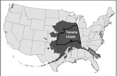
Figure 1. Map comparing the area of the Tanana Chiefs Conference (thick black line), Alaska (dark gray), relative to the
lower-48 United States
One of the functions of the TCC is cadastral mapping and surveying. Since 1993, the TCC survey department has been engaged in community development and engineering by providing boundary and topographic surveys for village expansion and public works. Slow and expensive land surveys during the short summers had been the primary solution for cadastral mapping. But by 2007, it became clear that alternative methods and new technologies were needed to improve project efficiencies and lower costs. TCC began researching low-altitude, do-it-yourself photo surveys to complement traditional
land surveys. They soon realized that a new generation of photogrammetric software could generate low-cost orthomosaics using off-the-shelf digital cameras.
Before summer’s end, TCC would demonstrate the concept in the village of Huslia, which had grown without the benefit of surveyed lots or boundaries. Thirty ground-control targets (GCT) were established in the one-square-kilometre village. A small helicopter flew 400 meters above ground, collecting imagery by means of an operator holding a Lumix camera outside the passenger window. Through this method, operators collected several oriented-image pairs with a 60% overlap, the imagery providing 4 cm-per-pixel detail.
Using age-old photogrammetric engineering principals and traditional aerial-triangulation methods, surveyors were able to create an accurate orthophoto mosaic with Topcon PI 3000 software. Subsequent GPS ground checks confirmed the accuracy. The ortho-mosaic could be relied upon for the design of lot lines, road right-of-ways, and utility easements. Several limitations in this process were learned, including issues with the helicopter platform, calibration of the camera’s zoom lens, and the Topcon software.
In the summer of 2008, TCC began testing alternate cameras and platforms to improve its cadastral mapping. A Nikon D3 and a 35mm lens replaced the Lumix camera. The Nikon’s sensitivity permitted faster shutter speeds and a larger aperture, reducing blur from vibration and forward speed of the aircraft. Image resolution improved, and there were fewer corner distortions typical of non-metric cameras.
To map four more villages, the team chartered a fixed-wing aircraft capable of slow flight speeds. Two benefits were observed: the aircraft’s operational costs were less than the helicopter’s, and a camera port in the plane fuselage meant the operator no longer had to lean out the door to collect imagery.
Ground surveys confirmed that accuracies of the resulting orhtoimagery were within the sub-pixel range. The exceptional accuracy permitted the fusion of survey data with imagery to create photogrammetric-cadastral plats, and changed how the surveyors at TCC went about working with the Native villages.
Using the accurate orthoimagery, property lines could be defined in group meetings attended by the village residents. Legal property descriptions and rights-of-way were established. Any issues of trespass were immediately resolved, allowing residents to more easily sell property and secure home improvement loans.
Several other useful by-products were also made possible from the imagery. Highly accurate digital surface models allowed precise contouring and accurate volumetric calculations, reducing the cost of other engineering and development applications. Mapping drainage and wetlands and conducting erosion studies along riverbanks where Alaskan villages are predominantly located would be cheaper. Utility design and as-built surveys of road construction also would be less expensive.
With the intent to further reduce mapping costs in remote areas of Alaska, TCC began in 2010 to test new photogrammetry applications capable of automatic tie-point generation. Part of this assessment included an understanding of the accuracy of automatically generating tie points and the placement of GCT. TCC also wanted to understand which photogrammetry International Archives of the Photogrammetry, Remote Sensing and Spatial Information Sciences, Volume XXXVIII-1/C22, 2011
ISPRS Zurich 2011 Workshop, 14-16 September 2011, Zurich, Switzerland
software solutions would be capable of self-calibrating the camera’s interior and exterior orientation parameters.
UAS & CADASTRAL MAPPING
TCC continued to think about ways to reduce cadastral survey costs in remote Alaskan bush villages. Its surveyors became aware of UAS applications for imagery collection in Europe, as well as the UAS research at the neighbouring rocket range. Discussions began in late 2010 about how TCC and Poker Flat might collaborate, with Poker providing the UAS expertise and TCC generating orthomosaics from a UAS-mounted camera.
The plan was to have TCC acquire its first UAS, a Gatewing X-100. TCC would purchase and own the UAS, and it would then be leased to Poker Flat for research purposes. The two organizations formalized an agreement in the spring of 2011 allowing experienced staff from Poker to manage airspace and operations when the UAS collects data on behalf of TCC.
With each research flight conducted by Poker Flat, the resulting dual-use data is then shared with TCC. Poker researchers can evaluate the Gatewing and its sensor while conducting other investigations of the UAS, including waterproofing it for launch and recovery at sea. From these data sets, TCC is now able to plan how the remaining bush villages can be flown to create initial cadastral surveys from UAS orthoimagery.
University researchers also work with TCC to determine how digital surface models created from the imagery could be applied to more detailed property measurements. The ability to use “structure from motion” to extract three-dimensional measurements from the overlapping imagery permits richer derivative products, including digital surface models (DSM). UAF and TCC envision the day when their imagery will be used to create wireframe models for the buildings and houses on each parcel. Moreover, the same DSM products used for cadastral mapping purposes would be applicable for engineering, public safety and community development planning.
CADASTRAL IMAGING & MAPPING STANDARDS
Aerial imaging has become an integral component in the business of property measurement and valuations. The ability to measure the dimensions of real property is the foundation for eliminating issues of property trespass. It ensures real-property tax rolls are both accurate and complete, providing a basis for fair and equitable valuations and tax assessments.
If these measurements cannot be done directly from field surveys, then remotely-sensed imagery has been determined to be a suitable substitute. Throughout the US and many other countries, a variety of imaging is collected for physical inspection and measurement. Image products include orthoimagery, oblique imagery, and street view imagery.
The International Association of Assessing Officers (IAAO) has embraced imaging as part of its standards related to property measurements. Termed the “Desktop Review,” the IAAO standards describe how imagery can be a substitute for physical inspection of properties in communities adhering to the IAAO standards for mass appraisal of real property.
IAAO standard, Section 3.3.5, states that as an alternative to on-site real-property inspections, tax jurisdictions may use digital imagery to supplement field inspections. Acceptable imagery includes orthophotos for horizontal property measurements, oblique imagery for vertical measurements, and ground-view imagery to assess the grade and condition of real property. This standard is widely used in the US as well as by other nations around the world. The most recent revision to the standard was adopted in 2011.
Cadastral data collected by the TCC will ultimately be integrated with a computer-aided mass appraisal (CAMA) system. CAMA is software that allows mass appraisals based on property measurements, including the dimensions of buildings and other improvements on the parcel. Integrating the CAMA databases with UAS property imaging and accurate property measurements is necessary for home property sales, home equity loans, and tax assessment.
In rural Alaska, no administrative method currently exists for tracking new construction or improvements to properties. Yet repeated imaging and the generation of current orthomoasics are foundations of the cadastral update in other regions. When new imagery is collected, buildings and structures are compared to the previous tax rolls to determine if changes have occurred. Properties identified through imagery as having a change are then physically inspected and measured by a property appraiser. Efficient collection of recent imagery is integral to the maintenance of the cadastre.
SUMMARY
Cadastral survey quality is a direct function of population density. Rural Alaska, because of its very small and remote population, has poor cadastral surveys. In some Native villages, surveys are very old, inaccurate, and even non-existent. In certain cases, original federal survey records from 100 years ago have been lost due to building fires and even a volcanic eruption having destroyed records. Today, many Alaskan Native villages are still without cadastral surveys, creating issues such as property trespass.
Property definitions are part of the complex modern society into which Alaskan Native villages need to fit. Getting there presents not only a unique challenge but also an opportunity to leverage the latest and best technologies for cadastral update. The unique circumstance of the rural Alaskan interior and the timing of new technologies permits the development and fusion of technologies not used elsewhere in the United States. The experience of operating unmanned systems inherent to the Poker Flat Research Range and the unique needs of the Tanana Chiefs Conference encourage the cooperative development of new cadastral mapping technologies and methods that fit with accepted international cadastral mapping standards.
Poker Flat is also eager to leverage its other UAS sensors, including LiDAR and SAR in this unique cadastral mapping opportunity. Each sensor has its own specialized role in remote sensing. For example, SAR is excellent for mapping property lines marked my metal wire fences. It also images well at night, and through fog and smoke that punctuate Alaska summers.
TCC and the University have a joint goal to assist Alaskan Native villages to develop the most accurate, complete, and cost-effective cadastral mapping data for their communities. International Archives of the Photogrammetry, Remote Sensing and Spatial Information Sciences, Volume XXXVIII-1/C22, 2011
ISPRS Zurich 2011 Workshop, 14-16 September 2011, Zurich, Switzerland
This will help ensure that proper government functions and support can be provided to all rural and Native Alaskans.
REFERENCES
International Association of Assessing Officers. 2011. Standard on Mass Appraisal of Real Property.
Cunningham, K. 2007. The Use of LiDAR for Change Detection and Updating of the CAMA Database. Journal of
Property Tax Assessment & Administration. 4(3), pp. 5-12 .
Cunningham, K. 2008. CAMA Change Detection with Light Detection and Ranging. Journal of Property Tax Assessment &
Administration. Volume 5(1), pp. 33-47.
Cunningham, K. 2009. Change Detection: How Do They Do That. International Association of Assessing Officers Annual
Conference. Louisville, Kentucky.
Donatello, G. 2005. Using remote sensing technology for appraisal data verification and collection. International
Association of Assessing Officers Florida Chapter Fall Conference. Clearwater, Florida.
Lomax, M. 2009. Property Assessment Administration for the People’s Republic of China. The Lincoln Institute of Land
Policy.
Stahlke, E. 2011. Aerial perspective: Close-range aerial photogrammetry comes of age. Professional Surveyor
Magazine. July 2011.
International Archives of the Photogrammetry, Remote Sensing and Spatial Information Sciences, Volume XXXVIII-1/C22, 2011 ISPRS Zurich 2011 Workshop, 14-16 September 2011, Zurich, Switzerland