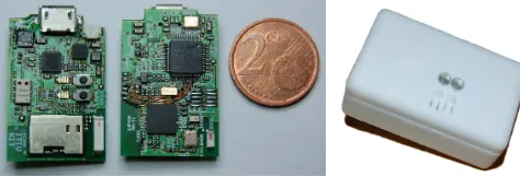
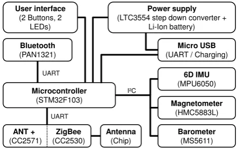
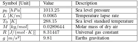
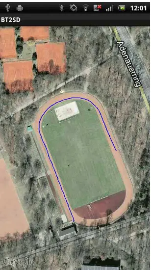
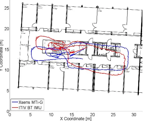
Smartphone pedestrian navigation by foot
Teks penuh
Gambar
Garis besar
Dokumen terkait
This paper proposes the use of hybrid coordination node to coordinate multi fuzzy q-learning behavior for navigation of autonomous five legs robot in cluttered
In this paper, we explore the range of walking solutions for the hip- actuated simplest walker. In particular, we use the hip actuator to do accurate foot placement. Using
Based on the results of the study, it shows that there is a significant relationship between the intensity of smartphone use and the physical fitness of class VIII students at SMP
The relationship between dimensions of privacy concerns collection, secondary use, unauthorized access and errors and attitude towards smartphone apps purchase The first hypothesis
AIM: The present study aimed to detect the etiologic substances and the regularity of fungal corruptions in ulcerated diabetic foot tissue samples utilizing two important diagnostic
Keywords: Attention deficit disorder with hyperactivity, child, Iran, massage, mothers The Effect of Foot Massage by Mother on the Severity of Attention‑Deficit Hyperactivity Disorder
5.4 Mediation Analysis: Sociocultural Factors, Psychological Well-Being, and Smartphone Use Patterns The mediation analysis aimed to examine the potential indirect effects of
Our website may use these cookies to: Measure the audience of the advertising on our website, without profiling Display personalized ads based on your navigation and your profile
