
Conference paper
Teks penuh
Gambar
Dokumen terkait
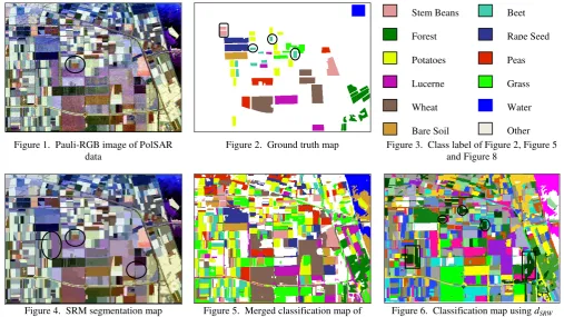
Many studies on segmentation and classification of agricultural fields from remotely sensed data can be found in the literature. Studies related to change detection or updating
the scanned surfaces. Segmentation eliminates the task of point by point classification which reduces the overall time required for detection. Most of existing
The complete segmentation and extraction of pole-like features from a single TLS using the proposed segmentation approaches is usually not feasible due to
First of all, the points belonging to the same object must be classified into one or several closed polygons. The algorithm chooses randomly one point and
In particular, we focus on the derivation of building roof outline model using image segmentation and edge detection techniques under the guide of the classification result of
Object-based land cover classification and change analysis in the Baltimore metropolitan area using multitemporal high resolution remote sensing
This study proposed the integration of watershed and region merging method based on statistical features for cortical bone segmentation on dental panoramic radiographs.. Watershed
MULTI-ORGAN SEGMENTATION OF CT IMAGES USING STATISTICAL REGION MERGING Gobert Lee Flinders University School of Computer Science, Engineering and Mathematics Bedford Park, Adelaide,
