ArcticSpatialDataPilot | OGC
Teks penuh
Gambar
Garis besar
Dokumen terkait
The polar bears live at the North Pole.. There is only snow, ice,
Forecasting models may be implemented with different data models. Integration of results from different models can be challenging. For the flooding scenario, questions may rise
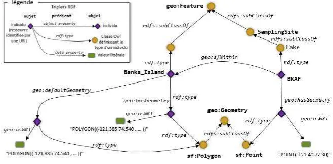
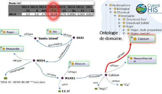
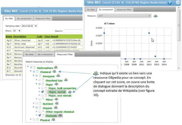
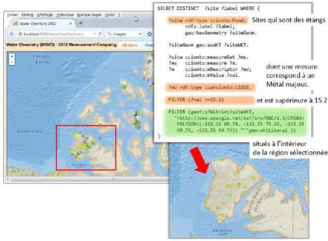
Common semantics support the reference of features to the concept they represent and the integration of data proceed using the semantic framework such mappings provide. However
On behalf of the Board of Directors of the Open Geospatial Consortium, and with the unanimous support of the Gardels Award Committee, it is with the greatest personal pleasure that
This award affirms the key role you have played in our cooperative endeavor with ISO and other standards organizations, the value of your many Technical Committee contributions,
hemispheres by combining Arctic and Antarctic contributions for each month. The trends in the ice cover as inferred from linear regression analysis of the monthly data
ASC ALASKA OFFICE SMITHSONIAN LEARNING LAB: NEW ASC SITE COMPLETED By Dawn Biddison In the fall of 2019, the Alaska office of the Arctic Studies Center ASC, in partnership with the
미국의 지역적 특성 Geography of the United States The term "United States", when used in the geographical sense, is the contiguous United States, the state of Alaska, the island state of
