INTERNET MAPPING
by
AHMAD FAIZ MUSTAPHA KAMAL
Dissertation submitted in partial fulfillment of the requirements for the
Bachelor of Technology (Hons) Information System
Universiti Teknologi PETRONAS
Bandar Seri Iskandar 31750 Tronoh Perak Darul Ridzuan
July 2004
Approved by,
CERTIFICATION OF APPROVAL
INTERNET MAPPING
by
AHMAD FAIZ MUSTAPHA KAMAL
A project dissertation submitted to the Information System Programme Universiti Teknologi PETRONAS In partial fulfillment of the requirement for the
BACHELOR OF TECHNOLOGY (Hons) (INFORMATION SYSTEM)
(JUSTIN DINESH DEVARAJ)
UNIVERSITI TEKNOLOGI PETRONAS TRONOH, PERAK
July 2004
II
CERTIFICATION OF ORIGINALITY
This is to certify that I am responsible for the work submitted in this project, that
the original work is my own except as specified in the references and acknowledgements, and that the original work contained herein have not beenundertaken or done by unspecified sources or persons.
•-1
^ U V
AHMAD FAIZ MUSTAPHA KAMAL
III
ABSTRACT
Geographical Information System (GIS) are methods to visualize, manipulate, analyze, and display spatial data. GIS application software such as Arc View or Maplnfo allows the integration of such GIS maps with programming language software such as Visual Basic. As we all know, internet has been a major information distribution channel. If we could integrate both GIS map and serves it in a web browser medium, we could provide GIS applications online, the users could manipulate and handle each map with their own choice. In order to create the Internet map that allows GIS map, Arc IMS will be use. ArcIMS runs in a distributed environment and consists of both client and server components. The ArcIMS HTML Viewer and ArcIMS Java Viewers are client-side components.
The ArcIMS Spatial Server, ArcIMS Application Server, ArcIMS Application Server Connectors, and ArcIMS Manager are server-side components. As a conclusion, Internet mapping benefits the user by clearly indication GIS data to
them.
IV
ACKNOWLEDGEMENT
First of all, I would like to express my gratitude to Allah s.w.t. for His blessings,
giving me the opportunity to complete this final year project.I would like to express my appreciation to Mr. Justin Dinesh Devaraj, as my
supervisor for his guidance and advice. I would also like to thank Mr. Shuib Basri as the coordinator for final year project for IT and IS students. I would also like to thank my parents for their blessing and moral support.To Mr. Mathavan and JUPEM crew that support my research. They have provided me with the data as the backbone of my research. Their guidance and advice was
a major factor in completion of this project.Not forgetting my companion Mr. Shahriman a fellow student under the
supervision of Mr. Justin. His help in attending ArcIMS is the key factor in completion of the project. This is due that the project focuses on the development of Malacca Map concentrating on website applications. This is made possible the Mr. Shariman that have countless time help me attending the complicated software, from installing to understanding the functionality of the software.
Last but not least I would like to thank my roommate, Mr. Azlan Norzan as the
financial benefactor that provided me with the financial capacity which allowed me to complete the tasks and problems faced during the completion ofthe project.
I would also like to thank all that contributed to the completion this project, which requested to remain unmentioned. Your aid and greatly affected the completion of
the project.
V
TABLE OF CONTENTS
CERTIFICATION OF APPROVAL II
CERTIFICATION OF ORIGINALITY HI
ABSTRACT IV
ACKNOWLEDGEMENT V
CHAPTER 1: INTRODUCTION 1
1.0 Background of Study 1
1.1 Problem Statement 3
1.2 Objectives 4
1.3 Scope of Study 4
CHAPTER 2: LITERATURE REVIEW / THEORY . . . 6
2.1 Arc IMS Overview 6
2.2 Metadata 7
2.3 Arc IMS Virtual Server 7
2.3.1 Image Serverand ArcMap Server. . 8 CHAPTER 3: METHODOLOGY / PROJECT WORK . . 9
3.0 Overview 9
3.1 Requirements and Analysis Phase. . . . 10
3.1.1 Arc IMS 10
3.1.2 Hardware Requirements. . . . 14 3.1.3 Software Requirements . . . . 15 3.2 System and/or Software Design . . . . 15 3.2.1 Create Map Services . . . . 15 3.2.2 Customizing Arc Viewer . . . 18
3.2.3 JAVA Viewer 19
3.2.4 Java Viewer Toolbar . . . . 20 3.2.5 Website development . . . . 20
3.3 Implementation and Unit Testing . . . . 23 3.4 Integration and System Testing . . . . 24
VI
3.5 Operation and Maintenance 24
CHAPTER 4: RESULTS & DISCUSSION . . . . . 25
4.1 Data Gathering and analysis 25
4.1.1 Negeri Melaka (Malacca State) . . 25 4.1.2 Bandar Melaka (Malacca City) . . 26
4.2 Results and Discussion 27
CHAPTER 5: CONCLUSION AND RECOMMENDATIONS . 28
5.1 Conclusion 28
5.2 Recommendations 29
REFERENCES 29
APPENDICES 31
List of Appendix Content
VII
1 Report Submission Gantt Chart A
2 Letter to JUPEM B
3 Reply Letter from JUPEM C
LIST OF FIGURES
VIII
Figure 1 The Waterfall Model Figure 2 Virtual Drive 7.0
Figure 3 Arc Explorer 4.0.1 Java Edition Figure 4 ServletExec 4.1.1
Figure 5 Arc IMS Installer
Figure 6 Arc IMS Manager - Create Services Figure 7 Arc IMS Manager - Website Overview
Figure 8 Arc IMS Manager - Website Service Confirmation Figure 9 Arc IMS Manager - Manage the Website
Figure 10 Arc IMS Manager - Administer the Website Figure 11 Arc IMS Viewer - Map Before
Figure 12 Arc IMS Viewer - Map After Figure 13 Java Viewer
Figure 14 Java Viewer Toolbar Figure 15 Website Development
IX
ABBREVIATIONS & NOMENCLATURES
GIS Geographical Information System
Arc IMS Software that allows Map Browsing through internet SARS Severe Acute Respiratory Syndrome
JUPEM Jabatan Ukur dan Pemetaan Malaysia
X
CHAPTER 1 INTRODUCTION
1.0 BACKGROUND OF STUDY
Geographical Information Systems (GIS) enables the interaction between users and the map itself. The map enables search functions that help the users to identify the location and spatial data of their geographical interest.
Currently the GIS applications are stand alone software that is very not practical for international market, because it lacks the web accessibility through the Internet decreasing its user friendliness.
This projects target to overcome the problem by enabling a web based GIS.
The web site will be integrated with multimedia elements that increase the user friendliness, which are essential factor in attracting tourist to our country.
Multimedia elements will be included in the map by using Macromedia products such as Macromedia Flash and Macromedia Dreamweaver.
The study will also focus on the Arc IMS and its usage. The functionality of the Arc IMS is that it allows the administrator to provide and determined the needs and wants of the users. Applications can be simple, with only a few viewing and navigation tools, or more sophisticated, with tools for advanced
query and analysis. A full suite of functionality, from panning and zooming to
buffering and editing, can be included in the Web site. The map could customization to each viewer's toolbar, providing a level of functionality appropriate to the users' needs and expertise.An Internet GIS application can contain more than one Image or Feature Service. This gives the flexibility to divide data layers into logical groups.
Each group constitutes a single service. Dividing data layers into separate services can improve the organization of the site. The following list describes several ways to organize data layers into logical groups.
1. Reusable. Maps often contain layers that are primarily used for reference. These referential data layers are used over and over again in different applications.
2. Domain-specific. When data is specialized, it should be allocate to its own service. Corporate data, data requiring extensive analysis, and data to which are restricted accesses all fall into this category.
3. Application-specific. Some data layers are always used together to support a specialized application—for example, waterlines, valves, and meters—and should be kept together in the same service.
4. Frequently changing. Data layers that are frequently updated should be
kept separate from layers that change infrequently. This prevents frequent updates from affecting data layers that only need infrequent
changes.
5.
Detailed. Layers containing detailed information could be groupedtogether in the same service.
1.1 PROBLEM STATEMENT
Nowadays Malaysian government is focusing their effort into enhancing the Internet capabilities. A crystal clear of their efforts is building the Multimedia Super Corridor (MSC). They are hoping that Malaysian citizens will take this opportunity to enrich their knowledge in the technological industry.
Among the new branches of Internet capabilities is Internet Mapping. Internet mapping is to show and allow map manipulation through the Internet. Maps are pictures that show information usually of geographical terms.
Geographical Information System (GIS) applications allow this kind of manipulation. GIS applications are systems that allow the manipulation of spatial data thought the use digital format. GIS has many unexplored potentials. Usually, the applications are develop on a stand-alone program basis. This programs lack the user friendliness of current software and the
distribution medium is installation CD's.
The integration of Internet Mapping idea and GIS could provide a good
impact. This is because users all over the world could use the GIS application
maps, to better understand the geographical structure of the data shown.1.2 Objectives
The objective of this project is to develop an application with the following
characteristics:
i. Creating a GIS map that is accurate according to the real map.
ii. Integrating the GIS map with Web base medium, iii. Creating a Web-site that is accessible through the internet.
1.3 Scope of Study
Scope of study is the tourism part of Malacca as it is the heart of our nation's historical value. Melaka or Malacca or Malaqua (as it was known to the Europeans in the 1500's) began its humble existence as a fishing village and grew into the region's most important entrepot. For years, Malacca flourished
under the watchful eyes of the Malay Sultans, until the struggle of power
among the Europeans finally led to its slow and painful demise.Its initial success under the governance of a Sumatran prince and his descendants was based on the model of an old entrepot called Srivijaya that
ruled the straits for centuries before the 'discovery' of Malacca. There is stillmuch debate amongst historians as to the exact period of this once great maritime empire, which ruled the trading routes in the straits. The agreement lies somewhere between the 7th to the 13thcentury. But many believe that the nucleus of the kingdom may have been in Palembang. (Palembang, Sumatra -
across the straits of Malacca in Indonesia).Through years of perseverance, Malacca finally regained a small fraction of
its old days of fortune when a tapioca planter, Tan Chay Yan converted his
tapioca plantation into rubber plots. Today, Malacca is swarming with visitors
from all over the world, looking for a historical city that tells a tale of
merchant traders and European conquerors. Among the target parts of the Malacca tourism spots that will be targeted for the project are;
Melaka Sultanate palace
St. Paul's Church.
A'Famosa.
The Stadthuys
Bukit China
Kampung Keling Mosque Cheng Hoon Teng temple
Baba and Nyonya Heritage Museum.
Hang Jebat and Hang Kasturi's mausoleum.
Hang Tuah's well
Jonker's Street Maritime Museum Memorial hall
Portuguese Square Sam Po Kong Temple
St. Francis Xavier's Church St. John's Fort
St. Peter's Church
All of the tourism spots have been pointed out by the Malacca state Government, through their website.
CHAPTER 2
LITERATURE REVIEW / THEORY
2.0 Literature Review
2.1 Arc IMS Overview
In recent years the Internet has emerged as an extremely popular and effective means of sharing information, data, and technology. The tremendous growth in Internet use has resulted in an increased demand for the delivery of geographic data, maps, and applications over the Internet. Arc IMS was developed by ESRI to meet this growing demand. Arc IMS is rooted in ESRI's proven Internet map publishing technology and development. Arc IMS was developed to meet a number of challenges including:
i. Ease of use at a variety of skill levels
ii. Out-of-the-box usability, while providing a highly customizable
environment
iii. Comprehensive suite of administration tools iv. Open and scalable architecture
Arc IMS is designed for novice and expert Web developers alike who seek the advantage of dynamic, accessible maps and interactive tools for information viewing, query, and exchange. Arc IMS is a GIS solution that allows user to centrally build and deliver maps, data, and tools over the Internet. Arc IMS takes advantage of the Internet technology that makes it possible to share information and data with many users, either locally or around the world.
Using Arc IMS, your organization can author maps and publish them to a
Web site of your own creation, complete with map navigation and query tools.
Using the Arc IMS security features allows you to regulate access to the services you deliver over the Internet.
2.2 Metadata
Metadata is the description about the subject. There's metadata for a wide variety of things, with varying levels of detail. The nutritional information on the label of a can of soup is metadata. A department store catalog is metadata.
The price sticker on a new car is metadata. Anything that describes something else can be thought of as metadata.
Metadata is useful because it tells about something without having that something. For example, we might browse through a store catalog before
deciding to make a purchase. The metadata about the items in the catalog give us valuable information—such as price, size, and material—to help us
determine whether the item is right.Metadata for geographic data is often described as data about data. Metadata
for geographic data typically describes the content, quality, type, collection date, and spatial location of the actual data. Looking at metadata canhelp you determine whether a particular dataset is appropriate for use. In fact, it's often easier to judge the suitability of the data from its metadata than by examining the actual data itself. This is because metadata is generally much smaller and
easier to share than the actual data.
2.3 Arc IMS Virtual Servers
Virtual Servers group a number of Spatial Servers together and define the
types of requests that will be processed by them. Six Virtual Servers installwith Arc IMS—Image, Feature, Metadata, Geocode, Query, and Extract.
There are two additional servers ArcMap Server and Route Serve which can
be added as optional extensions to Arc IMS.Image, ArcMap, and Feature Servers are used to publish maps over the Internet. Image and Feature services may appear similar in a Web browser;
however, an Image Server sends a "snapshot" of a map to the client, while a Feature Server streams map features.
2.3.1 Image Server and ArcMap Server
Both of the Image Server and the ArcMap Server support shapefile, ArcSDE, and image data. ArcMap Server also supports versioned geodatabases. Both servers use information about data layers to create complete map images.
Configuration files contain information about map content and symbology.
Creation of an Image Service involves registration of a configuration file with the Arc IMS Application Server.
ArcMap documents and ArcReader published map files contain similar information to Arc IMS configuration files. Map documents and published map files are registered with the Arc IMS Application Server to create ArcMap Image Services.
When a user requests an Image or ArcMap Image Service, a map image is
created on the Arc IMS Spatial Server and sent back to the client. A new map
image is generated each time user requests new information. For example, if a user zooms in on an area of a map, a message is sent from the client to the server. A new map image of the zoom extent is generated by the server and sent back to the client, replacing the old image. The image is sent to the client in one of three formats—as a JPEG, GIF, or PNG file.CHAPTER 3
METHODOLOGY / PROJECT WORK
3.0 Overview
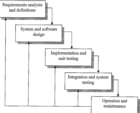
The methodology that would be used for this web is "The Waterfall Model".
Among the widely used methodology in the world, the waterfall model is a linear style methodology that states phases cascades each other. The model was developed by Royce, in 1970. The principle stages of the model map onto fundamental development activities.
Requirements analysis
and definitions
Implementation and unit testing
Integration and system testing
Operation and
maintenance
Figure 1.0: The Waterfall Model
3.1.1 Requirements and analysis phase.
3.1.1 Arc IMS
• Installing Arc IMS
The Arc IMS was installed and it is running properly. The platform used was
Windows 2000 as discussed previously. Below are the descriptions on how toinstall Arc IMS:
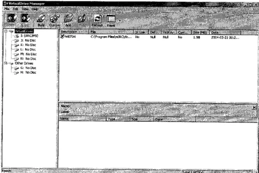
• Install Virtual Drive 7.0
This software is installed to allocate the Arc IMS virtual CD that was taken from Mr. Shariman.
»--i- •- '•
1% u. a:.
Js, 3 NoDisc - j . k No Disc ' jul L No Disc i ^ m No disc j j N NoDlK
<=S <i Other Drives
I .j* G NoCSsc
m H No Disc
rto.-ie
Lte
&*hmHP*!R . .vJ"'
*l
jkJ.
loio11 vc3»
Figure 2.0: Virtual Drive 7.0
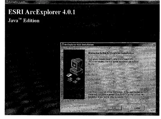
• Installed Java Applet 4.0.1
This isto enable Map viewing using Java Applet. This is an Object Oriented
Procedure and is successful in installation.
10
ESRI ArcExplorer 4.0.1
Java™ Edition
Figure 3.0: Arc Explorer 4.0.1 Java Edition
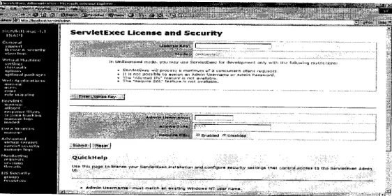
• Installed ServletExec 4.1.1
ServletExec enables the system to deploy servlets and JSP on Microsoft
Internet Information Server (IIS), Netscape Enterprise Server (NES), iPlanet Web Server (iWS), and Apache HTTP Server in a standard, robust, high-
performance environment
Figure 4.0: ServletExec 4.1.1
11
There are five steps required to get Arc IMS running:
1. Verify that site meets Arc IMS system requirements.
2. Determine Arc IMS site configuration.
3. Install Arc IMS. This includes the installation and post installation setup.
4. Configure your Web server.
5. Configure Arc IMS.
Step 1: Verify that site meets Arc IMS system requirements Hardware configuration
1. Memory requirements 2. Disk space
System software
1. Operating system
2. Web server
3. Servlet engine
4. Java 2 Platform Standard Edition Runtime Environment (J2SE JRE)
5. Web browser
Step 2: Determine Arc IMS site configuration
1. Arc IMS Typical Configuration—All on a single computer
2. Arc IMS Custom Configuration—Arc IMS Application Server Connectors 3. Arc IMS Custom Configuration—Arc IMS ArcMap Server (Windows
only)
4. Arc IMS Custom Configuration—Arc IMS Manager Applications 5. Arc IMS Custom Configuration—Arc IMS Service Administrator 6. Arc IMS Custom Configuration—ArcSDE Services Monitor
12
7. Arc IMS Custom Configuration—Arc IMS Spatial Servers 8. Arc IMS Custom Configuration—Metadata Explorer Step 3: Install Arc IMS
Step 3a - Complete the installation for the features selected
Step 3b - Complete the post installation setup for the features installed
Step 4: Configure Web server
Step 4 is required if no reconfiguration of the Web server, using the Web
Server-Servlet Engine Configuration option, in the post installation (Step 3b).
1. Configure Web server and servlet engine.
2. Create virtual directories.
Step 5: Configure Arc IMS
Set environment parameters.
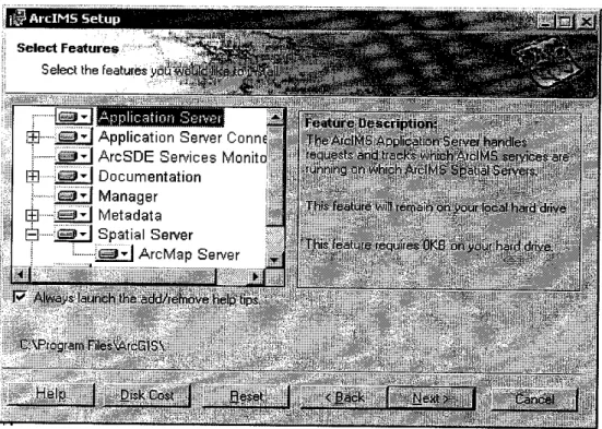
ArcIMS Setup
Select Features
Select the featuresyou"$f$
IfenlApplication Sei ES OtJ Application Ser\
'• ..^-1 ArcSDE Service ffl Sj^| Documentation
:• gSTl Manager
$ Egjl Metadata El =S3^'J Spatial Server
••jail ArcMap S
i i J
W Alwayslaunch the add/remove
CAProgram Files\ArcGIS\
lii • Milium
zi
• I
ug'p | PS* Cost j Pc:et | <Bacl j f,:<^ | Card |
Figure 5.0: Arc IMS Installer
13
3.1.2 Hardware Requirements
1. Intel Pentium 4 2.2 GHz (socket 478)
2. MSI 845E Max motherboard
3. Kingston 256MB DDR RAM 4. Sound Blaster Audigy2 Platinum 5. GeForce4Ti 4600-VTD (128MB DDR) 6. Western Digital 80G 7200 rpm
7. Sony CRT monitor 17"
8. Casing MEC318R2/2F Extreme 919 9. Altec Lansing Ultimate 621
10. 52X ASUS CD-ROM S520 11. 16x48x Asus DVD ROM E-616
12. 40xl2x48x Yamaha CD-Rewritable Drive
13. Sony 1.44MB Floppy Disk Drive 14. Logitech Multimedia Keyboard 15. Logitech Optical Mouse
3.1.3 Software Requirements
1. Macromedia Dreamweaver MX 2. Macromedia Flash 5.0
3. Adobe Photoshop 7.0
4. ArcViewGIS3.2 5. Arc IMS 4.0 6. ACDsee5.1
3.2 System and/or software design
This is the designing the layout and the functionality of the website. I have identified two aspects that are going to be separated. The first is Arc IMS and the lateris the design of the website using Macromedia Dreamweaver.
14
3.2.1 Create the Map Services
&•
1
HF5KCT
-»•• j j
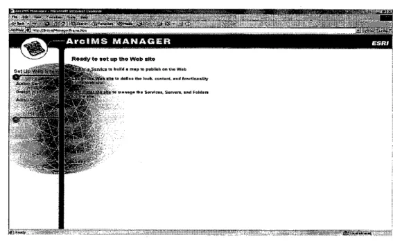
A r c I M S M A N A G E R
Ready to lot up the Web slto Hlu bull* a maplo publish onliiaWab i til* to dellna (he look, content and functionality
itlfliD rnanaga Urn Services. Server*, and FnldBn
• *
iff-
~W»- •JW|fc--',TOH*S«fc-i-
Figure 6.0: Arc IMS Manager - Create Services
The software used to create the map services is Arc IMS Manager. There are three options, Author Service, Design the Web Site and Administer the Site.
Author the service lets the user define the type of layers. Afterwards, the user createsthe service which means the user sets the map into the server.
e ' . . . i . a.
. «
*
24
|gapart ImtM^MouT
P%r.n I -< J j •.• jl "'D
A r c I M S MANAGER b * ♦ -,
Figure 7.0: Arc IMS Manager - Website Overview
15
.WtUtUti uraiuM?!--'*-'»*
[g]N.w»ro r r r
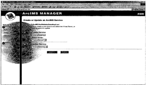
Figure 8.0: Arc IMS Manager - Website Services Confirmation
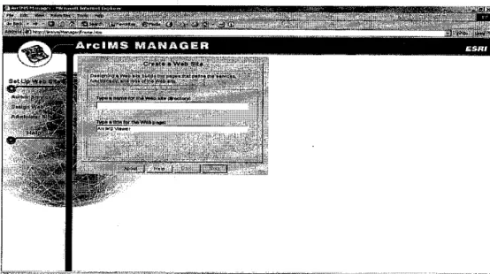
The next step is to define the web site accordance to the server administrator's requirement. This is to make sure that the only the necessary tools that are need to view the map are laid out in the website.
A r c I M S M A N A G E R
ISTodpj* om^tiijtmaiaat^r/AnmMr-vatwtai
Crtata a W a b Slta
liV •loaakefj-ff-ibMa
i ui—i.nL.jj
Figure 9.0: Arc IMS Manager - Manage the Website
16
ffVtS^
J " B8fiL«l*M»Bl»t
The last Phase is to administer the website. The administrators are allowed to
stop the services if they wish to, for updates and future enhancement.
iT=3a:
- f - . j - • » : •
A r c I M S M A N A G E R
V A r c I M S S e r v i c e s
t r
\ i •»...*
» -
•*#
V *
S'flWHHiHItVIM* * T_r-r - i ^ ^ j
Figure 10.0: Arc IMS Manager -Administer the Website
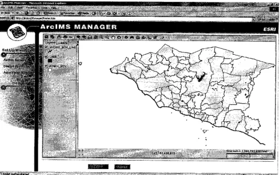
3.2.2 Customizing the Arc Viewer
•a.*- .ffiMJHI m
!*.»>--?
B retail, | -A."*/*! I ? •"* N.',i» J!
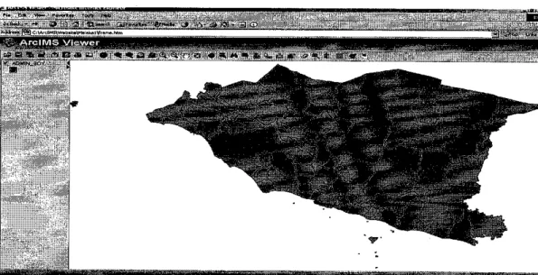
Figure 11.0: Arc IMS Viewer-Map Before
The ArcViewer allows the map to be viewed in web browsing applications software such as Internet Explorer or Navigator, but the system requires the
17
computer to install the java applet first. The ArcViewer are then modified using Macromedia Dreamweaver to look like the picture below
Figure 12.0: Arc IMS Viewer-Map After
3.2.3 JAVA Viewer
The Java Custom Viewer has the same elements as the Java Standard Viewer:
a map display area, title, toolbar, legend, scale bar, and overview map. The
primary differences are the organization of the elements and the contents ofthe toolbar.
18
Toolbar
Tool Status
l o ^ T B T J . ' T W ' . r r a E23
: "li L* f- I vis :*: ,-»: -.lET fl*- ,W" "i^53ftWl
•» . . . ' • v- • • £ > wEytf
S-.
Figure 13.0: Java Viewer
•Title
•Overview Map
.Legend
•Scale bar
The tool bar is to the left of, rather than above, the map display area. The legend is to the right of the map display area and the overview map appears above it rather than below it. The toolbar contains only the tools you specified when you designed your Web site. It does not include the Viewer Elements and Cancel Data Retrieval buttons found on the Java Standard Viewer toolbar.
Also, instead of a Pan One Direction button, the Java Custom Viewer has four
separate button for panning north, south, east, and west. Instead of a single Select Features tool, the Java Custom Viewer has four tools: Select by Rectangle, Select by Circle, Select by Line, and Selectby Polygon.
3.2.3 Java Viewer toolbar
The toolbar is oriented horizontally in the Java Standard Viewer and vertically
in the Java Custom Viewer. The Java Standard Viewer toolbar is shown here.
Minor differences exist between the two toolbars and the Java Custom toolbar
19
will contain only the tools you specified when you designed your Web site.
Differences are noted in the following tool descriptions.
I-.I Xx. i . r i
\> % \ 4 \ v *
* 1 v% >
>
Figure 14.0: Java Viewer Toolbars
3.2.4 Website Development
The website contains 5 directories, Home, Map guide, Site tutorial, history
and links.
_ j y •<.-•• *ff£s
^v^Cft-S
-**
•mfciBimnninia n w nimm^Minimi i ai i
Figure 15.0: Website Development
• Home
This directory contains welcome note and little description about the website
and its functions.
20
m
. iL'jia*"-?
•;• -i. j • _» ; . • •* -
HUME
Welcome to .Mebkal\!ap
Founded by Parameswera In 1396 who named his sultanate after the "Melaka" tree, Melaka has provided the stage on which !he Chirsse, Portuguese. Dutch and English played their roles in shaping history
Today. Melaka posesses a charm that Is all Is own. Hall a trishaw for a ride along little streets that wind through a cofourfut mishmash of architectural styles Cruise along Melaka rivsr. then walk otono, hillocks thai have tales to tell, of warfare and treachery, romance and heartbreak.
• '*>'" !«'•- l a ' " l•:•<•" l-*i-"» m ™ H a - " l*!••*• -«••:-* iiB»** ira'MH^.-
• Map Guide
The Map Guide is divided into 2 sub-websites. The first is State Map. This map shows the Malacca's state map. The map was developed using Arc IMS provided with JUPEM's data. The later is City Map. The City Map was developed using Macromedia Fireworks 4.0 the City Map shows the interesting tourism spots in Malacca city.
. » - *
• •-«••.
W£M£-9m
The map cointans the overview map of Melaka SEare. This map shows the length and mglnal scole of Me'ekg. This map was developed using Arc IMS. A software thai focuses i Map Server TorInternet usage. With map we hope you can understand ths geographical
i of Melaka State.
City Map focuses on the Interesting sires that Melaka have To oner There are many beautiful see nary, hisiorial landmarks and tegends diet may interest you to come to MeFaka.
This map was devefope using Macromedte Fireworks 4 0 We hope that this irrforrnaDon would be useful to you.
21
• Galleries
This site shows some pictures taken from Malacca. The picture shown is The Stadthuys, Malacca Sultanate Palace, Proclamation of Independence Memorial, Portuguese Square, Christ Church and the famous A' Famosa.
11^)83 IgwB,,rem*.,,!b*c.>IAa- f«icoi»,fBR«..Hawc im*. lift**'itgiseniagfri. *«• -*i
• History
Explain briefly about Malacca, and its origin.
=-=j---=u—Si
Tfthv*
Z£
&£&.
* - • # .
li l
»•• j i -•
* * a
V '•St -•»
in has Bssn able up lo now to pin-point Hie ysar Malacca was founded. Going by the Sla it's celebration of the 600th anniversary of the founding In Aliquse 19SO. it could be deduced Ih
•asfounded in 1390.
However, some historians had placed the founding at between 1^76 and 1400 That Sumatran pflnc*
"-ni=-l Parameswars was creditod wit to -n :-J nn * Hie or, and naming it Melaha roti'ir vt •,
•• •- tiii i~iln « a» out hunting one div- i«li~ —u ij under a tree one of his dogs tn nr i i
in. ..• -lerdnk
" &-1 i«i""_ €3bm llSI"g Jajacw MK--' :g™ l*V<* I glWM tip**. HffiSi.' M NAf .» '* - f
22
• Links
Links page tell the users on any links and other information on the creation of
the website.
LI. V K T T a g
i ' -
• • •- j .- J-
i**f*+
f+**J:EEH
On behalf o! the production team... we would like to humbly thank you for using our MelakaMap,. its not much.... but Ihope itsatisfy your intellectual need for touring information onMalacca.. Below arecertain links that you may find helpful for your journey... seeyou in
Melaka!
www.melaha.pov.inv www.mei9ka.net
www.almanak.com.my www.viriualmalaysia.com
www.iupBm.gov.my
:3
s *» ~§e
3.3 Implementation and unit testing
The first testing is to test the linkage of the website. Making sure all the linkage and properties of the website is available for usage.
23
3.4 Integration and System Testing
On these phase I have tested the linkage between the website and the usage of the Arc Viewer. I have also test the system usage on intranet with the address
http://160.0.110.176
Remote Site testing
1. Own computer 2. Roommate Computer 3. Housemate Computer
4. Building 2 Programming Lab
Results
Success
Failed due to no Java Applet
Success Success
3.5 Operation and Maintenance
The operational of this system will be conducted after the fully integrated system have been completely installed and running. The maintenance of the product is to make sure the Windows IIS running smoothly.
24
CHAPTER 4
RESULTS AND DISCCUSION
4.1 Data Gathering and Analysis
All the data have been obtained through JUPEM. Letters have been sent to JUPEM requesting the data (see Appendix B). There are 5 levels of data. The website will only use 2 levels of data that will be extracted into 1 map. The data have analyzed and have resulted in results below:
• Negeri Melaka
• Bandar Melaka
• Jasin
• Ayer Keroh
• Alor Gajah
All the data are in *.shp format which is the standard format for ArcView, by Esri. The software use to open the file is ArcView 3.2. Based on the scope, the project will only used data from Negeri Malacca, and Bandar Malacca files, as this is the central location of tourism spots.
4.1.1 Negeri Melaka (Malacca State)
There are 13 layers under Negeri Melaka The layers are:
1. Road - Consist of all the roads in Malacca 2. River - Consists of all the rivers in Malacca 3. Rail_line - The railroad in Malacca.
4. Named_location - Name of all rivers and villages in Malacca 5. Lake - The geographical lakes in Malacca
6. Kaw_state - Political map of Malacca
25
7. Kaw_mukim - Mukim locations in Malacca
8. Inland_water_area - The rivers, rivers name that contributes to water supply in Malacca
9. Hidro_bdy_line - The line that separates land and sea in Malacca 10. Hidro_bdy_area - The islands in Malacca
11. Canals - The major pipes in Malacca for clear water distribution 12. Building - The government buildings in Malacca
13. Admin_bdy - The state, and district political Map
4.1.2 Bandar Melaka
There are 16 layers for Bandar Melaka (Malacca City) The layers are:
1. Roadl - Bituminous roads in Malacca City 2. Road - Street's name in Malacca City 3. Nilaikontor - The contour of Malacca City
4. Nama_sungai - List of rivers name in Malacca City 5. Nama_hydro_lain - The names of Malacca City's hydro 6. Mukim - Names of mukim's in Malacca City
7. Jin - Graphics and names of the newest names in Malacca City 8. Frame - A square box that is used to draw the map
9. District - The name of the district which consist Malacca City 10. Canal - Major canal names in Malacca City
11. Building - The names and locations of buildings in Malacca City 12. Bgn - Newest buildings in Malacca City
13. Bg - Still graphics of the buildings
14. Bangunanlain - Uncertain description, still graphics of buildings 15. Bangunan lain - Uncertain description, still graphics of buildings 16. Bangunan - Uncertain description, still graphics of buildings
26
4.2 Results and Discussion
Data of the real map was taken from JUPEM. There is also no exact direction of interesting spots in Bandar Malacca. In order to get the proper interesting spots, a tourist map is taken from Malacca.
Arc IMS is designed for novice and expert Web developers alike who seek the advantage of dynamic, accessible maps and interactive tools for information viewing, query, and exchange. Arc IMS is a GIS solution that allows user to centrally build and deliver maps, data, and tools over the Internet. The pop up multimedia linkage from the map itself was unable to be done due to the lack of software available. To do is the server needed another application called Arc SDE, which costs approximately RM 60,000.
Arc IMS Image and Feature Servers serve maps over the Internet as Image and Feature Services. Information about map content and symbology is saved in a configuration file (.axl). The Image or Feature Service registers this file with the ArcIMS Application Server. ArcMap Image Services are like Image Services, except they are created using ArcMap documents (.mxd) or ArcReader™ published map files (.pmf) instead of configuration files.
Metadata Services serve metadata over the Internet. Route Services serve
routing directions
Site administration is essential to the success of any Internet GIS application.
Use Arc IMS Administrator or Manager to manage Arc IMS services, servers, and folders. The objective of site administration is to make the most efficient
and effective use of available resources.
27
CHAPTER 5
CONCLUSION AND RECOMMENDATION
5.1 Conclusion
The objective of this project consists of three major objectives. The first is to creating a map that is accurate to the real map. To fulfill this objective, the Melaka Map was taken from JUPEM. The data is in *.shp format which is in digital form. The data is accurate as train professionals in JUPEM did all the
measuring.The second objective is to integrate the map in a web-base medium. This requires a server provider that made my desktop as a server. The application used for this purposed was Microsoft IIS. The software requires, a Java Applet and server. The java applet was provided by Sun, and the servlet is
ServletExec 4.1.1 ISAP, from New Atlanta.
The last and main objective of the project is to make sure that the website containing the GIS application map is accessible through the Internet. This objective isn't fully accomplished as the Internet was replaced by Intranet UTP campus. According to the system testing, the project has managed to serve the website through the Intranet accessibility in UTP campus.
28
5.2 Recommendations
During the time length of the project, I have encountered numerous problems.
Among the major problems are installing Arc IMS, obtaining the data of Malacca Map, obtaining pictures and information about locations in Malacca.
Several problems encountered have resulted in changing the structure of the program. Preliminarily, the software was supposed to have routing service and pop up menu for interesting places. Nevertheless these functions could not be put up in this project because lack of financial, expertise and software aid.
In order to make the necessary enhancement, the software Arc IMS, needed to be integrated with another Esri product called Arc SDE. This Arc SDE specialized in routing and map linkage. The software costs about RM 60,000.
This amount is too high for one semester project; hence the functionality was dropped out of the program, which made the application lack of its original functionality. For these reasons I would like to recommend that these functionalities could be implemented for future usage of the product.
Another important part of the website is that the Arc Viewer that displays the map, lack the original website look. This makes the particular site different from other links. This happens due to my lack of expertise in Java programming to encode and customize the Arc Viewer. I also would like to recommend that for future enhancement that the product could obtain these
customizations.
29
REFRENCES
1. Arc IMS architecture
http://www.esri.com/software/arcims/architecture.html
2. Arc IMS Overview
http://www.esri.com/software/arcims/overview.html
3. Arc IMS Server
http://www.esri.com/software/arcims/arcmap server.html
4. Malacca Internet Map 1
http://www.almanak.com.mv/mal_info/state/melaka/e_mapl.html
5. Website on Malacca http://www.melaka.net
6. Official Malacca Website http://www.melaka.gov.mv
7. Official JUPEM Website
http://www.iupem.gov.my
8. Spatial Information Clearinghouse, 2002, "Components of a GIS", Mine Action Information Centre, James Madison University.
9. Chrisman, Nicholas, 1999, "Exploring Geographic Information
System", John Wiles and Sons Inc, New York.10. Carver, Steve and Sarah Cornelius and Ian Heywood, 1998, "An
Introduction to Geographical Information Systems", Prentice Hall,New Jersey.
11. Michael Kofler, 1998, "Object-Oriented Database Systems",
Institute for Computer Graphics and Vision.30
12. Shahshi Shekhar, Sanjay Chawla, 2003, "Spatial Databases A tour",
Prentice Hall.
15. Guptill, S.C and J.L Morrison (eds.), 1995, "Elements of Spatial Data Quality", Elsevier Science, Oxford, New York.
31
::APPENDIX A ::
REPORTSUBMISSIONSGANTTCHARTFORINFORMATIONSYSTEMFINALYEARPROJECT PreliminaryReport LogBookSubmission ProgressReport Supervisor'sFinalDraft Submission FinalDraftsubmission OralPresentation ProjectDissertation Submission 01 o CM I v* g CI
02 CM O O I CD CM
03 CM O CO O CM O CM O Week16-18:ExamWeek
04 CM g CM g o
05 CM g CM CM CM g CO
06 CM o a> CM I CM o CO CM
YEAR5SEMESTER1 0708091011 CO g o CO o o
CO g I CO g CO o
CO g CM I CO g
CO g oo CM CO g CM CM 5JUN2004
g o CO g CM
12 o g LO o
13 g CO g CM
14 g In CM I •«• g 15 ir> g CM o o CD CM
::APPENDIX B ::
u n i v e r s i t i
UTP-ACAD/PROG-1T/02-006 fpNOlOQ
p k t o o n a s
Untuk Perhatian:
En. Mathavan
Sekseyn Kartografi
Jabatan Ukur Dan Pemetaan Malaysia Bangunan Ukur,
Jalan Semarak,
50578 Kuala Lumpur 27 Januari 2004
Tuan/Puan
Lanjutan :Projek Akhir Tahun Bagi Peiajar Akhir Tahun UTP
Dengan segala hormatnya saya merujuk kepada perkara diatas.
2. Kami disini ingin mengucapkan ribuan terima kasih terhadap pihak tuan kerana sudi meluangkan masa dengan peiajarkami.
3. Berdasaikan perbincangan di antara peiajar kami, Ahmad Faiz Mustapha Karnal, dengan En. Mathavan, peiajar kami memerlukan beberapa data dalam bentuk digital bagi melaksanakan projek beliau. Segala butiran data ada disertakan dalam lanipiran.
Oleh itu kami pihak universiti berharap sudilah sekiranya tuan dapat memberikan segala
data yang di perlukan bagi projek beliau.
Sekian. Terima kasih.
Yang Benar,
Justin Dinesh Devaraj
Penyelia Peiajar Projek Tahun Akhir
Program Teknologi Maklumat dan Teknologi Sistem Maklumat
Universiti Teknologi PETRONAS
Cc: En. Sliuib B. Basri
Penyelaras Projek Tahun Akhir
UNJVERS1TI TEKNOLOGI PETRONAS
INMTI U IE 0!: ITCtlNOi OGY PETiiONASsDN. til ill (Gwip.uiy Nu::i52X7M/) W'hJIv oumcd utbsitti.uy of PE'I'HONAS llaiubi iicii U!,,\ri(i,n, 31750'IWmoh, IYtA D.mil Riti/n-.,;i Kkil:sy:.s.i
;?\\i)(i Im;: ,'no .U'il."'.,!>l J), liu^; 1\i\h\ <'.n /,','.<! .Vi~> I'liijn,. (.{)=, V.'l I ;iy> I \\-..try (-.(ir> V/llXMi
BtJTllftAN
1. Peta kartografi Negeri Melaka.
2. Peta kartografi bandar Melaka, Alor Gajah, Jasiii dan Air Keroh, dan lokasi
baru'iinan-baimunan berikul:
• istana KesuUanan Melaka
• Gereja St. Paul
• A 'Famosa
• Hangtitian Stadthuys
• Hit kit China
a Masjid Kampitng Keting
• Tokong ChengHoon Teng
« Minium Haba and Nyonya
•
Makam HangMat dan Hang Kasturi• Perigi Hang Tuahl
• Man Jonker
<* Mtizittm Maritim
• Dataran Pedngatan Portugis
• Tokong Sam Po Kong
• #///>« AY. JWjh
• Gereja St. Peter
Segala data yang diperlukan adalah dalam bentuk digital. Segala cadangan yang
difikiikan hern as muiik menjayakan laui projek ini adalah amat dihargai.
''APPENDIX C ::
iiAHAt ilAN I'l. \IL'!AA.\
(SEkNYEN KAkli'u iKA.l-h TINGKATo. IJ.-WGUNAN LEER JALAN SEMARAK
5057S KRAI A I EMPER
•V I-
JUPEIV1 WcLi
ll." - ,1(1I" Ofilill
I)j - 26l)7(li4(l
liiiji: u'ww.juponi.L'O'
Rujukan Kami: JUPEM.BP.K.02.5.6 Jld.2(88)
Tarikh : y Februari 2004
Penyelia Peiajar Projek Tahun Akhir,
Program Teknologi Maklumat dan Teknologi Sistem Maklumat, Universiti Teknologi PETRONAS,
Bandar Seri Iskandar,
31750 Tronoh, Perak Darul Ridzuan.
(u/p: En.Justin Dinesh Devaraj)
Tuan,
DATA NEGERI MELAKA
Adalah saya dengan horrnatnya merujuk kepada perkara diatas.
2. Bersama-sarna ini disertakan data-data Negeri Melaka dalam format .shp files sepertimana yang dipohon.
3. Diharap agar data ini dapat digunakan bagi tujuan pembelajaran sepertimana yang
dibincangkan.
Sekian. terima kasih.
" BERKHIDMAT UNTUK NEGARA "
" C1NTAILAH BAHASA KITA "
Saya yang menurut perintah,
(JOHN EOISJJIOH, PPT.]
Pengarah ukur Seksyen Kartografi