isprsarchives XL 4 W7 23 2015
Teks penuh
Gambar
Garis besar
Dokumen terkait
The target image was registered on the image and the vehicles on defined parts of the road were detected and extracted using comparisons approach. Some issues reflected on
For example, create ground plan of high point cloud density and extract contour line data of 3D point cloud data by create layer that has been divide height. Also, 3D
In this study, we proposed a method that can be used to efficiently create product models from the point cloud data of civil structures.. Our primary idea was
The rest parts of the paper are organized as follows: section 2 analyzes characteristics of indoor spatial environment; section 3 analyzes features of indoor spatial
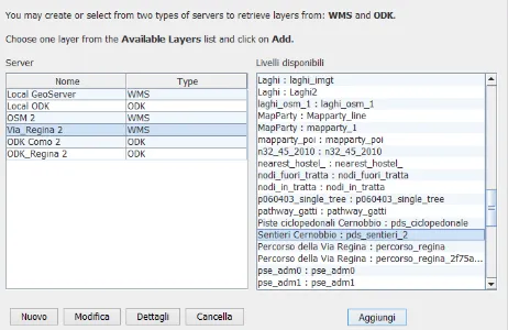
This research aims to provide a self-service mechanism for local government spatial transactions with their state government’s spatial data through the use of the
In this work we present a GIS developed for the study of the historical and territorial coastal defense system of Sardinia (16 th – 18 th century), in order to respond to the need
In this paper we investigate common qualitative spatial reasoning methods as a preliminary step to enhancing the capabilities of GeoSPARQL in an online
When the features have been distributed over the fields of the Fieldtree every field in the lowest level can be processed. executing the automated generalization pro- cess for this
