isprs archives XLII 2 W3 55 2017
Teks penuh
Gambar


Garis besar
Dokumen terkait
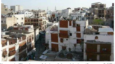
Another stage of the work regards the 3D survey with reality- based techniques of all the remains still visible in order to have a starting point for the
This specification represents an important turning point in the use of new media for the heritage goods preservation and dissemination, so that this chart be considered the
Once a laser scanning project needs to be georeferenced, Trimble SX10 scanning total station presents the advantage of requiring only one device in the field, whether georeferencing
In order to represent the Stratigraphic Unit duration, using time intervals we use Qualitative Constraints Networks (QCN) suc- cessfully used in the domain of knowledge
3 shows an image of the scene captured from the perspective of the fixed camera used for scanning, a subset of the extracted laser curves in white and the computed intersection
Previous studies have compared these specific software packages in terrestrial systems and found minor variability in 3D reconstruction capability between the two
The experiments presented in the next sections (accuracy of image orientation, point cloud generation and surface extraction) were always carried out with a
The architecture is composed by five main functional blocks: Access control, Context Broker, Event Storage, Video Stor- age and Processing module, in Figure 2 the overall archi-
