isprsannals II 2 W1 7 2013
Teks penuh
Gambar

Dokumen terkait
In this paper, we proposed a sequential modelling method to improve existing rooftop models driven from LiDAR data by incorporating lines extracted from optical
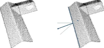
Figure 2: A sample scene from the Vaihingen data set: (a) raw LIDAR points overlaid on an orthoimage, (b) building mask and non-ground LIDAR points, (c) grouping and clustering of
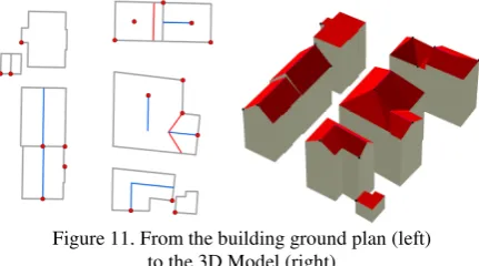
The graph shown in Figure 11 shows two types of 3D spatial data sets used in the single object search: CityGML data and 3D spa- tial data with space-filling curve implementation..
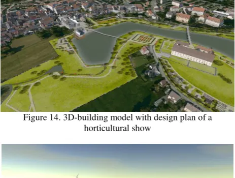
The experience in this project has shown that the integration of 3D spatial plans and BIM is beneficial in the design process and offers significant innovations. Technically,
As the National Mapping Agency for Great Britain, Ordnance Survey’s products include address data, digital terrain models (DTMs), road networks, imagery and
From the concepts presented, the requirements for the unified spatial data model: are to construct a 3D geometry capable of representing regular objects (such
Building Analysis for Urban Energy Planning using Key Indicators on Virtual 3D City Models - the Energy Atlas of Berlin. International
DESIGN OF AN INTELLIGENT INDIVIDUAL EVACUATION MODEL FOR HIGH RISE BUILDING FIRES BASED ON NEURAL NETWORK WITHINU. THE SCOPE OF
