isprs archives XLI B8 1357 2016
Teks penuh
Gambar


Garis besar
Dokumen terkait
Derived layers (CPR and RFDI) did not improved the classification accuracy in addition to three dates temporal dual polarisation SAR images, though these
A revised Evaporative Stress Index (RESI) was also used to assess the likelihood of the occurrence of drought and to create drought hazard maps.. Finally, a combined
(2015) to map spatial and temporal patterns of natural and anthropogenic disturbance: First, we classified the Landsat time series disturbance and recovery metrics into three
This article describes a preliminary study to evaluate the potential of using altimetry data from Envisat and Saral satellites combined with satellite imagery to estimate water
The aim of the study was to estimate the spatial variability of surface runoff using PESERA model and remote sensing techniques in Ermenek subcatchment where
Temperature and moisture profiles are significantly affected by the choice of planetary boundary layer (PBL) scheme in the lower troposphere, which could interact with
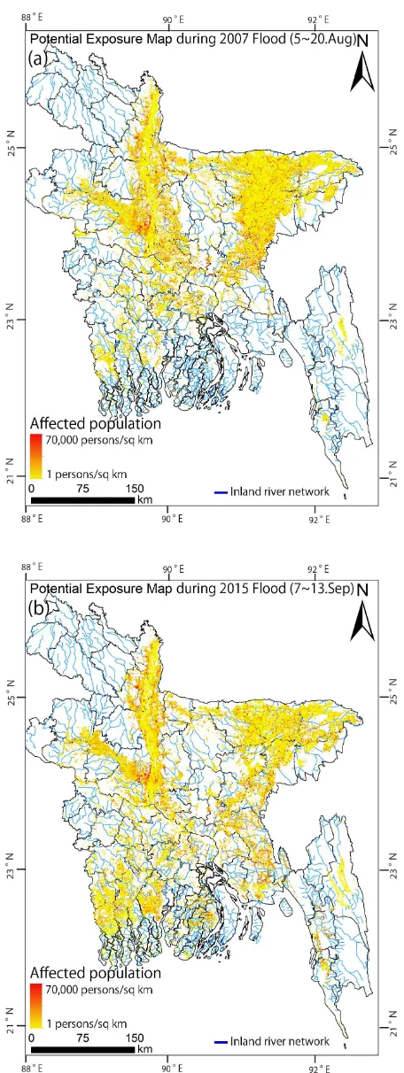
Differences between the numbers of affected people estimated based in SRTM and in remote sensing imagery show that uncertainty in the assessment of impacts of
This paper discusses the Stanford Method for Persistent Scatterer (StaMPS) based PS-InSAR and the Small Baselines Subset (SBAS) techniques to estimate the surface deformation in