IMPLEMENTING GEOGRAPHIC INFORMATION SYSTEM
FOR LAND USE AND SPATIAL PLANNING
Wahyu Ario Pratomo
Ketua Departemen EP FE USU E-mail: [email protected]Abstract: Nowadays, a local government has to improve their own financial ability in order to enhance the quality of life of the local community. Although, the local governments have successfully increased their own earnings, they have not yet optimized the potential income. Moreover, regarding to Wagner’s Law, the government budget has to improve through the years simply as the public needs increased. Based on this condition, the local government should prepare strategic policies by using creativity and intelligent in optimizing local earnings. One way to support those strategic policies is by using information technology. The implementation of information technology by a local government is started from the development process planning until preparing public services and optimizing local potential economy. The Geographic Information System (GIS) is recently used to support those activities.
Keywords: GIS, land use and spatial planning
INTRODUCTION
The establishment of Law No. 22 and Law No. 25 in 1999, which subsequently renewed by Law No. 32 and Law No. 33 in 2004 that concern about administrative decentralization and financial balancing between central government and regional government. The objective of regional autonomy basically, is to enhance the development process in each region. This condition is based on the presumption that the community in a region has more understanding about the problems and their solution than central government. The other objective is to reduce the gap between regions and to enhance the quality of public services. To sump up, the autonomy is more responsive to the needs of each region and its potencies as well.
The regional autonomy so far has created a change in fiscal management. In National Government Budget (APBN) year 2006, total budget that channel to regions by fiscal decentralization scheme is about Rp 219.4 trillions or 7.0 percent of GDP (Gross Domestic Product) of Indonesia. This number increases very high compare to in year 2000, where the fiscal decentralization only about Rp 33.5 trillion or 3.7 percent of Indonesia’s GDP.
In the implementation of regional autonomy, the region is given authority to
classify local earnings (PAD). The earnings together with fiscal decentralization fund (DAU and DAK) will be arranged by local government independently to disburse all of local expenditures. These expenditures’ objective is to stimulate local economic growth.
Nowadays, the local government has to improve their own financial ability in order to enhance the quality of life of the local community. The North Sumatra government has successfully increased its original local earnings (PAD) from 423.1 billion in 2001 to Rp 1.377 trillion in 2006. The same conditions also occurred in local government earnings in North Sumatra Province. Although, the local governments have successfully increased their own earnings, they have to optimize the potential income in the future. According to Wagner’s Law, the government budget has to improve through the years simply as the public needs increased. Based on this condition, the local government should prepare strategic policies by using creativity and intelligent in optimizing local earnings. One way to support those strategic policies is by using information technology.
local potential economy. The Geographic Information System (GIS) is commonly used nowadays in order to support those activities. Developing information technologies like Geographical Information Systems (GIS) and Remote Sensing (RS) considerably support managerial decision making process to manage spatial planning. The management of spatial is an important issue to prevent the harmful effects of environmental changes. The spatial planning was determined with the using of Geographic Information System (GIS) technologies. In this study, spatial data attempt to clarify the usage of GIS to establish the spatial planning in North Sumatra. The system provides some advantages including updated and maintained data in a common platform and local government decision making process.
RESULT
Land Use Planning
Provinces and Regencies throughout Indonesia are dealing with an increasing number of sociological and physical changes which are commonly influenced by the changing of land use changes. Furthermore, land use planning in the Indonesia is actually done largely through zoning. According to Miller (1985) zoning relates to determining the best or the most suitable uses for all different parts of land in a certain area. This method is primarily concerned with preservation of long-term development of an area, which in Indonesia called Spatial and Regional Planning (RTRW).
Land use planning is a comprehensive strategy that is designed to assist achieves local and regional objectives (Branch, 1988). A land use plan is also used as a way for guiding and administering zoning ordinances for regulation of land and future locations of facilities in an area (Banovetz, 1984). The requirements from different areas may vary, but they must be consistent within a zone (Meshenberg, 1976). In addition, an ordinance will further subdivide the zones into different classifications with varying standards that shape each particular area (Johnson, 1989). Without these measures of control, many areas or region in Indonesia would be chaotic, messy assortments of structures lacking identity and direction. Hammond (1996) states that land use planning should be used to improve the environment in which we all live in.
Friedmann (1987) explains planning is a future-oriented activity, strongly conditioned by the past and present. It links “scientific and technical knowledge to actions in the public domain”. Ideally, it happens via public discourse between all groups and individuals interested in and/or affected by urban development and management activities pursued by the public or private sector. In practice, such comprehensive sharing of information and decision making is rarely found. At their best, urban and regional planning agencies are rich, dynamic arenas where many societal problems and solutions are explored and addressed in a direct and tangible way. Examples of such problems are: urban growth; unemployment and economic revitalization; transportation; environmental degradation and protection; neighborhood decline and redevelopment; historic preservation; conservation of land and natural resources; and provision of open space, parks, and recreational facilities.
Land use planning must integrate professional technicians, planners, planning commissions, elected officials, local governments and local parliament (DPRD) to arrange and develop plans that represent the views of the majority (Isberg, 1975). The problem with developing these plans for land use tends to occur with the fact everyone has a different idea on how the land should be used or is being used. Cullingsworth (1993) suggests that in the case of land uses planning, these opinions are better to be stratified across generations, socioeconomic classes, ethnicity and location factors and ideologies. All of those groups bring their own personal agendas and opinions to the planning process. The views of land use planning very widely throughout the different segments of society because it is viewed as placing restrictions on personal property. Decisions makers in a township have a huge amount of opinions to evaluate and consider in regards to land use.
can balance demands for development with the need to protect the environment as well as to achieve social and economic objectives.
Benefit of GIS in Spatial Planning
Planners have always sought tools to enhance their analytical, problem-solving, and decision-making capabilities (Mandelbaum, 1996). Beginning in the late 1950s, planners started to develop and use computerized models, planning information systems, and decision support systems to improve performance (Brail 1987). The adoption of a geographic information systems (GIS) and land information systems is a more recent manifestation of the same effort to incorporate new tools and technologies. Planning departments have been on the forefront of GIS use among local government agencies (French and Wiggins 1990). The planners’ interest in GIS and other geospatial technologies derives from the spatial nature of urban phenomena and from the interdisciplinary nature of urban planning.
Geographic Information Systems (GIS) provides the necessary means to forecast or analyze information in a spatially viable manner for a prescribed area. Modeling with GIS provides useful visual representations of the environment or jurisdictional areas. Developing a land use planning model
should include all major variables that considers and integrates information as a medium for accurate, factual and visually shared perceptions for responsible decisions. The hope for a land use model is to provide spatially visible and viable results that can be forecasted to a township or the entire county. Using a GIS system also allows for the merging of data to view the interconnectedness of the variables commonly associated with land use planning. Models will help put issues into perspective and give each issue relative importance.
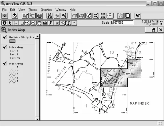
A GIS allows access to large amounts of information quickly and efficiently. Geographic Information Systems let you visualize information in new ways that reveal relationships, patterns, and trends not visible with other popular systems (Environmental Systems Research Institute, 1999). A GIS is a thematic mapping system, meaning you can produce maps based on themes such as soils or hydrology. Map features can be linked to corresponding information contained in database tables. Another advantage of GIS is that it is a dynamic product rather than a static product, making it is easy to update, edit, and reproduce maps. Multiple layers of maps can be quickly displayed in a variety of overlap, scales, and combinations to fit the needs of the user.
Nowadays, the field of computing for urban and regional planning is continuously advanced through various disciplinary areas, including geographic information system (GIS). Budic (2000) states that GIS as applied in the field of urban and regional planning should advance the following goals of urban and regional planning:
1. Better quality (livable, safe, and aesthetically pleasing) of urban environments;
2. Environmentally and socially sustainable communities;
3. Effective spatial organization of urban activities (work, residence, commerce, and recreation);
4. “Smart growth” of urban areas;
5. Efficient communication between various urban functions;
6. Revitalization of deteriorated areas; 7. Variety of housing options;
8. Employment opportunities and economic development; and
9. Democratization of the planning and policy-making process.
To understand the role of GIS and technology in urban and regional planning, it is useful to refer to the theoretical motives of planning, which assume instrumental and communicative rationality as two key frames for planning. Instrumental (functional) rationality is based on a positivist ideal, which gathered information and scientific analysis at the basic of planning. Communicative (substantive or procedural) rationality focuses on an open and inclusive planning process, public participation, dialog, consensus building, and conflict resolution (Innes, 1996). Participants in the planning process rely on many types of “information,” including the formal analytic reports and quantitative measures and the understandings and meanings attached to planning issues and activities (Innes, 1998). Indeed, GIS and technology have begun to contribute to the planning practice, and in some areas the developments transcend the “communicate versus calculate” dichotomy.
Indonesia has decided to start in implementing a GIS in the comprehensive land use process. Some departments such as ministry of public services in cooperation with national mapping board and ESRI Indonesia have prepared some information about GIS of Indonesia. Subsequently, many of provinces and regions also have designed their land use and spatial planning using GIS. However, many provinces do not have a comprehensive GIS program and either not socialized well. Government and local parliament should visually understand and portray the working relationships of the land and policies and regulations that prescribe the particular uses. Inventory modeling provides need information that portrays how much of a particular resource will or could be affected. This procedure allows for the most common method of analysis, known as observations that assist in providing sensible land use decisions that work. GIS also allows for an area to be broken down into smaller jurisdictions, areas or governmental sections. In the case of land use planning, it allows township level government to be looked in an individualized manner. Displaying data provides an invaluable, often under utilized awareness or visual inventory of what is occurring in the county or in a particular township. GIS can and will provide policymakers an ever “present backdrop” for evaluating particular thoughts or specific recommendations as they pertain to the entire area (Branch, 1985).
ANALYSIS
Obstacles in Implementing GIS
There are several obstacles found in implementing GIS to land use and spatial planning. First problem that planner face is significant processing and database costs. Sometimes, it is very hard to convince the parliament or the local government that GIS is very important to support the development of one region, although it costs a lot. Secondly, a planner always notices data collection. The effort put into database development is sometimes so immense that only little time is left for analysis and designing plans and policies. Another problem that may comes up, since planning databases are usually derived by compiling data from multiple sources and of varying
quality and scales, it is needed to apply the integration of the data. The integration of available data sets is one way to reduce database development time. For example, remote sensing data acquired via satellites or airborne camera, which is proven very useful particularly in mapping land use change (Mesey, 1997).
Budic (2000) emphasizes another challenge in implementing GIS in urban and regional planning is to develop training materials that suit to the planning professionals, to secure infrastructure for GIS technology for teaching and research, access and equity and to develop a code of ethics for GIS development and use among the community.
Furthermore Hammond (1996) states that with local planning departments limited amount of time, money, personnel and information developing a strong, well done comprehensive land use plan can be a difficult task. As a result, land as a resource is often squandered by under utilization or over use that cause environmental degradation.
C O N C L U S I O N A N D P O L I C Y I M P L I C AT I O N
To reach a better land use planning process it needs to be a large investment in Geographic Informational Systems. By creating visual map as the representations of the area as well as the important data that is attributed to these features, we have a better understanding to what is occurring on the land. Having this type of data it will improve many economies, environment and resolve many land use disagreements. Data that is readily available will improve the overall effectiveness of the land use planning procedure. Land as a resource is our most important asset and the wise utilization of this resource should be demanded and expected.
tool building and integration, technology transfer and legal framework.
In order to generate the sustainability of a comprehensive organized land use and spatial planning, GIS courses have been introduced as an important component in the undergraduate and graduate planning curricula. GIS-related capabilities, techniques, and methods contribute to several skill areas of professional planners, including analytical/research, communication, and data processing.
REFERENCES
Banovetz, James M. 1984. Small Cities and Counties. International City Management Association Washington D.C. 254 pp.
Brail, R.K., 1987, Microcomputers in Urban Planning and Management (New Brunswick, NJ: Center for Urban Policy Research)
Branch, Melville C. 1985. Comprehensive City Planning. Planners Press, Washington D.C. 238 pp.
Budic, Z.D., 2000, Geographic Information Science Implication for Urban and Regional Planning. URISA Journal Vol. 12 No. 2, 81 - 93.
Cullingsworth, J. Berry 1993. The Political Culture of Planning. Routledge Inc., New York, 350 pp.
Environmental Systems Research Institute, Inc. 1999. Getting to Know ArcView GIS. 3rd ed. ESRI: Redlands, California.
French, S.P. and L.L. Wiggins, 1990, California Planning Agency Experiences with Automated Mapping and Geographic Information Systems. Environment and Planning B, 17(4), 441-450.
Friedmann, J., 1987, Planning in the Public Domain: From Knowledge to Action (Princeton, NJ: Princeton University Press).
Hammond, Allen L. 1996. World Resources: The Urban Environment. Oxford University Press, New York, 375 pp.
Innes, J. E., 1996, Planning Through Consensus Building: A New View of the Comprehensive Planning Ideal. Journal of American Planning Association, 62(4), 460-472.
Innes, J. E., 1998, Information in Communicative Planning. Journal of the American Planning Association, 64(1), 52-63.
Isberg, Gunner C. 1975. Local and Regional Planning in Minnesota. The Metropolitan Council, Minneapolis, 187 pp.
Mandelbaum, S.J., 1996, Making and Braking Planning Tools. Computers, Environment and Urban Systems, 20(2), 71-84.
Mesey, V., 1997, Remote Sensing of Urban Systems: Hierarchical Integration with GIS. Computers, Environment, and Urban Systems, 21(3/4), 175-187.
Meshenberg, Michael J. 1976. The Language of Zoning. American Society of Planning Officials Chicago, 52 pp.