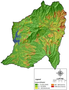
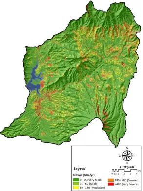
Estimation of soil erosion for a sustainable land use planning: RUSLE model validation by remote sensing data utilization in the Kalikonto watershed
Bebas
10
0
0
Teks penuh
Gambar
+4

Dokumen terkait
