THE
RESEARCH
ON
ACCURACY
EVALUATION
METHOD
OF
THE
TOMOGRAPHIC SAR THREE-DIMENSIONAL RECONSTRUCTION OF URBAN
BUILDING BASED ON TERRESTRIAL LIDAR POINT CLOUD
Li Linzea, Pang Leib, Zhang XueDongb, Liu Huic
a
School of Geomatics and Urban Spatial Information,Beijing University of Civil Engineering and Architecture, yongyuan street,[email protected]
b
School of Geomatics and Urban Spatial Information, Beijing University of Civil Engineering and Architecture, yongyuan street, [email protected]
c
Telecommunications Institute, Beijing University of Civil Engineering and Architecture, yongyuan street, Beijing
KEY WORDS : Tomographic SAR , Lidar , Urban Building , 3d Point Cloud, Facade Reconstruction ,Accuracy Evaluation.
ABSTRACT:
Muti-baseLine SAR tomography can be used on 3D reconstruction of urban building based on SAR images acquired. In the near future, it is expected to become an important technical tool for urban multi-dimensional precision monitoring. For the moment,There is no effective method to verify the accuracy of tomographic SAR 3D point cloud of urban buildings. In this paper, a new method based on terrestrial Lidar 3D point cloud data to verify the accuracy of the tomographic SAR 3D point cloud data is proposed, 3D point cloud of two can be segmented into different facadeds. Then facet boundary extraction is carried out one by one, to evaluate the accuracy of tomographic SAR 3D point cloud of urban buildings. The experience select data of Pangu Plaza to analyze and compare, the result of experience show that the proposed method that evaluating the accuracy of tomographic SAR 3D point clou of urban building based on lidar 3D point cloud is validity and applicability
b
Corresponding author Pang Lei ,email address , [email protected] At the end of twentieth Century, tomography technology is introduced in synthetic aperture radar,and produce the Tomographic SAR. Compared with the traditional SAR imaging technology, Tomography SAR imaging technology as a three-dimensional high-resolution SAR imaging system in addition to the range and azimuth to have a higher resolution,
while increasing the ability to distinguish in elevation. It really achieved the three-dimensional imaging of the target, in recent years it’s more and more attractive for many domestic and foreign research institutions and researchers. Three-dimensional reconstruction by the SAR will inevitably produce some errors, the error mainly includes time coherence error, SNR error, polarization error, atmospheric phase difference, etc. The influence of these factors is reflected in the accuracy of the point cloud data. The accuracy of the analytical SAR point cloud assessment mainly refers to the evaluation of plane accuracy and elevation accuracy, also known as the positioning accuracy evaluation. The accuracy of the SAR data is critical to the subsequent data processing and quality of the results. The terrestrial lidar is a set of global navigation system, inertial navigation system and lidar scanner in one for three-dimensional information remote sensing system. lidar as a new means of information access, it has a high point cloud density, fast efficiency, little impact by the weather, high data accuracy, rich product advantages, etc[1]. So the using of the current relatively mature LIDAR technology can be very good to verify the accuracy of the tomographic SAR.
1. TOMOGRAPHICSAR THREE-DIMENSIONAL RECONSTRUCON
Compared with the traditional SAR, the tomographic SAR adds a synthetic aperture at elevation, it achieve high-resolution
scatterer to high-resolution imaging by multi-baseline flighting over the same area. Three-dimensional imaging of the observed area is currently done mainly through the existing multi-orbit flight of the SAR system. First of all, it is necessary to observe the same area at different heights, to complete the focusing on range and azimuth for surface features. And the most critical focus on elevation need to observe the different tracks on the data and collected to calculate. Assume that Single Look Complex Images obtained from a different height orbit is observed for a region, and then to these images for image registration, de-slope and other pretreatment. After the steps we can choose a scatter as an example, the imaging results can be expressed by the following formula:
g n = ∫
, n = 1,2,………..,N
is the distribution function of the complex scatter coefficient along the nsr direction, is wavelength, R is the slant-range of the image center, is a vertical baseline. When the vertical baseline is evenly sampled, is sampling interval, .According to Nyquist Theorem, When the sampling interval is , The domain of no ambiguity time that can be reconstructed is 2t≤1/Δf. Apply to the above process, the ambiguity time domain with nsr direction is 2smax. 2smax = . [-smax, smax] is span of nsr, the length of equivalent synthetic aperture at nrs is determined by the vertical baseline span B. The nsr to Rayleigh resolution corresponding to the equivalent synthetic aperture is ρs= 2B / λr.
or two orders of magnitude higher than in range and azimuth[2]. In addition, because there will be some complex pseudo-scatterer around the building, SAR satellites will also receive electromagnetic signals from these scatterers when they fly over the building, some abnormal points away from the actual location of the building will be generated. The two-dimensional images of the SAR is coherent, so compared with the lidar when the three-dimensional reconstruction of the building through the TomoSAR more emphasis on the characteristics of the building. Side-looking SAR geometry enables TomoSAR point clouds to possess rich facade information. At the same time, objects such as trees, which are not coherent, will not be reconstructed[4-6]. This avoids the influence of the surrounding environment on the three-dimensional reconstruction of buildings. In addition, the three-dimensional point cloud of the building through TomoSAR can obtain the Scattering characteristics of scatterers,
from these characteristics, we can get the information of the material and geometry of the building facade.
2. FUNDAMENTALS OF TERRESTRIAL LIDAR
Just as its name implies, the ground 3D laser radar scanning system is on the ground, similar to the traditional ground photogrammetry[3]. It uses non-contact high-speed laser measurement, the geometric shape data of 3D terrain and complex objects are obtained in the form of point cloud. Laser scanner mainly includes laser ranging system and laser scanning system,, At the same time, it also integrates CCD and instrument internal control and calibration system. In the instrument, the two laser beams can be rotated in a fast and orderly manner, and the narrow laser pulse emitted by the laser pulse emitter is swept over the measured area, The distance of each laser pulse is calculated from the time difference (or phase difference) that is emitted from the surface of the analyte and then returned to the instrument, At the same time, the scanning control module controls and measures the angle of each pulse laser, and finally calculates the three-dimensional coordinates of the laser spot on the measured object.
3. ACCURACY EVALUATION OF TOMOSAR BUILDING RECONSTRUCTION BASED ON THE
TERRESTRIAL LIDAR
Extract the surface of the building in the cloud
Feature line extraction
original scan data of terrestrial lidar
The feature lines extracted by Lidar
The same processing
Analyze point cloud accuracy
Fig3-1 Flow Chart of Accuracy Evaluation
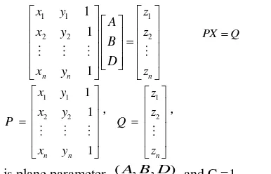
Point location of point cloud data is not easy to directly use measured instrument to obtain, the appropriate method should be chosen to evaluate the accuracy of
point cloud.Commonly used methods are point and point
comparative analysis, statistical analysis and so on.Since the lidar point cloud and the TomoSAR point cloud are all described as the location of the irregular distribution of the target surface, Point cloud density is related to many conditions. Therefore, it is difficult to find the points corresponding to the feature points accurately in both points. The accuracy of the terrestrial Lidar scan data can reach the millimeter level, it can be very accurate to build the outline of the building,So we can verify the accuracy of the point cloud by comparing and analyzing the geometric characteristics of the point cloud. For millimeter level ground lidar scan data, there is already a very mature processing flow.This paper mainly discusses the processing of the TomoSAR point cloud.First of all, we need to filter the TomoSAR point cloud, and the original TomoSAR point cloud will have a lot of messy points around the target point cloud,these will affect the subsequent extraction of the building contour. Through the filter, you can remove some outliers in the point cloud, Its principle is to filter the original point cloud of each point to traverse,delete all the data points within a certain range without reaching enough neighbors, this distance is a threshold that needs to be set by itself.After this step, we can get a complete point cloud model without isolated point. After obtaining the point cloud model of the building after filtering, as the point cloud data volume is relatively large,the overall participation in the operation makes the occupation of resources is relatively large,it is necessary to perform the grid
processing of the TomoSAR cloud model.The role of the
perpendicular to the vertical direction, so the normal vector constraint condition is increased. It can be more accurate segmentation of the TomoSAR building facade point cloud. Then use least squares algorithm for each segment of the facade of the point cloud plane fitting, after divided the facade of the building, and determine its
plane parameters. The intersection is obtained by
intersecting the surface with the surface, it can be directly obtained after the rule of the vertical boundary. The general equation of space plane is expressed as
0
Ax
By Cz
D
In the formula, A, B, C, D are parameters of plane. The number of points in each elevation due to segmentation is far greater than 3,and the discrete distribution of point cloud on both sides of the plane,In order to obtain the intersection between planar patches,it is necessary to have a plane fitting for point cloud of facades. It can use least square algorithm.The best plane is obtained on the basis of the least square sum of errors. Below is Least square plane fitting algorithm:
In this paper, the vertical and the ground buildings are used to detect the accuracy of TomoSAR point cloud, its facades perpendicular to the ground,so all points in the plane equation can be expressed as follows:
coordinate of each point, itcan be expressed in the form of a matrix:
The least squares solution of the plane parameters are as follows:
T 1 TX P PP Q
Repeat this process for each facaded, the plane parameters of all facades can be obtained, then the intersection line is obtained according to the plane equation of the adjacent two facades. The two facade equations are as follows:
1 1 1 1
Intersect the line equation is
x M y N z
E F G
The direction of the intersecting line can be obtained by crossing the plane normal vector
The point can be obtained through the intersecting line intersect the XOY plane, it’s
M N, , 0
Then the simultaneous coordinates of the endpoint can be obtained The length of the characteristic line.4. EXPERIMENT AND RESULT ANALYSIS
Fig4-1.Point Cloud Obtained From Terrestrial Lidar
Fig4-2.Point Cloud Data Of Building Obtained From The Tomosar
Fig4-3.. Comparison Of Lidar And TomoSAR Acquisition Of Building Data
The experiment can extract the two facades of the building extracted from the lidar and the ground of equation
-0.0038x+0.027y+0.00035z+1 = 0 1
0.005x+0.006y+4.022*10-5*z+1=0 2
0.0022x+0.004y-0.0042z+1 = 0 3
At the same time, the three-faceted equations reconstructed from the reconstructed building point cloud model of the TomoSAR can be extracted as
-0.09x+9.02*10 -17*y-5.55*10-17*z+1 = 0 1 0.0026x - 0.01y -0.001*z +1= 0 2
The equations of the three surfaces can be obtained, and the straight line equation of the building facade and the two contours of the building can be obtained. Then the maximum and minimum values of X, Y, and Z are taken to obtain the height, length and width of the building. The results are shown in the following table
( m ) TomoSAR Terresrial
lidar
length 47.03 47.05
width 41.25 41.22
height 90.10 88.184
Table 1. The Results Of Experiment
5. CONCLUSION
TomoSAR point cloud. The experiment needs further consideration is due to conditions, this experiment only selected a building as an goal of experiment, the number of test data is small, only the accuracy of the point cloud of TomoSAR can be roughly checked. If conditions permit, should increase the number of target buildings, has reached a more complete validation effect. TomoSAR is a fast, efficient and new method of data acquisition. However, due to the limitation of precision, the TomoSAR imaging algorithm needs to be further improved in order to improve its accuracy.
ACKNOWLEDGEMENTS
I would like to express my gratitude to all those who have helped me during the writing of this thesis. I gratefully acknowledge the help of my supervisor Pang Lei. I do appreciate her patience, encouragement, and professional instructions during my thesis writing. Also, I would like to thank Mrs He Shuguang and Miss Ai Liping, who kindly gave me a hand when I was making the questionnaire among the college English learners. Last but not the least, my gratitude also extends to my family who have been assisting, supporting and caring for me all of my life.
REFERENCES
1.Y.Wang, A.Xiong,J.,2013a.The research on Accuracy Evaluation Method of the Airborne Lidar Point Cloud
Data.Geomatics and Spatial Infortation Technology, 36(8),pp.130-131.
2. X. Zhu, M. Shahzad and R. Bamler,J., “From TomoSAR Point Clouds to Objects: Facde Reconstruction”, Proceeding of theTyWRRS 2012, Naples, Italy.
3 S.Zhu,J.,2006a,The Technique Principle of LIDAR and Its Application in Surveying and Mapping. Modern Surveying and Mapping, 29(4),pp.12-13.
4 Rottensteiner F., Briese Ch., “A new method for building extraction inurban areas from high resolution LIDAR data”, ISPRS. Photogrammet.Comput. Vision, Graz, Austria, pp. A-295 ff, 9–13 September, 2002.
5 F. Lombardini, “Differential Tomography: A New Framework for SAR Interferometry”, In proceedings of IGARSS, Toulouse, France, pp.1206–1208, 2003.