Conference paper
Teks penuh
Gambar

Garis besar
Dokumen terkait
presents the application of our combinatorial clustering to the problem of 3D reconstruction of similar objects from their detections then specifies it to polygonal traffic
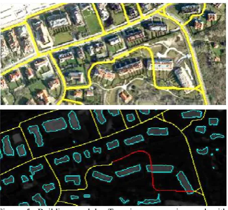
The proposed method first segments out 3D points belonging to the building fac¸ade from the 3D urban point cloud and then projects them onto a 2D plane parallel to the
The test scenes can be used to evaluate the quality of the 3D re- construction (e.g. by comparing the resulting point cloud to the ground truth available for the two 3D
The main contribution of this paper is the use of point feature attributes to better segment MLS data into components that have a one-to-one relationship with objects. The
Core of the approach is a primitive shape based algorithm, which introduces building primitives, to identify the façade objects separately from other irrelevant
We use this data set to evaluate the use of using OpenStreetMap (OSM) to generate an initial detector from globally-distributed training samples, followed by bootstrapping to fine
In the land cover layer, the nodes correspond to superpixels extracted from the image data, whereas in the land use layer the nodes correspond to objects of a geospatial land use
After the SE correction the resulting DN values are transformed to reflectance values to ease further analysis. Additionally, the environmental conditions may change
