isprs annals IV 4 W1 67 2016
Teks penuh
Gambar
Garis besar
Dokumen terkait
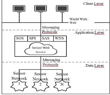
The HyperCGSF consists of a multifunctional geospatial service provider agent model, an underlying networking topology called ‘hypercube’, and a set of distributed
The CityGML-based semantic city model of Meidling is itself the product of a data harmonisation and integration process and acts as a prerequisite for the work described
Several urban energy simulation studies based on 3D city mod- els have demonstrated the methodology for derivation of required spatio-semantic data by evaluating the geometry of 3D
Another important issue is the navigation aid for ordinary road users after traffic incidents occur. Because the hazards caused by the incidents could make certain roads blocked,
In this paper, we attempt to (1) focus on the accessibility of firefighters immediately after an earthquake, (2) consider not only the single hazard but also the multi-hazards
Therefore, we have developed R ANDOM 3D CITY , an experimental procedural modelling engine for generating synthetic datasets of buildings and other urban features.. The engine
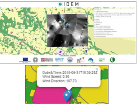
BUILDING INFORMATION IN ITALY In this section, three main sources of data on buildings are presented: the Topographic Database, the new format for local and regional
The sustainable, dynamic and participative solution includes (i) land cover and land use mapping using remote sensing and GIS, (ii) population density mapping using
