isprs annals IV 2 W1 187 2016
Teks penuh
Gambar
Garis besar
Dokumen terkait
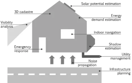
Several urban energy simulation studies based on 3D city mod- els have demonstrated the methodology for derivation of required spatio-semantic data by evaluating the geometry of 3D
The findings of the literature search are presented in this paper as grouped under 6 categories which are Virtual & Augmented reality, Routing & Navigation Methods,
We also presented extensions of the algorithm to handle sloped trajectories, perpendicular cut-offs and models using multiple cross sections, each of these on the basis of
There is a growing demand of 3D indoor pathfinding applications. Researched in the field of robotics during the last decades of the 20 th century, these methods focussed on
We present in the following section our method allow- ing to consider the indoor 3D space and its furnitures, and to ex- tract the actual free navigable space it contains,
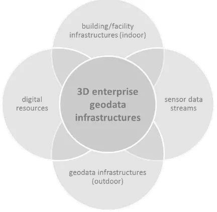
As a result, in the context of this paper, a 3D WebGIS application is developed in order to successfully retrieve and visualize CityGML data in accordance with their
Dynamizers support inlining of O&M data representing sen- sor observation values, which then are injected into the at- tributes of specific city objects.. This approach is useful
ISPRS Annals of the Photogrammetry, Remote Sensing and Spatial Information Sciences, Volume IV-2/W1, 2016 11th 3D Geoinfo Conference, 20–21 October 2016, Athens, Greece.
