
isprs annals IV 2 W1 241 2016
Teks penuh
Gambar


Garis besar
Dokumen terkait
Several urban energy simulation studies based on 3D city mod- els have demonstrated the methodology for derivation of required spatio-semantic data by evaluating the geometry of 3D
In this paper, we attempt to (1) focus on the accessibility of firefighters immediately after an earthquake, (2) consider not only the single hazard but also the multi-hazards
We also presented extensions of the algorithm to handle sloped trajectories, perpendicular cut-offs and models using multiple cross sections, each of these on the basis of
The system allows input of river maintenance information (Figure 9) at any points in the three-dimensional data. When the user clicks any points of three-dimensional
3D city models could represents data that can be used in urban applications and/or landscape architecture, which include buildings, roads or transportation systems, trees,
While this may have an impact when Coimbra try to identify the exact number of each specific case present in the Municipality, the fact that some users may not identify their
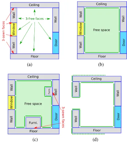
By identifying dynamic objects, doors and furniture, these floor regions can be modified so that each region represents a specific navigable space inside a building as a free
theless, the indoor features (e.g. building components, furnitures, spaces, etc.) as they are currently proposed by those standards are not adapted to applications such as
