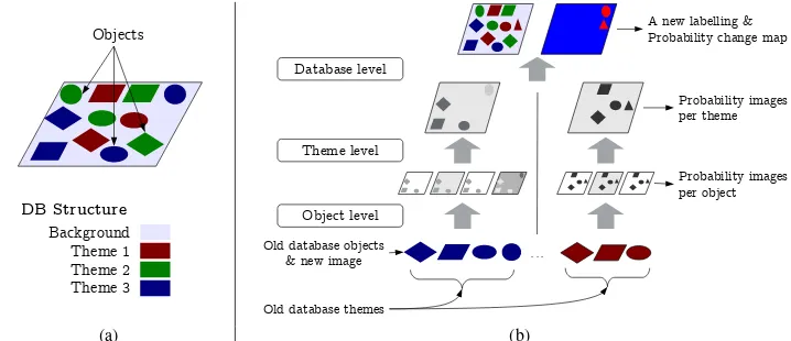
isprsannals II 3 W2 13 2013
Teks penuh
Gambar
Garis besar
Dokumen terkait
The proposed algorithm for building extraction in airborne LiDAR data can be divided into three key steps: Filtering, scan line segmentation, object based classification.. 2.1
Specifically, a 3D model is computed from the overlapping views, and the model is segmented into semantic labels using height information, color and planar qualities.. 2D detector
In this paper we have presented an automatic (parametric) approach for robust façade reconstruction using TomoSAR point clouds for large areas. The approach
The original images with the input Stixels (left), the 2D mapping results overlaid on Google Earth images (center) and the 3D representation (right) using the OctoMap representation
In this paper we develop and compare two methods for scene classification in 3D object space, that is, not single image pixels get classified, but voxels which carry geometric,
Our system works with more than 140 different classes of traffic signs and does not require labor-intensive labelling of a large amount of training data due to the
The GeoVideo data are divided into moving trajectory and video segments around the monitoring object and the same time period video segments from different
The Service- Oriented Architecture SOA -based flood response is a method with low efficiency due to the large volume of geospatial data transfer, and this
