isprs archives XLII 2 W2 17 2016
Teks penuh
Gambar
Garis besar
Dokumen terkait
In this paper, we regard the point cloud registration as a stochastic system and the global registration as the process that recursively estimates the rigid transformation
Considering the context of study (e.g. simulation model used, type of input varied), the building orientation and height were assessed as the most influential parameters
the z dimension (height) has a different influence from the position (x,y). To solve that, two different weight matrices can be calculated; one in the usual manner and
We use a national 10m DEM, a simplified 1:2M surface bedrock map, both regional and local high and low resolution aeromagnetic surveys, 1:250K and 1:50K geological profiles (
Effect of roll, pitch, yaw, theta and range errors on the x, y and z accuracies relating to the incidence angle value The International Archives of the Photogrammetry, Remote
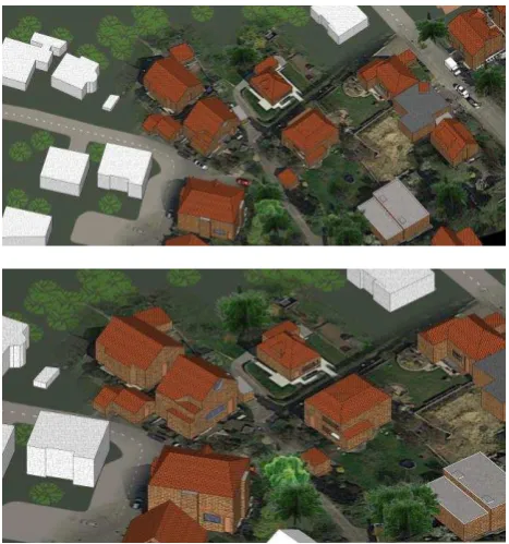
3. CityGML represents the land surface and the object area being mapped. LOD 1 illustrate the block model without the roof structure. LOD3 show with more
3D regional geological modelling containing typical structures (folds, faults) from the 2D geological map; (a) 2D geological map; (b) geological framework
Within the scope of this study, key issues for the 3D modeling of spatial objects and cities are considered and specifically the key elements and abilities of CityGML standard, which
