isprs archives XLI B3 131 2016
Teks penuh
Gambar
Dokumen terkait
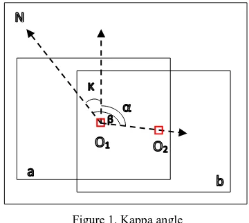
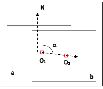
In this research, we perform a quantitative analysis about multi-image triangulation using NAC images with consideration of convergent angle and image matching
Small scale level classificat ion, the city of Košice, light and dark green represent low and high vegetation respectively, grey represents tar areas, red areas
We start with orienting unsorted image sets employing (Mayer et al., 2012), we compute depth maps using semi-global matching (SGM) (Hirschm¨uller, 2008), and fuse these depth maps
Synthesized and real oblique and vertical aerial imagery is transformed on the one hand into a dense photogrammetric 3D point cloud and on the other hand into photogrammetric
distance, intensity, FWHM and back scattering cross section was presented to predict the types of land cover in Miyun area as ground, trees, buildings and
While in image matching method, filtering DSM to obtain DTM using LIDAR processing approach in photogrammetric processes, especially when meet heavy forestry area,
XXIII ISPRS Congress, 12–19 July 2016, Prague, Czech Republic.. point clouds with a partial input from such data needs to be thoroughly investigated. Once ground points
The relationship between the GGRS and AGD local coordinates is the similar transformation, as the relationship is comprised of a translation and a rotation. A scale factor is
