isprsarchives XL 5 W4 345 2015
Teks penuh
Gambar
Garis besar
Dokumen terkait
The International Archives of the Photogrammetry, Remote Sensing and Spatial Information Sciences, Volume XL-5/W4, 2015 3D Virtual Reconstruction and Visualization of
The colours in the RGB scale of the 3D model show the deviation between the points of the Agisoft Photo Scan cloud, then from drone survey, and those of the RISCAN Pro cloud,
Again the boundaries of the homogeneous parts of the DSM detected using the plot of the Mumford-Shah auxiliary function s have been processed using the Blake-Zisserman model to
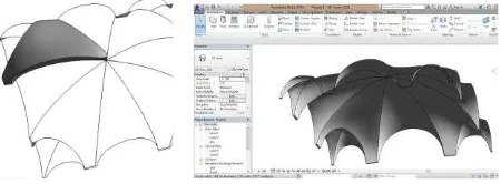
The use of points from photogrammetric method with those selected from the scanner point cloud allows the study of the coffers' general distribution.. 2.2
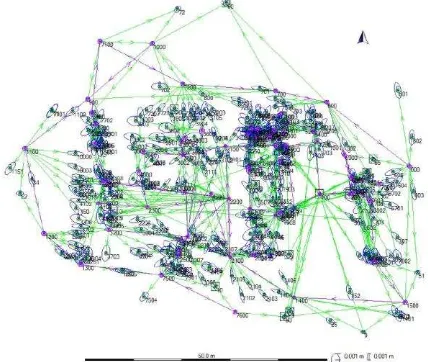
We can select the type of orientation such as to set equal to zero the coordinates of one of the three stations, S1, then equal to zero the Y coordinate of S2.
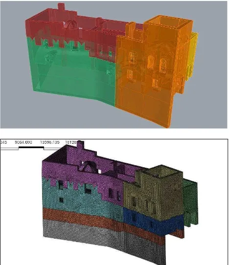
Figure 10: 3D surface model of the exterior walls (left) and the interior area (right) of the fortress Al Zubarah with and without texture generated with Autodesk web service
The Main task of matching results representation is to organize and store the related schema elements and the actual mapping between them achieved by schema matching, and to build
For instance a CityGML Model of Level of Detail (LOD) 4 will provide detailed information about buildings` interior elements. The building representations in city models utilize
