isprs archives XLII 4 W1 181 2016
Teks penuh
Gambar
Garis besar
Dokumen terkait
The aim of this paper is to propose a fuzzy logic model for landslide susceptibility assessment in District Mansehra of Pakistan using the available information and the expert
This paper describes the design of 3D modelling and topological data structure for cadastre objects based on Land Administration Domain Model (LADM) specifications..
This paper especially goes into detail on the optimization of the image tracking algorithms, the development of the video-based AR player for the Android platform and the evaluation
This paper presents the process of implementation of an efficient framework for precast concrete using terrestrial laser scanning that enables contractors to acquire accurate data
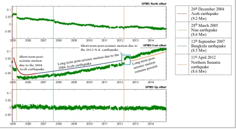
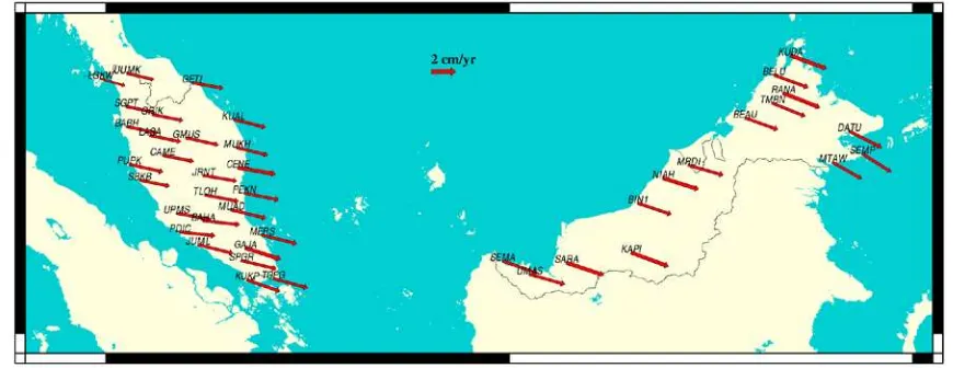
This paper describes an attempt to estimate postseismic deformation parameters for the 2011 Tohoku-oki event by utilizing GPS time-series analysis as produced by ten
City Geographical Markup Language (CityGML); the idea of view frustum determining level of details could be improvised to allow efficient streaming protocol for spatial
It is a spatial multi-criteria decision making (MCDM) method for producing a risk map based on the index values (Chang, 2011; Malczewski, 2000) and environmental risk factors
To avoid this issue, we proposed a combination of market segmentation based on geographic criteria and clustering algorithm for 3D geomarketing data management.. The proposed
