isprs archives XLI B8 537 2016
Teks penuh
Gambar

Dokumen terkait
Therefore, in the present paper, object-based change detection strategy is first adopted, domain knowledge structure for global land cover updating has been exploited,
However, the present research has made an attempt for development of cities in real world scenario particulary to help local, regional and state level planners and policy makers
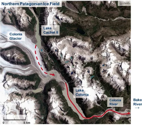
In addition, the satellite data observation time considered the processing time of the analysis and the acquisition costs and the data acquisition was performed
The lower part of Table 1 lists the CVs for the spheres derived amplitudes and the complete point cloud corrected by the spheres polynomial.. Since the maximum available
In the present study, we used mono-window algorithm for to determine land surface temperature from 21.10.2014 Landsat 8 TIRS band 10 data.. We chosed only TIRS band 10 data
The major objective of this study is to develop a retrieval model that is acceptable to estimate soil moisture quickly in the whole coal mining zone of Northern of Shaanxi
There are descriptions of bigger events (for example The Prague Uprising) where the story can be composed from partial events of individual addresses. The number
Top-down view orthoimage is one of the most fundamental products of photogrammetry, and is one of the most important and popular spatial data sources in modern
