isprs archives XLI B7 475 2016
Teks penuh
Gambar


Garis besar
Dokumen terkait
Geographic Object – Based Image Analysis (GEOBIA) has been consolidated as a methodology for urban land use and cover monitoring; however, classification of
and (ii) Atmospheric Correction aims at transforming TOA reflectance into BOA reflectance. The International Archives of the Photogrammetry, Remote Sensing and
In this paper, combining with texture and the spectral indices, including Brightness, Soil adjusted vegetation index SAVI, Normalized Differences Water Index (NDWI) and
Inspirited by the thresholding-based methods, ACCA ( Irish et al., 2000 ) and Fmask ( Zhu et al., 2012 ), several spectral bands and band radios that defined according
This paper proposes techniques to classify the object in the satellite image by using ROI automatic detection technique based on histogram segmentation.. The ROI
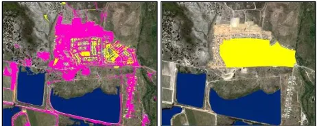
High resolution remote images supply us with more detail information of different kinds of targets, such as texture, shape and spatial structure, etc.. Image
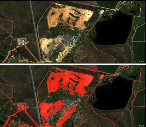
In this study, the classification of greenhouses was performed by using object-based image analysis method with high- resolution satellite images.. This study
In object-based classification, the meaningful features are based on similar spectral or spatial properties of the remotely sensed imagery or the LiDAR data.. Applying an
