Conference paper
Teks penuh
Gambar
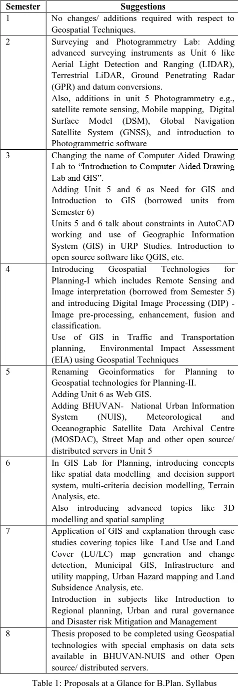

Garis besar
Dokumen terkait
In this context, this study aims to evaluate the use of ASTER sensor images, along techniques of remote sensing and digital image processing for the mapping
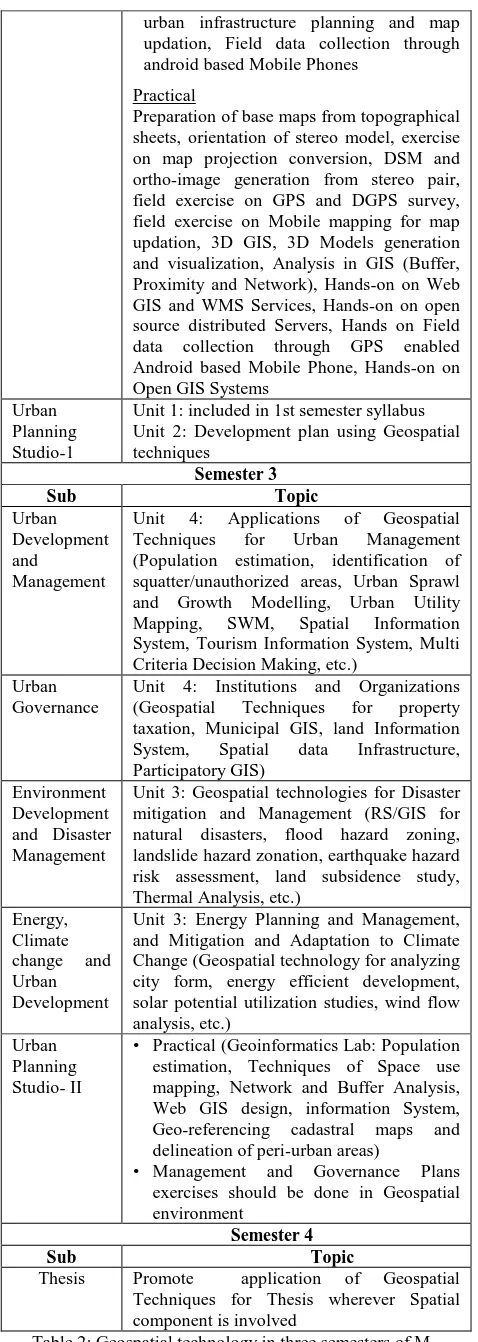
A distance or time impedance factor in combination with the population demand for health care services and the supply of healthcare providers within the
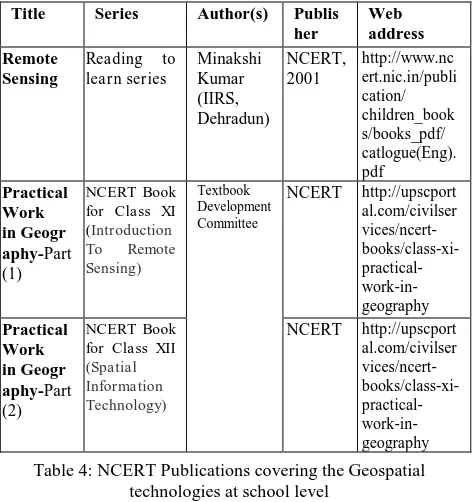
Historical data is a prime input for temporal studies using remote sensing technology. For most of the country, historic data in high resolution is not available for
In addition, the possibility to use a combination of automatic and manual tools for enhancing parameterization, respectively coming from photo-modelling
In this study, the feasibility of time lapse terrestrial photogrammetry for glaciological applications was demonstrated. The cost effectiveness of the technique coupled with
The partial least squares (PLS) and multiple linear (MLR) regression techniques were used to identify suitable bands and develop spectral models for assessing severity of yellow
The regional level science applications include use of MODIS satellite information products and services for environmental and natural resources monitoring in the Himalayan
The gridded data of Water Equivalent Height (WEH) for the Himalayan region were used for statistical analysis and estimation for the secular trends over the Indus, Ganga and
