isprsarchives XL 4 W1 57 2013
Teks penuh
Gambar


Garis besar
Dokumen terkait
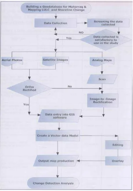
The sustainable, dynamic and participative solution includes (i) land cover and land use mapping using remote sensing and GIS, (ii) population density mapping using
KEY WORDS: crop, agriculture, management, GIS, remote sensing, multi-data approach, land cover, land use, regional
KEY WORDS: Green Cities, Concrete Cities, Remote Sensing, Google Earth, GeoEye, Transformation
Then, in order to fully assess the noise exposure situation in 2000, four analyses were implemented, using the four noise maps available: (1) exposure of
International Archives of the Photogrammetry, Remote Sensing and Spatial Information Sciences, Volume XL-4/W1, 29th Urban Data Management Symposium, 29 – 31 May, 2013, London,
International Archives of the Photogrammetry, Remote Sensing and Spatial Information Sciences, Volume XL-4/W1, 29th Urban Data Management Symposium, 29 – 31 May, 2013, London,
In the event that a large number of inputs put into satellite remote sensing and aerial remote sensing undertaking, market tilt toward domestic enterprises, in accordance with
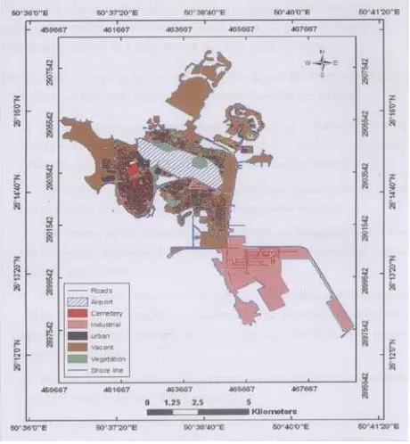
These are the land use map, the map soil morphology and sand cover map (extracted from the map of land) that constitute the basic maps that will serve to establish
