isprsarchives XL 4 W2 63 2013
Teks penuh
Gambar
Dokumen terkait
The SCANSITES 3D ® is based on the combination of the SCANSITES ® method, an advanced tool which provides numeric defect inspection of large structures, a new wide ranged
The method based on the correlation coefficient with geometric constraint, POS supported geometry corrective for matching window, and global relaxation optimization
In this article, we will present a new developed onboard direct georeferencing system which is real-time capable, applicable for lightweight UAVs and provides very precise
As the figure 2 shows, for the same parameters, the flight plan calculated by the software provides two acquisitions to reconstruct the stereoscopic of the area
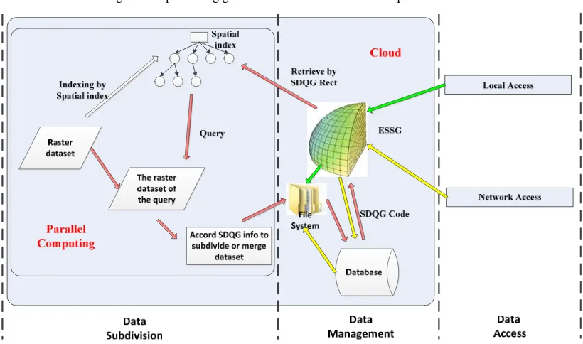
Based on the strategies mentioned above, a prototype platform was designed. In this platform, VMware which is a kind of virtualization software was firstly
These products use different data sources for the layers represented on the globe (digital elevation models, satellite and aerial imagery, topographic maps, vector
Recently, some approximation raster-based algorithms were presented which can generate spherical Voronoi diagrams for point, curve, and face sets easily.. However,
subdivision layer should be the 18 th layer of DGGS. The average area, average radius and average curvature error of cells on A4HCI hexagon DGGS. Discussion about data models is
