isprs annals III 2 181 2016
Teks penuh
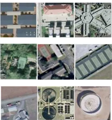
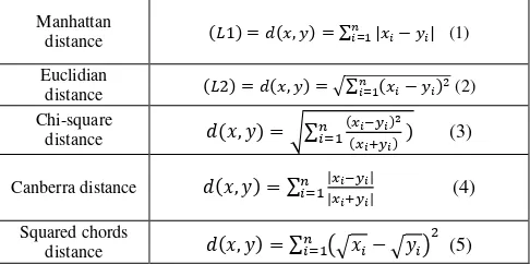
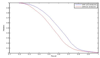
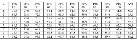
Gambar
Garis besar
Dokumen terkait
In this section, we test the proposed interactive change detection method based on active learning with Gaussian processes on remote sensing images from
DETECTION AND COUNTING OF ORCHARD TREES FROM VHR IMAGES USING A GEOMETRICAL-OPTICAL MODEL AND MARKED TEMPLATE MATCHING.. Philippe Maillard a∗ ,
To well process the dense striped data and ensure a reliable solution, we construct a statistical property based constraint in our proposed model and use it to control the
Therefore, for testing purposes, the Meidling dataset was further enhanced, in that all buildings falling into cases b) an c) were hierarchically reordered by means of
In this section the rectification of the image triplets, dense matching with SG optimisation, subsequent sub-pixel interpolation and the calculation of 3D point clouds will be
Automatic assessment of data acquisition and transmission losses has helped in quick quality tagging of browse images which is extremely useful for the users
A NEW CONTROL POINTS BASED GEOMETRIC CORRECTION ALGORITHM FOR AIRBORNE PUSH BROOM SCANNER IMAGES WITHOUT ON-BOARD DATAP. of Aerophysics and Space Research, MIPT, Dolgoprudny, Russia
BUILDING INFORMATION IN ITALY In this section, three main sources of data on buildings are presented: the Topographic Database, the new format for local and regional
