isprs archives XLI B4 143 2016
Teks penuh
Gambar
Dokumen terkait
Therefore, in the present paper, object-based change detection strategy is first adopted, domain knowledge structure for global land cover updating has been exploited,
By least-cost path method in the year 2012 and 2014, the forest boundaries of section afforestation land and low- elevation mountain ecosystem is connected after many
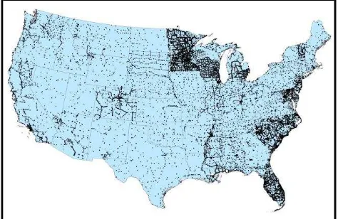
The National Land Survey (NLS) has had a digital topographic database (TDB) since 1992. Many of its features are based on the Basic Map created by M. First new version
Basemaps (BM) in the last decade were defined as (Decker, 2000) : “… a theme that provides essential information on common land features upon which
Disparity error maps can therefore be generated, for both the original and the compressed images, The International Archives of the Photogrammetry, Remote Sensing and
In this research, we perform a quantitative analysis about multi-image triangulation using NAC images with consideration of convergent angle and image matching
New obstacle point is detected on the path and it is added with the corresponding buffer to the network (see Figure 4.b). New path avoiding the excluded area is calculated
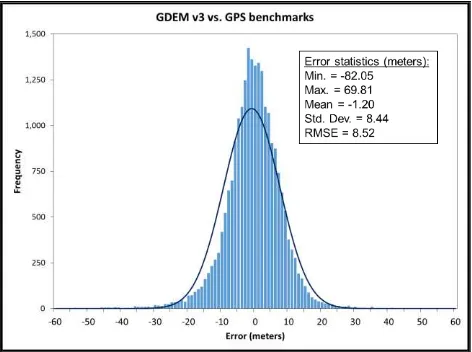
Another is the medium method (Med), which is selected a medium height value i.e. If it shows a masked value, same value is kept in AW3D30. This is likely keeping the terrain
