isprsarchives XL 1 W2 317 2013
Teks penuh
Gambar
Garis besar
Dokumen terkait
On the basis of RMS height and the mean backscattering coefficient within each window, the groups of pixels are labeled as one of the major land cover types i.e., water, urban
The visualization is at its core a custom 3D rendering engine tai- lored for rendering georeferenced data of different kinds: Raster maps and elevation data as well as functionality
The flight platform, the data link system and the mobile ground control station is in the responsibility of OHB, the wing-pod equipment and hyper spectral processing was the part
(2012) an automatic orientation of thermal image blocks acquired from an UAV is presented using artificial ground control points.. But since a high number of control
Since only a few months, the new lightweight single-line laserscanner Hokuyo UTM-30LX-EW is available (210 g without cable), which allows capturing multiple
The UAV based correction factor had a dependence on the flying direction: when UAV was flying to northeast (strips 1, 3, 5), the UAV based factor was larger than the ground
The experiments proved, that implementation of the aircraft without the camera cover is especially problematic in winter conditions, since snow accumulates in the camera
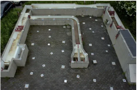
These configurations are used to determine the best photogrammetric results based on number of ground control points in the photogrammetric block during image processing..
