isprsarchives XL 3 W2 9 2015
Teks penuh
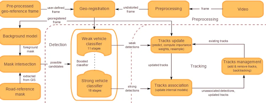
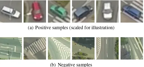
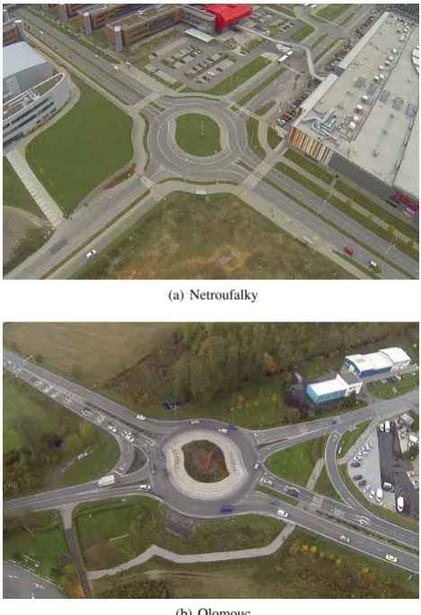
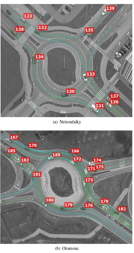
Gambar
Garis besar
Dokumen terkait
KEY WORDS: Traffic sign detection, Sliding window, Object Detection, Frequency
The overall goal of this study was the measurement of a digital surface model of the area by use of aerial imagery taken with a small format camera and a micro UAS as sensor
Very high resolution crop surface models (CSMs) from UAV-based stereo images for rice growth monitoring In Northeast ChinaJ. Bareth
These products use different data sources for the layers represented on the globe (digital elevation models, satellite and aerial imagery, topographic maps, vector
With respect to linear-feature change detection using Curvelet-based approach, the pink square indicates the composite study area in section 4.3, and the blue square encircles
In this work we describe the preprocessing of VHR satellite data from WorldView-2 or the Pl´eiades beginning from the panchromatic and multispectral stereo imagery up to the
nates can be translated into the aerial source image as well. With the known camera orientations, if the translated window contours are now being ray-cast, their 3D coordinates will
KEY WORDS: Unmanned Aerial Vehicles, UAVs, Mapping, Arctic, Disturbance, Permafrost, Structure from
